
Table of Contents
Rannoch Moor
Introduction
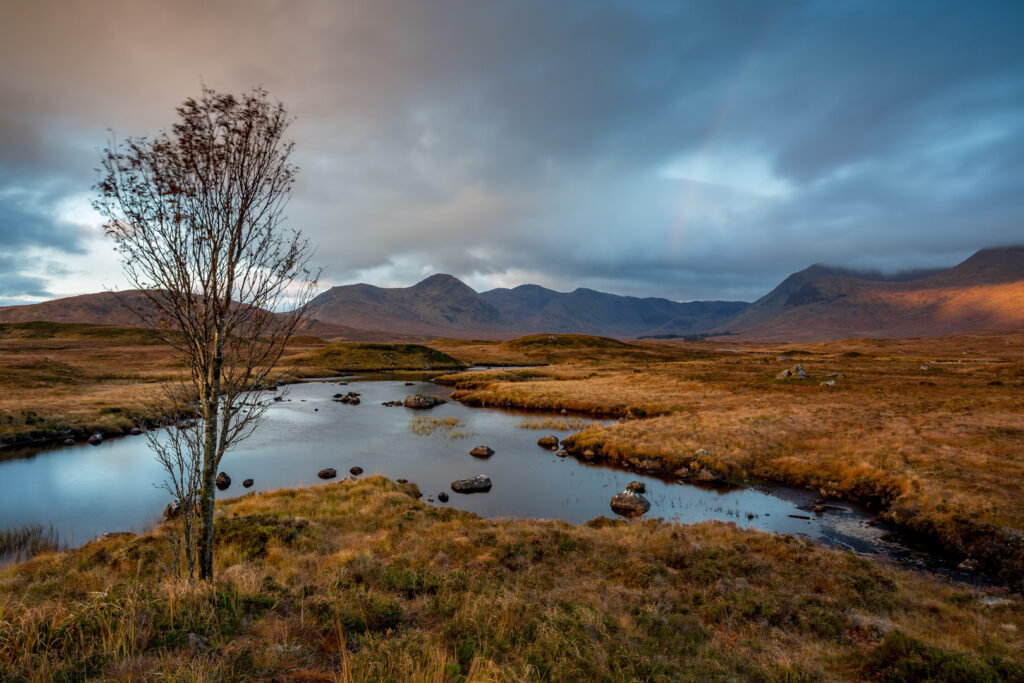
There are few places left in Britain where you can stand and see nothing but bog, rock, water and sky in every direction. Rannoch Moor is one of them. This vast, 50-square-mile expanse of blanket peat bog sits at the meeting point of Perthshire, Argyll and the Highlands, framed by mountains and crossed by only one road and one railway line.
Most visitors experience Rannoch Moor through a car window on the A82, somewhere between Bridge of Orchy and Glen Coe, as the road climbs onto the plateau and the Buachaille Etive Mor swings into view. That’s a memorable enough introduction on its own. But the moor rewards those who slow down, whether that means stopping at Loch Tulla for the view, catching the train to Corrour Station, or lacing up boots for the old drovers’ track known as the Road to the Isles.
This guide covers everything you need to plan a visit to Rannoch Moor: how to get there, the best walks and viewpoints, where to eat and sleep nearby, what the wildlife and history add to the experience, and a suggested two-day itinerary that takes in the wider Glen Coe area. Whether you’re driving through for twenty minutes or spending two days exploring on foot, this is the practical, honest information you need.
What Is Rannoch Moor? A Short History and Landscape Overview
Rannoch Moor is a raised plateau of blanket bog, lochans and heather moorland that sits at just over 300 metres (1,000 feet) above sea level, ringed by mountains that rise well above 900 metres on almost every side. Geographically, it forms a rough triangle roughly ten miles across, straddling the boundary of Perth and Kinross, Argyll and Bute, and Highland council areas. It is one of the largest continuous areas of unbroken wilderness left in Britain, and one of very few places in the country with no permanent public road crossing it.
The moor’s peat has been building up since the last Ice Age, and studies of ancient tree stumps preserved in the bog show that Rannoch Moor was once covered in Caledonian pine forest before the climate cooled and waterlogged ground took over. What remains is officially recognised for its ecological importance: much of the moor is a Site of Special Scientific Interest and a designated Special Area of Conservation, protecting one of the largest blanket bog systems in Europe.
Historically, this was not empty land in the way it can feel today. A drovers’ route known as the Road to the Isles once crossed the moor, used for centuries to move cattle and later as a military road. Robert Louis Stevenson sent his fictional hero David Balfour fleeing across the moor in Kidnapped, describing it memorably as a wearier-looking desert than he had ever seen. That description still resonates on a grey, midge-heavy August afternoon, though on a clear day with low sun catching the lochans, the same landscape feels closer to glorious than grim.
Two features shape how people experience the moor today: the West Highland Railway, opened in 1894, which crosses the plateau on embankments built over the bog using brushwood and ash foundations because conventional foundations simply sank; and the A82 road, which skirts the western edge and gives most visitors their first and only view of the interior.
Where Is Rannoch Moor and How to Get There
Rannoch Moor sits roughly midway between Glasgow and Fort William, in the central Scottish Highlands. The nearest towns are Tyndrum and Bridge of Orchy to the south, Glencoe village to the west, and Kinloch Rannoch and Pitlochry to the east.
By car: The A82 is the main route, running from Tyndrum through Bridge of Orchy and directly across the western edge of the moor before descending into Glen Coe. This stretch of road, roughly 20 miles, is one of the most scenic drives in Scotland and includes several laybys for photographs, though pulling over safely requires care given the narrow verges and fast-moving traffic. Glasgow to the moor takes around two hours; Fort William is closer to 45 minutes.
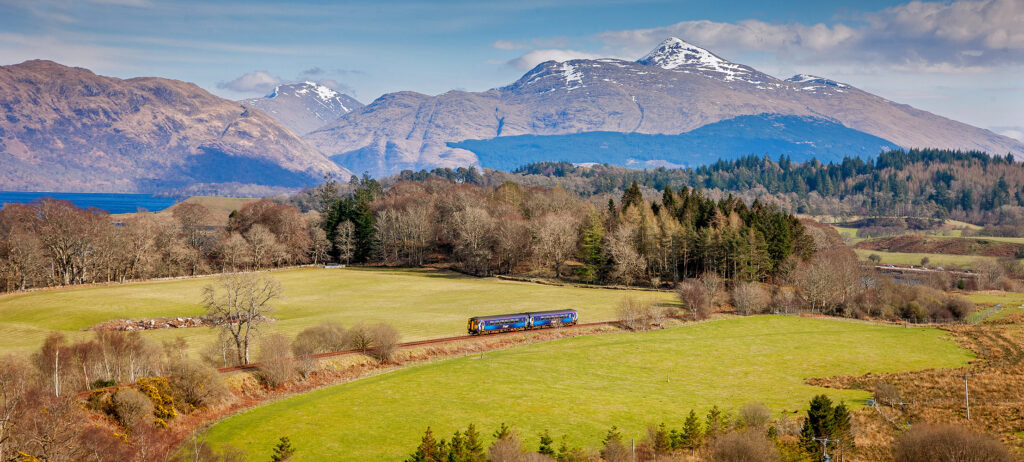
By train: The West Highland Line crosses Rannoch Moor itself, stopping at Rannoch Station in the east and Corrour Station in the north, both served by ScotRail trains running between Glasgow Queen Street and Fort William or Mallaig. Neither station has road access from the west, which is part of their appeal. Rannoch Station can be reached by car via the B846 from Pitlochry; Corrour Station has no road access at all and can only be reached on foot, by bike, or by train, which is precisely why it remains one of the most remote request stops in Britain.
By bus or coach: Scottish Citylink coaches between Glasgow and Fort William use the A82 and pass directly across the moor, making this a good option for visitors without a car who still want to see the landscape, even without stopping.
Quick Facts Table
| Detail | Information |
|---|---|
| Location | Central Scottish Highlands, spanning Perth and Kinross, Argyll and Bute, Highland |
| Size | Approximately 50 square miles (130 km²) |
| Altitude | Around 300m (1,000ft) plateau |
| Main road access | A82 (Tyndrum to Glen Coe) |
| Rail stations | Rannoch Station, Corrour Station |
| Designation | Site of Special Scientific Interest, Special Area of Conservation |
| Nearest towns | Tyndrum, Bridge of Orchy, Glencoe, Kinloch Rannoch |
| Best for | Hiking, wildlife watching, photography, scenic drives, train journeys |
| Typical visit length | 1 hour (drive-through) to 2 days (walking/exploring) |
Best Time to Visit Rannoch Moor
Rannoch Moor is a genuinely year-round destination, but each season changes the experience significantly, and the weather can shift in minutes regardless of what month it is.
Spring (April–May) brings longer days and a good chance of clear visibility, before the midges arrive in force. The moor is still brown and winter-toned early in the season, with green growth appearing through May. This is a reliable window for walkers who want challenging conditions without the summer crowds on the A82.
Summer (June–August) offers the longest daylight hours, useful for the full Corrour-to-Rannoch walk or a Munro like Buachaille Etive Mor. It’s also midge season, and Rannoch Moor’s boggy ground makes it one of the worst-affected areas in Scotland for these biting insects, especially in still, humid conditions from late June onward. Pack repellent and a midge net if walking here in July or August. Traffic on the A82 is also heaviest in summer.
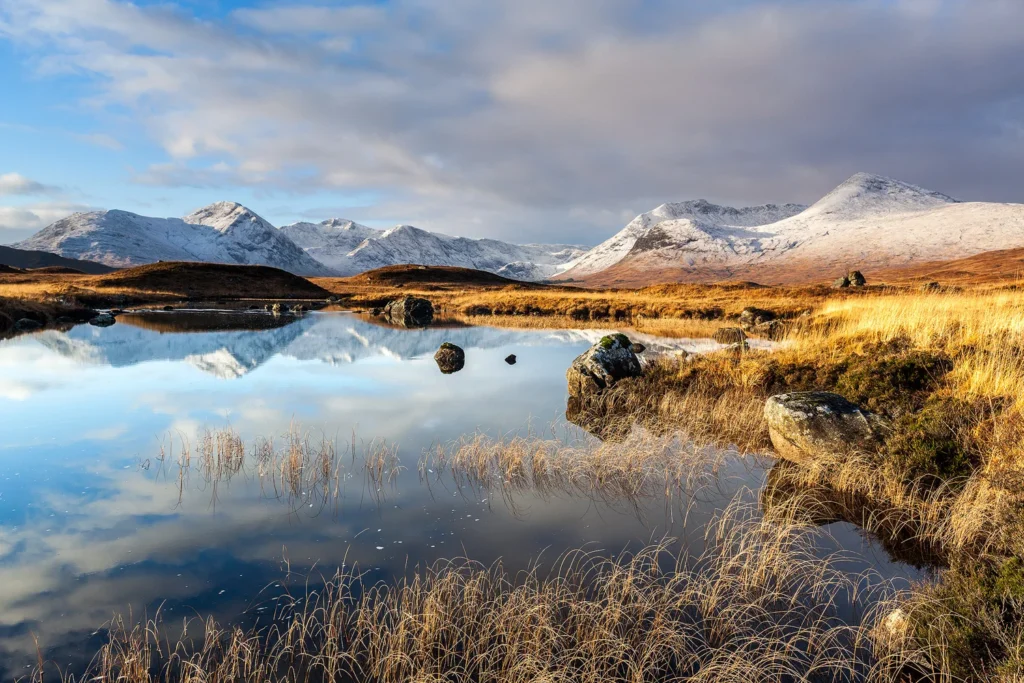
Autumn (September–October) is arguably the best season for photography. The moor grass turns rust and gold, deer rutting activity picks up, and the midges largely disappear after the first frosts. Days are shorter but light quality is often exceptional, particularly at Loch Tulla and around the Black Mount.
Winter (November–March) transforms the moor into a stark, occasionally snow-covered wilderness. The Glencoe Mountain ski centre at White Corries, on the moor’s western edge, opens when conditions allow, typically from December. Winter walking on the open moor requires proper hillwalking experience, navigation skills, and appropriate equipment, since the peat bog conditions combine with short daylight hours and rapidly changing weather.
Whatever season, check the Met Office or Mountain Weather Information Service (MWIS) forecast before setting out on foot, and remember that the moor’s exposed, treeless plateau offers no shelter if the weather turns.
The Best Viewpoints and Photography Spots
Rannoch Moor rewards a slow approach, and several spots along the A82 and around its edges consistently draw photographers.
Loch Tulla and the Black Mount offer one of the most photographed views in the Highlands, looking north-west across the loch towards the mountains of the Black Mount range. There’s a layby with parking near Victoria Bridge that gives easy access to this view without a long walk.
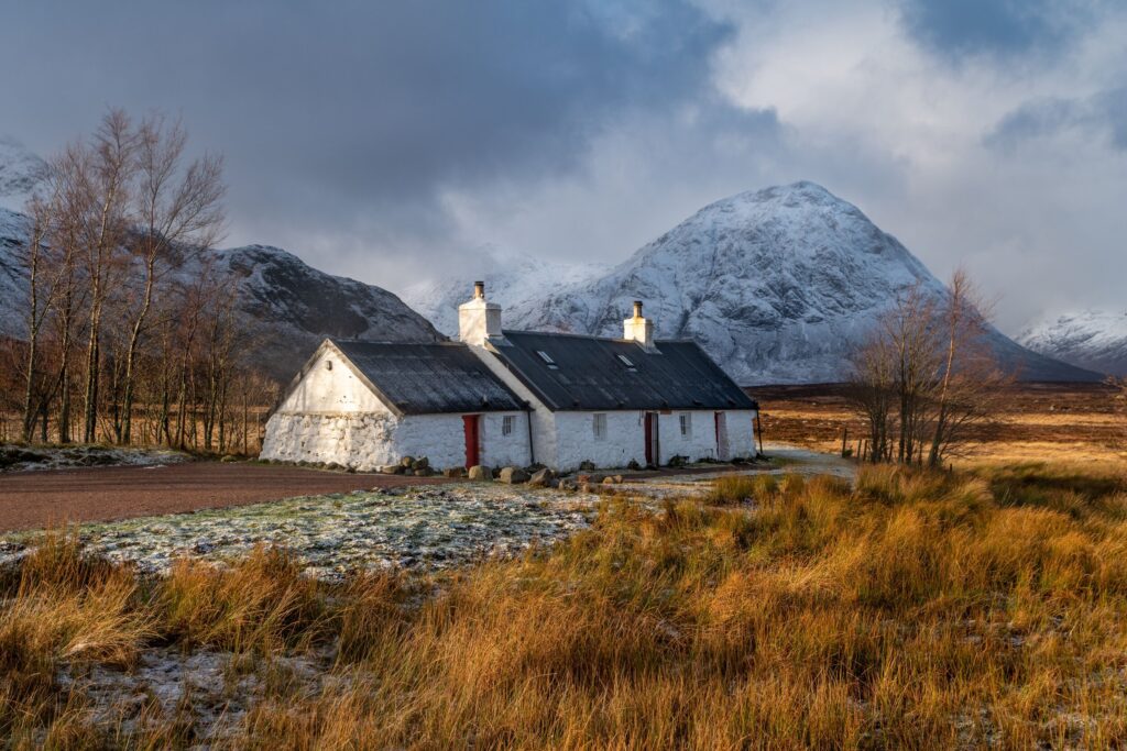
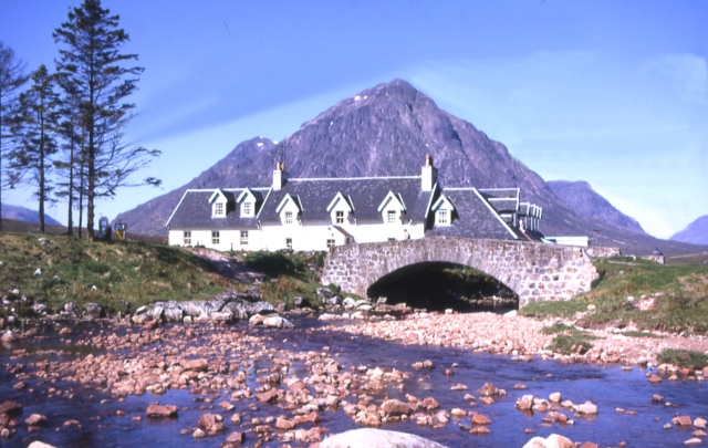
Blackrock Cottage, near the Glencoe Mountain ski centre, is a well-known photography subject in its own right: a small stone cottage set against Buachaille Etive Mor, reachable via a short walk from the ski centre car park.
The A82 viewpoint layby, roughly at the point where the road crosses the open plateau, gives a genuine sense of the moor’s scale, with lochans scattered across the peat bog stretching to the horizon and mountains on every side.
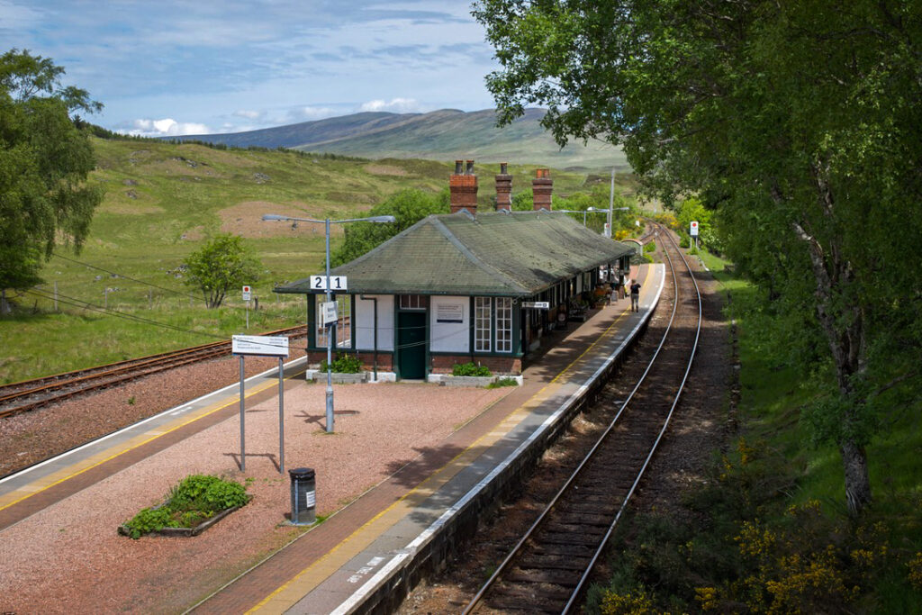
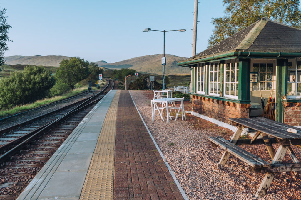
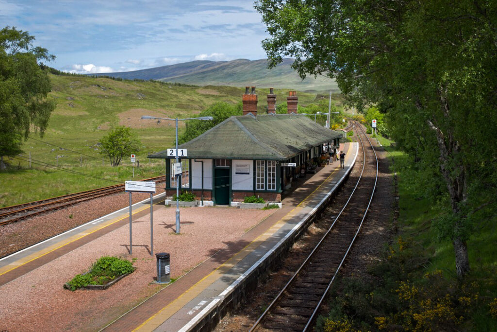
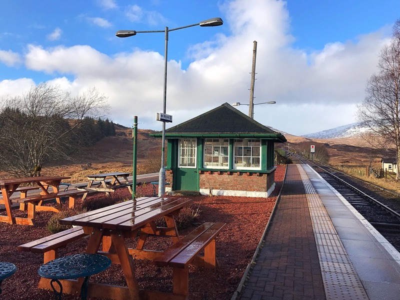
Rannoch Station itself is a subject worth photographing, an isolated Victorian station with a small tearoom that seems to serve no community at all, framed by the empty moor.
Golden hour, either early morning or the hour before sunset, produces the most dramatic light here, since the low sun rakes across the peat and lochans and picks out texture that flat midday light misses entirely. A polarising filter helps cut glare off the water in the many small lochans if you’re shooting with a dedicated camera.
Top Walks and Hiking Routes on Rannoch Moor
The classic route across the moor’s interior runs between Corrour Station, the highest railway station in the British Isles at around 1,350 feet, and Rannoch Station, following a good track on the old Road to the Isles.</cite> This walk is roughly 11 miles, takes most walkers around four to five hours, and involves a modest height gain with a steady descent towards Rannoch. Because Corrour has no road access, most people start at Rannoch Station, park there, catch an early train the short distance to Corrour, then walk back. <cite index=”19-1″>Trains typically run at set times from Rannoch, so it’s worth checking timetables in advance and building the return journey around them.</cite> The path is well-maintained enough that mountain bikes and even careful 4x4s can use it, though it remains a remote route with no mobile signal for much of its length and no facilities beyond the two stations. <cite index=”18-1″>One important safety note: never walk on the railway tracks themselves, since trains on this line don’t always announce themselves in time for pedestrians to react.</cite>
Loch Ossian from Corrour Station is a shorter and gentler alternative, following an easy track from the station around the southern shore of this remote loch, with good chances of spotting red deer in the surrounding woodland. This can be combined with the Rannoch walk or done as a shorter there-and-back trip for those with less time or fitness.
The West Highland Way across the moor forms part of the long-distance trail between Bridge of Orchy and Kings House, crossing the western fringe of Rannoch Moor. This section includes a stretch of genuinely path-free, boggy walking near Beinn Chaorach that gives a real taste of the moor’s wild character, before descending to the ski road and Blackrock Cottage.
Buachaille Etive Mor, while technically a separate mountain rather than part of the moor itself, dominates the skyline from Rannoch Moor’s western edge and is one of Scotland’s most recognisable peaks. <cite index=”22-1″>The standard route up via Coire na Tulaich starts from the Altnafeadh layby on the A82 and covers around 8.25 miles with roughly 1,110 metres of ascent, typically taking seven to nine hours in summer conditions.</cite> This is a serious hillwalking day requiring good fitness, navigation skills and proper equipment, not a casual add-on to a moor visit.
For walkers who prefer not to tackle the full crossing, simply parking at one of the A82 laybys and following any of the informal paths a short distance onto the moor gives a genuine sense of the terrain, though the ground is often wet underfoot even close to the road.
Wildlife and Nature on Rannoch Moor
<cite index=”6-1″>Rannoch Moor’s rugged, untamed landscape supports a distinctive range of flora and fauna adapted to harsh, waterlogged conditions.</cite> <cite index=”6-1″>Red deer are the most commonly spotted large mammal, along with golden eagles overhead and black grouse in the heather.</cite> Herds of deer frequently gather close to Kings House Hotel and Rannoch Station, making these reliable spots for a sighting without a long walk.
The peat bog itself is the moor’s real ecological star. Carnivorous plants including sundews and bladderworts grow in the nutrient-poor, waterlogged ground, trapping insects to supplement what the bog can’t provide. <cite index=”6-1″>These wetland habitats and lochans are internationally important for biodiversity conservation, which is part of why the moor holds Special Area of Conservation status.</cite>
Birdwatchers should watch for red-throated divers on the larger lochans in summer, along with golden plover and dunlin nesting on the open moor. Rannoch Moor is also known locally for a rare damselfly species, evidence of just how specialised the ecosystem here has become over thousands of years of undisturbed bog formation.
Because the moor is largely treeless and exposed, wildlife is often visible at considerable distance, and binoculars are genuinely useful even for casual visitors stopping along the A82.
Rannoch Station and the West Highland Railway
<cite index=”2-1″>Rannoch Station is one of the most photogenic and unusual stops on the entire West Highland Line, seeming to serve no surrounding community at all.</cite> It was built to serve the railway’s crossing of the moor rather than any town, and today functions mainly as a walkers’ station, a request stop for hillwalkers heading out onto the moor or catching the short connecting journey to Corrour.
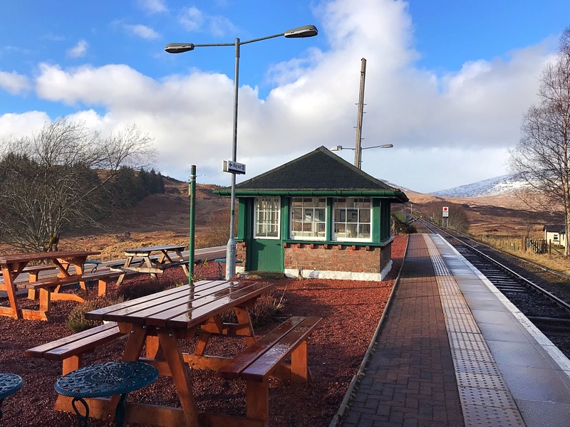
A small tearoom operates at the station seasonally, offering a welcome stop for walkers finishing the Corrour crossing. <cite index=”19-1″>It typically opens from March to October, on a limited weekly schedule, so it’s worth checking ahead rather than relying on it being open.</cite> Free parking is available for those arriving by car to walk onto the moor or catch a connecting train.
<cite index=”12-1,17-1″>Corrour Station, further north, sits at 1,350 feet and holds the record as the highest mainline railway station in the United Kingdom.</cite> <cite index=”17-1″>It has no road access whatsoever, just a single platform, an old station building and the wilderness stretching away in every direction, with the railway itself the only connection to the outside world.</cite> The station gained wider recognition as a filming location in the 1990s, and remains a popular starting point for hillwalkers heading into the surrounding Munros as well as for the classic walk south to Rannoch.
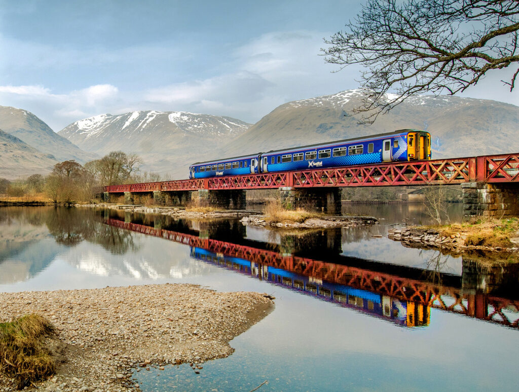
The West Highland Line crossing of Rannoch Moor is itself considered one of Europe’s great scenic rail journeys, and taking the train through rather than driving the A82 gives a genuinely different perspective on the landscape, with views across the bog and lochans that aren’t visible from the road.
Where to Eat Near Rannoch Moor
Dining options directly on the moor are limited by its remoteness, which is part of its character, but a handful of good choices sit at its edges.
Kings House Hotel, on the western edge of the moor at the head of Glen Coe, has a restaurant with panoramic views towards Buachaille Etive Mor, serving hearty Highland fare including venison dishes well suited to walkers coming off the hill. <cite index=”20-1″>Its bar and restaurant are popular with West Highland Way walkers</cite>, and the setting alone, with deer often visible from the windows, makes it worth a stop even if you’re only passing through.
Rannoch Station Tearoom offers simple refreshments for walkers on the eastern side of the moor, though its seasonal opening hours mean it can’t be relied upon outside the main walking season.
Bridge of Orchy Hotel, a short drive south of the moor on the A82, has a bar and restaurant serving classic Scottish pub food and is a popular stop for both drivers and West Highland Way walkers.
Glencoe village, roughly 20 minutes from the western edge of the moor, has a wider choice of cafes and restaurants, including options for evening meals if you’re basing yourself there rather than staying on the moor’s immediate fringes.
Given the distances involved and limited opening hours at moor-edge establishments, it’s worth carrying your own food and water for any walking trip, rather than relying on finding somewhere open along the route.
Where to Stay: Accommodation Near Rannoch Moor
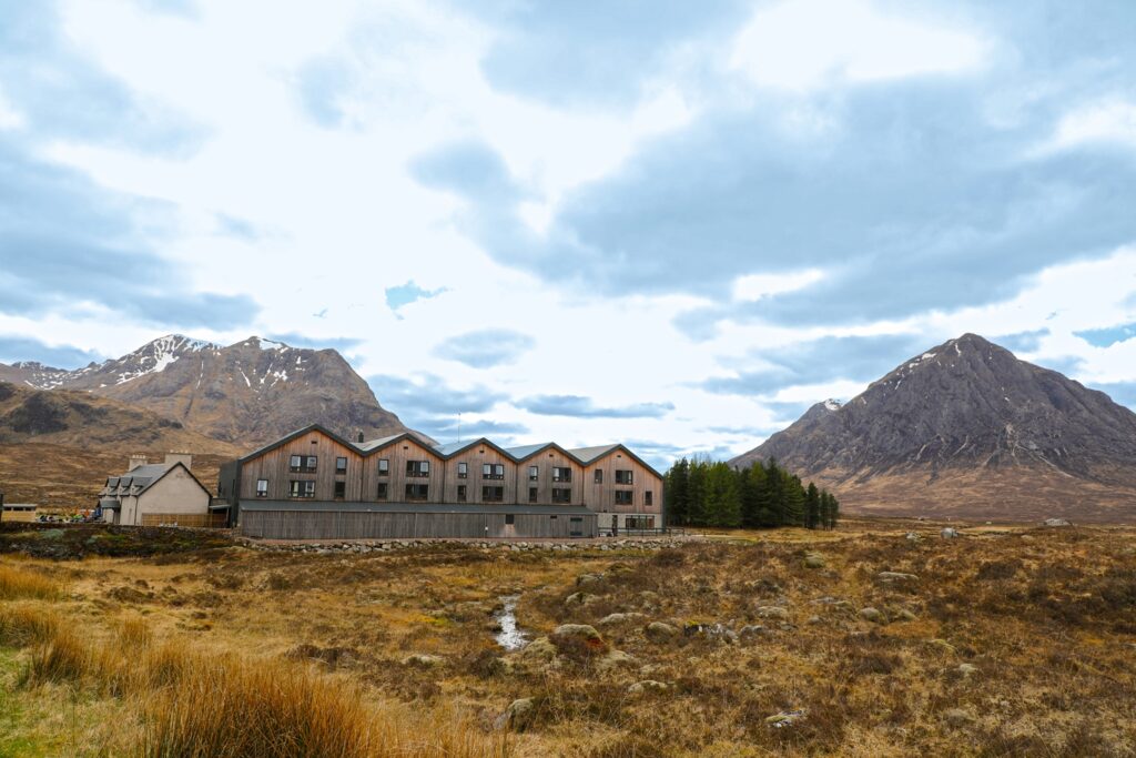
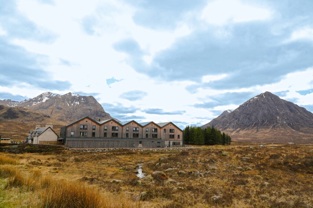
<cite index=”24-1″>The Kingshouse Hotel sits directly on Rannoch Moor beside the A82</cite>, just above the point where the road descends into Glen Coe, and is the most atmospheric base for exploring the immediate area. <cite index=”24-1″>It offers stunning views of Buachaille Etive Mor and Creise in the Black Mount, and two of Scotland’s most famous viewpoints, Blackrock Cottage and the Etive Mor Waterfall, are just a five-minute drive away.</cite> <cite index=”23-1″>The hotel dates back to the 1700s and is among Scotland’s oldest licensed inns, though it was extensively rebuilt in 2019, keeping only the original 18th-century coaching inn as part of the new building.</cite>
Bridge of Orchy Hotel, at the southern approach to the moor, offers hotel rooms and a bunkhouse, making it a good budget-conscious option for walkers.
Loch Rannoch Hotel and Spa, near Kinloch Rannoch on the eastern side, suits visitors wanting a more comfortable, spa-style base with easy access to Rannoch Station.
Wild camping is legal in Scotland under the Scottish Outdoor Access Code, and the open moorland around Kings House in particular is a popular spot for walkers on the West Highland Way. <cite index=”23-1″>Anyone wild camping here should be prepared for midges in season and should follow Leave No Trace principles given the ecological sensitivity of the peat bog.</cite>
Glencoe village, a short drive from the moor’s western edge, has the widest range of guesthouses, self-catering cottages and hostels for those who prefer a fuller range of amenities than the moor’s immediate edge can offer.
Booking ahead is strongly advised for anywhere close to the moor, particularly Kings House Hotel, since accommodation options are genuinely limited given the remoteness of the location.
Transport, Parking and Accessibility
Getting around Rannoch Moor itself requires some planning given its remoteness. The A82 is the only road that touches the moor directly, and there is no road crossing the interior at all. Laybys along the A82 provide the easiest access for anyone wanting a short walk onto the fringes of the moor without committing to a full day hike.
Parking is available free at Rannoch Station for anyone arriving by car to walk or take the train onward. Corrour Station has no parking, since it has no road access; anyone visiting must arrive by train, on foot, or by bike.
For visitors without a car, Scottish Citylink coaches on the Glasgow to Fort William route cross the moor on the A82, and the West Highland Line offers a genuinely spectacular way to see the interior by rail, stopping at both Rannoch and Corrour.
Accessibility on the moor itself is limited. <cite index=”9-1″>Some viewpoints along the main transport corridors are described as accessible at all times</cite>, referring to road and rail access rather than the terrain, but the moor’s paths are uneven, boggy and unsuitable for wheelchairs or those with limited mobility. Visitors with mobility considerations are best served by viewing the moor from A82 laybys or by train, both of which offer genuinely spectacular views without requiring any walking on the peat bog itself.
Family-Friendly Tips and Solo Traveller Advice
Families will find the A82 drive-through and the viewpoints at Loch Tulla the easiest ways to experience the moor with young children, since these require no walking on difficult terrain. The train journey across the moor on the West Highland Line is also an excellent option for families, offering dramatic views from the comfort and safety of the carriage, and children often enjoy the novelty of Corrour’s remote, road-free station. Longer walks like the Corrour to Rannoch crossing are only suitable for older children with hillwalking experience, given the distance, exposure and lack of facilities en route.
Solo travellers should exercise the same caution here as on any remote Scottish upland walk: tell someone your planned route and expected return time, carry a map and compass rather than relying solely on a phone, and be aware that mobile signal is patchy to non-existent across much of the moor. The Corrour to Rannoch walk is popular enough with solo hikers that you’re unlikely to be entirely alone on the path in summer, though winter conditions demand more self-sufficiency.
Couples looking for a memorable, low-key experience might consider timing a visit around sunrise or sunset at Loch Tulla, or booking a stay at Kings House Hotel to wake up looking directly at Buachaille Etive Mor, widely considered one of the most romantic mountain views in Scotland.
A Suggested Two-Day Rannoch Moor and Glen Coe Itinerary
Day One: The Western Moor and Glen Coe Start at Tyndrum and drive north on the A82, stopping at the Loch Tulla viewpoint near Victoria Bridge for photographs of the Black Mount range. Continue across the moor itself, pulling into the main viewpoint layby to appreciate the scale of the landscape. Stop at Kings House Hotel for lunch with views of Buachaille Etive Mor, then take the short walk to Blackrock Cottage if weather allows. Spend the afternoon exploring Glen Coe proper, including the Three Sisters viewpoint and Glencoe Lochan Trail, before returning to Kings House or a Glencoe village guesthouse for the night.
Day Two: Rannoch Station to Corrour Drive to Rannoch Station via the B846 from Pitlochry or Kinloch Rannoch, allowing extra time given the winding single-track sections. Park at the station and catch the morning train to Corrour, checking timetables in advance since services are limited. From Corrour, walk the Road to the Isles back to Rannoch Station, roughly 11 miles taking four to five hours, pausing at the ruined Corrour Old Lodge partway along. Finish at Rannoch Station Tearoom if it’s open, or head back towards Pitlochry for an evening meal.
This itinerary combines the easiest, most accessible views of the moor with a genuine walking experience of its interior, without requiring technical hillwalking skills beyond reasonable fitness and proper footwear.
Practical Travel Tips for Visiting Rannoch Moor
- Fuel up before arriving. Petrol stations are sparse around the moor; fill up in Tyndrum, Glencoe or Pitlochry before setting out.
- Pack for all weather, regardless of season. Waterproofs, warm layers and sturdy footwear are essential even in summer.
- Bring midge repellent from late May through September, particularly for any walking away from the road.
- Check train times in advance if planning the Corrour to Rannoch walk, since services are limited and missing the return connection means a very long wait.
- Don’t rely on mobile signal. Download offline maps before setting out, and carry a physical map and compass as backup.
- Stick to marked paths where they exist, since the peat bog can be genuinely hazardous underfoot away from established tracks.
- Book accommodation well ahead, especially Kings House Hotel, given how few options exist close to the moor.
- Allow extra driving time on the A82 in summer, when the road can be busy with tour coaches and slow-moving traffic.
Nearby Destinations Worth Combining With Rannoch Moor
Glen Coe, immediately to the west, is one of Scotland’s most famous glens, combining dramatic scenery with a dark historical past connected to the 1692 massacre, along with excellent walking and the Glencoe Mountain ski centre at White Corries.
Glen Etive, reached via a single-track road off the A82 near Kings House, offers quieter scenery and was used as a filming location for the James Bond film Skyfall, with the River Etive and its wild swimming spots a popular detour.
Loch Lomond and the Trossachs National Park, to the south, provides an easy add-on for visitors approaching from Glasgow, with its own network of lochs, walking trails and villages.
Fort William, around 45 minutes north-west, serves as the gateway to Ben Nevis and the wider Lochaber area, and makes a natural next stop for visitors continuing their Highland trip.
Pitlochry, to the east, offers a more conventional Highland town experience with shops, distilleries and easy access to Rannoch Station via the B846.
Frequently Asked Questions About Rannoch Moor
What is Rannoch Moor known for? Rannoch Moor is known as one of Britain’s largest and last truly wild, uninhabited areas, a 50-square-mile expanse of blanket peat bog crossed by only one road and one railway line, surrounded by mountains and dotted with hundreds of small lochans.
Can you walk across Rannoch Moor? Yes. The most established route is the roughly 11-mile track between Corrour Station and Rannoch Station, following the old Road to the Isles. It requires good fitness, proper footwear and awareness of the remote, exposed conditions.
Is Rannoch Moor accessible by car? Only the western edge, along the A82 between Bridge of Orchy and Glen Coe, is accessible by car. There is no road crossing the moor’s interior; access there is on foot, by bike, or by train to Rannoch or Corrour stations.
How do you get to Corrour Station? Corrour Station has no road access at all. It can only be reached by train on the West Highland Line, on foot, or by bicycle, which is part of what makes it one of the most remote stations in Britain.
What is the best time of year to visit Rannoch Moor? Late spring and autumn generally offer the best combination of good visibility and fewer midges. Summer has the longest days but the worst midges, while winter offers dramatic, stark scenery for experienced hillwalkers only.
Are there midges on Rannoch Moor? Yes, and the boggy, waterlogged ground makes the moor one of the worst-affected areas in Scotland for midges, particularly from late June through August in still, humid conditions. Repellent is strongly recommended.
Is Kings House Hotel on Rannoch Moor? Kings House Hotel sits right on the moor’s western edge, at the point where the A82 begins its descent into Glen Coe, facing directly towards Buachaille Etive Mor.
Can you see wildlife on Rannoch Moor? Yes. Red deer are commonly seen, particularly near Kings House Hotel and Rannoch Station, along with golden eagles, black grouse and a range of specialised bog plants and insects across the moor’s protected wetland habitats.
Is Rannoch Moor suitable for families? The A82 viewpoints and the West Highland Line train journey are excellent, easy ways for families to experience the moor. The longer interior walks are better suited to older children with some hillwalking experience.
What should I pack for a visit to Rannoch Moor? Waterproofs, warm layers, sturdy walking boots, midge repellent in summer, a physical map and compass, and enough food and water, since facilities on and around the moor are limited and often seasonal.
Conclusion
Rannoch Moor isn’t a destination you tick off in five minutes, even though many visitors only ever see it through a car windscreen on the drive to Glen Coe or Fort William. Give it more time, whether that’s an hour at the Loch Tulla viewpoint, a train journey to the extraordinary isolation of Corrour Station, or a full day walking the old drovers’ track back to Rannoch, and it becomes one of the most memorable landscapes in Scotland: genuinely wild, genuinely empty, and shaped almost entirely by weather and light.
Plan around the season, respect the unpredictable conditions this exposed plateau can throw up, and Rannoch Moor delivers something increasingly rare in Britain: a landscape with no roads, no buildings and no crowds, just peat, water and mountains stretching to the horizon.