
Table of Contents
Beinn Alligin
Introduction
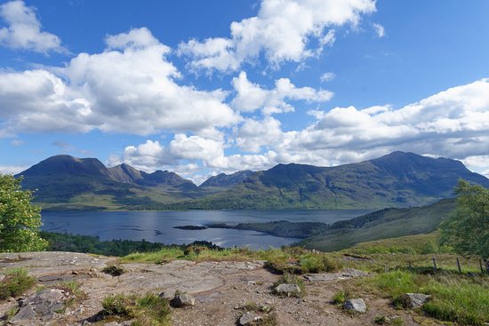
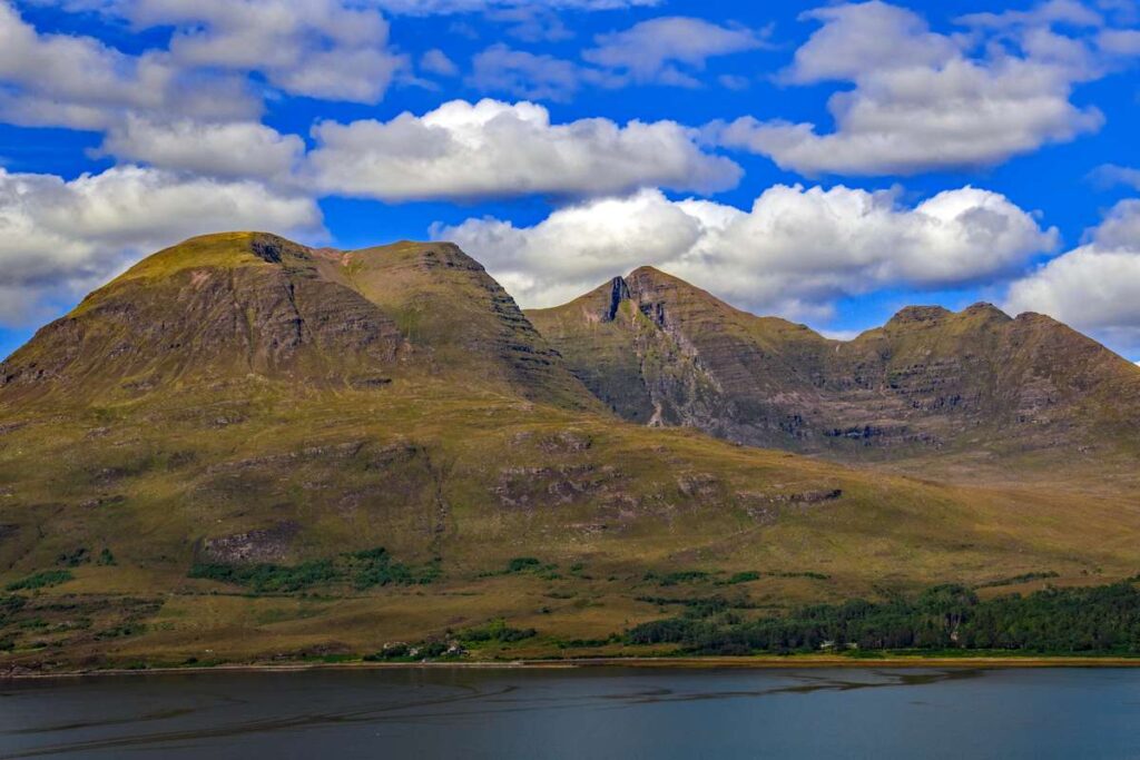
Beinn Alligin rises above Loch Torridon like a stone crown, and the first time you see it from the road near Torridon village, it’s hard to keep your eyes on the driving. This is one of Scotland’s great Munros, a mountain of two summits, a dramatic black gash of a gully, and a knife-edge ridge known as the Horns of Alligin that has humbled more than a few confident walkers.
Beinn Alligin sits in the heart of Torridon, alongside its more famous neighbours Liathach and Beinn Eighe. Together, these three peaks form what many hillwalkers simply call the Torridon giants. Of the three, Beinn Alligin is generally considered the most approachable, which is not the same as saying it’s easy. It’s a full mountain day, with genuine exposure on the ridge and weather that can change in minutes.
This guide walks through everything you need before setting out: how to get there, where to park, the different route options, what the Horns of Alligin scramble actually involves, when to go, what to pack, and where to base yourself in Torridon. Whether you’re ticking off Munros or simply want one unforgettable day in the Highlands, Beinn Alligin delivers scenery that rarely disappoints.
Where Is Beinn Alligin and Why It Matters
Beinn Alligin stands in Wester Ross, in the northwest Highlands of Scotland, roughly three kilometres west of Torridon village along the single-track road toward Inveralligin and Diabaig. The name comes from Scottish Gaelic and is usually translated as “Jewelled Hill” or “Mountain of Beauty,” though some local sources render it closer to “Hill of Anguish,” tied to old legends about the mountain’s darker corners.
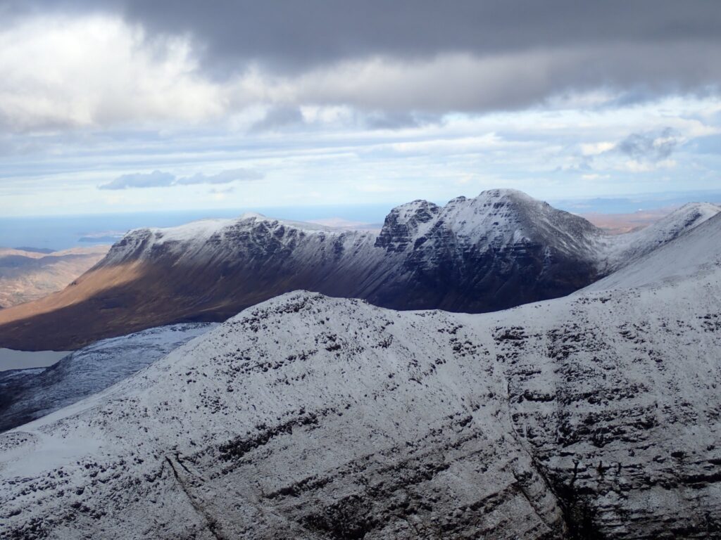
The mountain has two Munro summits. Tom na Gruagaich reaches 922 metres and was only promoted to full Munro status in 1997, having previously been classed as a subsidiary top. Sgùrr Mhòr, the higher and more dramatic of the pair, tops out at 986 metres and dominates views of the mountain from the road below. Between and beyond these summits runs the famous ridge of Na Rathanan, better known in English as the Horns of Alligin, a serrated line of three rocky towers that forms the highlight of the full traverse.
What sets Beinn Alligin apart from Liathach and Beinn Eighe isn’t just its slightly gentler approach. It’s the sense of drama packed into a single circuit. You get a steep pull onto open moorland, a high-level ridge walk with sea views, a genuinely startling chasm called the Eag Dhubh (the Black Cleft), and then a scramble along the Horns that feels more like something from the Cuillin of Skye than a typical Munro day. Locals and guidebook writers alike often call it the best single-day mountain walk in Britain, and once you’ve stood on the ridge with Loch Torridon glinting far below and Skye visible on a clear day, it’s easy to understand why.
Geologically, Beinn Alligin belongs to the ancient Torridonian sandstone formations that give this whole region its rust-red, layered cliffs and terraced slopes. These rocks are among the oldest exposed land surfaces in Europe, laid down hundreds of millions of years before complex life existed on Earth. Walking here is, in a very real sense, walking across deep time.
Getting to Beinn Alligin
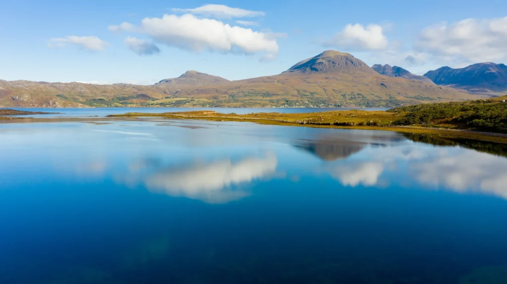
Reaching Beinn Alligin means reaching Torridon first, and Torridon is remote by design. The nearest towns of any size are Kinlochewe to the east and Gairloch to the north, both small settlements with limited services.
By car: Most visitors approach via the A832 from Inverness, turning off toward Kinlochewe and then following the A896 west through Glen Torridon. This drive from Inverness takes roughly two hours, covering about 100 kilometres of increasingly spectacular scenery. From Kinlochewe, the road threads between Liathach and Beinn Eighe before dropping to Torridon village on the loch shore. From there, continue west on the minor road toward Inveralligin for about three kilometres to reach the main walkers’ car park.
The roads narrow considerably in the final stretch and much of the route from Torridon village onward is single-track with passing places. This section forms part of the North Coast 500 route, so expect camper vans and slower traffic during peak summer months, particularly July and August.
By public transport: This is genuinely difficult terrain for anyone without a car. A limited local bus service connects Inverness to Kinlochewe and on toward Torridon village, but timetables are sparse, especially outside summer, and none of the buses continue to the actual trailhead car park three kilometres further on. Most walkers relying on public transport either arrange a taxi from Kinlochewe or factor in an extra hour of road walking each way. If you’re without a car, it’s worth checking current timetables directly with Highland’s public transport provider before committing to a trip, since rural services change from year to year.
By train: The nearest railway station is Strathcarron, on the scenic Kyle of Lochalsh line from Inverness, but it’s still a substantial drive or taxi journey from there to Torridon. Achnasheen station is a similar distance away. Neither option removes the need for a car or taxi for the final leg.
Given the isolation, most serious hillwalkers either drive themselves, join a guided trip with transport included, or base themselves at accommodation in Torridon for several days to make the most of the journey.
Parking at Coire Mhic Nobuil
The standard starting point for Beinn Alligin is the car park at Coire Mhic Nobuil, sometimes signposted simply as the Torridon walkers’ car park. It sits beside the bridge over the Abhainn Coire Mhic Nobuil river, about three kilometres west of Torridon village on the road toward Inveralligin, Wester Alligin, and Diabaig.
This car park is maintained by the National Trust for Scotland, which owns and manages much of the surrounding Torridon estate. Historically parking here has been free, though NTS periodically reviews charges across its properties, so it’s worth checking the current situation on the National Trust for Scotland’s Torridon page before you travel, particularly if you’re visiting during peak season.
A few practical notes on parking:
- The car park is relatively small and fills quickly on fine summer weekends, sometimes by mid-morning. Arriving before 8am gives you the best chance of a space.
- Overflow parking along the roadside verges is limited and can obstruct passing places on this narrow road, so it’s best avoided.
- There’s no fuel, food, or toilet facility at the car park itself, so stock up in Torridon village or Kinlochewe beforehand.
- The car park also serves other popular routes, including the walk behind Liathach through Coire Dubh and Coire Mhic Nobuil, so don’t assume every parked car belongs to a Beinn Alligin walker.
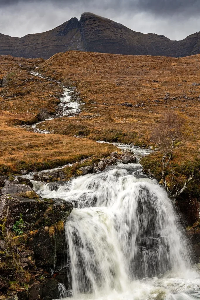
From the car park, cross the road bridge over the river gorge, which is worth a minute’s pause on its own. The water tumbles through a narrow, steep-sided ravine here, and on the far side sits the privately owned Torridon House, visible through mature trees. The path proper begins just west of the gorge.
Route Options on Beinn Alligin
There isn’t just one way up Beinn Alligin, and choosing the right route matters more here than on many Munros because of the scrambling involved on the ridge.
The full horseshoe with the Horns of Alligin. This is the classic route and the one most guidebooks and hillwalking sites describe as the best day out. It climbs Tom na Gruagaich first, crosses to Sgùrr Mhòr, then descends over the three Horns before dropping back to the glen. Expect around 12 to 13 kilometres of walking with roughly 1,250 metres of ascent, and a full day of 7 to 9 hours depending on fitness, weather, and how much time you spend soaking in the views.
The two-Munro route without the Horns. For walkers who want both summits but aren’t comfortable with exposed scrambling, it’s possible to climb Tom na Gruagaich and Sgùrr Mhòr and then retrace your steps back down rather than continuing over the Horns. This shortens the technical difficulty considerably while still delivering both Munro ticks and most of the same ridge views.
Tom na Gruagaich only. Some walkers, particularly those short on time or dealing with uncertain weather, climb only the first Munro and descend the same way. This still involves a genuinely steep pull up from the corrie and rewards you with a trig point view over Loch Torridon, but it misses the more dramatic terrain further along the ridge.
Reverse direction. A smaller number of experienced hillwalkers tackle the horseshoe in reverse, climbing the Horns first while fresh and descending via Tom na Gruagaich. Guidebooks generally recommend the clockwise direction described above, since climbing the Horns from the eastern end is considered marginally easier and safer than descending them, but either is possible in good conditions for confident scramblers.
Whichever option you choose, carry an Ordnance Survey map (Explorer OL8 or Landranger 24 both cover the area) and know your bail-out points in advance. Mist can descend on this ridge with little warning, and route-finding among the Horns becomes considerably harder when visibility drops.
Step-by-Step: The Classic Horseshoe Route
From the Coire Mhic Nobuil car park, take the path on the west side of the gorge rather than the larger path on the east bank, which leads elsewhere. This smaller path climbs steadily up the southeastern flank of Tom na Gruagaich.
The initial stretch follows a fairly gentle gradient before reaching a deer fence around the 200-metre contour, crossed via a stile. Beyond the fence, the path steepens and begins a longer, more sustained climb, twisting up the hillside as it follows the line of a burn into a steep-sided bowl beneath the summit. This section is the main grind of the day: relentless but straightforward underfoot, on a well-trodden path.
The gradient eases as you reach a broad col beneath the final summit push. Turn right here and follow the path up to the trig point on Tom na Gruagaich at 922 metres. This is your first Munro of the day, and the view northeast toward Sgùrr Mhòr and the Horns beyond is one of the best moments of the whole route, a preview of the terrain still to come.
From Tom na Gruagaich, the ridge dips before climbing again toward the higher summit. Shortly before reaching the top, you’ll pass close to the Eag Dhubh na h-Eigheachd, the Black Cleft, a dramatic rockslide gash cutting through the ridge on the southeast side. Local legend holds that shepherds once heard cries echoing from this chasm, and that anyone who went to investigate fell to their deaths. Whatever you make of the story, the gully itself is genuinely striking and easily bypassed on the left.
Beyond the cleft, the path leads quickly to Sgùrr Mhòr at 986 metres, the highest point of the mountain and the second Munro summit. The pyramidal shape of this peak is what you see dominating the skyline from the Torridon road, and standing on top, you’ll understand why it looks so imposing from below.
From Sgùrr Mhòr, the route descends toward the Horns of Alligin. This is where the character of the walk changes from a big hill day into something closer to a mountaineering scramble, and it’s covered in detail in the next section.
After the Horns, the path drops steeply and continues over rougher, rockier ground before eventually crossing a stile at another deer fence and entering forest. From here, a clear path leads back down through the trees to re-emerge at the car park, closing the loop.
Tom na Gruagaich and Sgùrr Mhòr: The Two Munros
It’s worth understanding a little about each summit individually, since they have distinct characters.
Tom na Gruagaich, at 922 metres, is the gentler of the two in feel, even though the climb up to it is unrelentingly steep. Its promotion to Munro status only came in 1997, following resurvey work that confirmed its height and topographical prominence met the criteria. Before that, it was classified as a subsidiary top of Beinn Alligin rather than a separate mountain. The summit offers a wide panorama over Loch Torridon and the coastline, and on the descent, walkers should watch for a section of loose rock and zig-zagging path that can be trickier heading down than it was on the way up.
Sgùrr Mhòr, at 986 metres, is the true high point of Beinn Alligin and one of the most recognisable summits in Torridon thanks to its steep, pyramidal profile. Flanked by cliffs to the north and south and by the Horns to the east, it has a commanding presence on the ridge. The summit area is compact, and in windy conditions it’s worth being cautious near the edges, since the drops on both flanks are considerable.
Between the two summits, keep an eye out for golden eagles, which nest in this region, along with red deer that graze the lower slopes and corries. Ptarmigan are sometimes spotted near the higher ground, especially outside the busiest summer months.
The Horns of Alligin Scramble
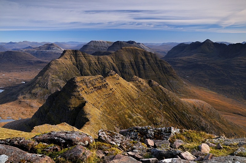
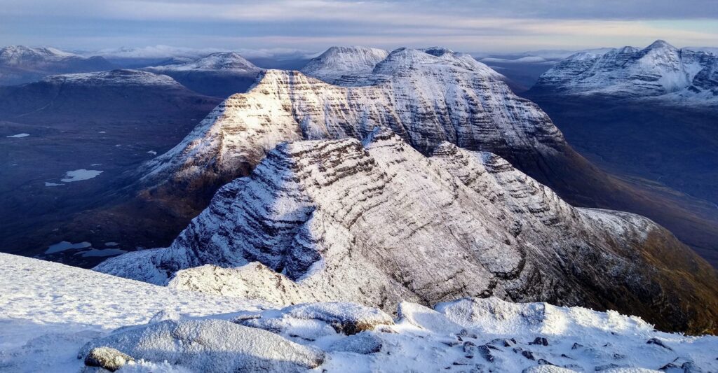
The Horns of Alligin, known in Gaelic as Na Rathanan, are the reason this mountain has such a strong reputation among hillwalkers. This is a narrow, rocky ridge made up of three distinct rock towers, and crossing them involves easy scrambling, generally graded 1 to 2, over exposed but reassuringly grippy Torridonian sandstone.
The ridge begins with a steep drop from Sgùrr Mhòr toward the first Horn. This initial descent is one of the more attention-demanding parts of the whole route, with loose rock underfoot and a real sense of exposure on either side. From there, the path crosses the first Horn before continuing to the second and third.
The most technically demanding sections tend to be around the second and third Horns, where the ridge narrows and the scrambling becomes more sustained. There are bypass paths on some sections that avoid the very crest of the ridge, but several hillwalking guides note that these lower alternative paths can actually feel more exposed than tackling the ridge directly, since they often traverse steep, loose ground below the crest rather than solid rock on top of it.
A few honest points about the Horns:
- The rock itself, Torridonian sandstone, offers excellent friction in dry conditions, which makes the scrambling feel more secure than the exposure might suggest.
- In wet, icy, or windy weather, the difficulty and risk increase substantially. Many experienced Torridon walkers will turn back or choose the non-scrambling route if conditions on the ridge look poor.
- The scrambling is unroped for the vast majority of parties. If you’re inexperienced with exposed terrain, consider hiring a qualified mountain guide for your first crossing, or choose the alternative route back down after the second Munro instead.
- Winter transforms this ridge into a serious mountaineering undertaking requiring ice axe, crampons, and the skills to use them. This is not a route for winter beginners.
If in doubt when you reach Sgùrr Mhòr and look ahead at the Horns, remember that turning back the way you came is always a valid option, and one that experienced Munro-baggers take without hesitation when the weather or their own confidence isn’t right on the day.
Best Time to Climb Beinn Alligin
Beinn Alligin can technically be climbed year-round, but the experience varies enormously by season.
Late spring to early autumn (May to September) is the most popular and generally the safest window for the full horseshoe route, including the Horns. Long daylight hours, typically light of a Highland summer, mean you’re not racing the clock, and the scrambling sections are at their most straightforward when the rock is dry. June through August also brings the highest footfall, so expect company on the ridge and a fuller car park. Be aware that snow can linger on the higher sections into late June in some years, so check recent trip reports before committing to the full traverse early in the season.
Autumn (September to October) often brings some of the clearest, calmest weather of the year in the Highlands, along with golden light on the sandstone and fewer crowds than midsummer. Days shorten quickly though, so plan your start time carefully and carry a headtorch as a precaution.
Winter (November to March) turns Beinn Alligin, and particularly the Horns, into a full winter mountaineering route. Snow, ice, and short daylight hours mean this is strictly for those with proper winter skills, an ice axe, crampons, and experience assessing avalanche risk. Many walkers instead climb only Tom na Gruagaich in winter conditions, avoiding the more exposed ridge entirely.
Midge season deserves a mention of its own. Scotland’s biting midges are most active from late May through September, particularly in still, humid conditions near dawn and dusk. They’re rarely a serious problem once you’re up on the open ridge in a breeze, but they can be relentless in the car park and lower, wooded sections of the walk. Pack repellent if you’re visiting in midsummer.
Whatever the season, check a specialist mountain weather forecast rather than a general town forecast before setting out. Conditions on an 900-metre Torridon ridge can differ dramatically from conditions in the glen below.
Difficulty, Fitness, and Safety
Beinn Alligin is often described as the easiest of the three great Torridon Munros, but that comparison is relative. This is still a serious mountain day.
Difficulty rating: The full horseshoe with the Horns is generally graded as a hard hillwalk with grade 1-2 scrambling. Without the Horns, sticking to the two summits and retracing your steps, the difficulty drops to a tough but non-technical hillwalk.
Fitness required: The initial climb from the car park to Tom na Gruagaich is short but genuinely steep, gaining roughly 700 metres over a couple of kilometres. Combined with the total distance and cumulative ascent across the full route, walkers should be comfortable with long days on rough mountain terrain before attempting this.
Navigation: In clear weather the path is well-trodden and easy to follow across most of the route. In mist, particularly among the Horns, navigation becomes significantly harder, and having a map, compass, and the skills to use them is essential. GPS devices and mapping apps are useful backups but shouldn’t be relied on as your only method, since batteries fail and signal can be unreliable in the glens.
Weather awareness: Torridon sits close to the Atlantic and catches weather systems early. Rain, wind, and low cloud can arrive with little warning even on days that start clear. Build in a turnaround time and stick to it.
Group size and solo walking: Beinn Alligin is popular enough that you’re rarely entirely alone on a summer weekend, but the Horns section still deserves respect if walking solo. Many soloists choose to tackle this route on busier days specifically so there are other walkers nearby, and it’s good practice to leave your planned route and expected return time with someone before setting out regardless of group size.
Mobile signal: Coverage is patchy to non-existent across much of the route. Don’t rely on being able to call for help; carry a proper map and consider a personal locator beacon if you frequently walk remote terrain solo.
If in doubt about your own scrambling experience, several Torridon-based guiding companies offer accompanied ascents of Beinn Alligin, which is a sensible option for a first attempt at the Horns.
What to Pack for Beinn Alligin
Preparation matters more here than on a straightforward hill walk, given the scrambling and the remoteness of the terrain.
Footwear and clothing
- Sturdy walking boots with good ankle support and grippy soles, essential for both the steep ascent and the scrambling on the Horns
- Waterproof jacket and trousers, regardless of the forecast
- Warm mid-layers, since temperatures on the ridge can be significantly colder and windier than at the car park
- Gloves, even in summer, useful for handling rock on the scramble
Navigation and safety
- OS Explorer OL8 map (Cuillin & Torridon Hills) or Landranger 24, plus compass
- A charged phone with an offline mapping app as backup, though not a substitute for a paper map
- Headtorch, particularly for autumn and winter starts or if the day runs longer than planned
- A basic first aid kit and a means of raising the alarm in an emergency
Food and water
- At least 1.5 to 2 litres of water, more in warm weather, since there are limited reliable water sources once you’re above the burn
- Substantial food for a 7 to 9 hour day: sandwiches, energy bars, and something warm for a summit break
- A flask of tea or coffee is a small luxury that goes a long way on a cold, windy ridge
Optional but useful
- Trekking poles for the steep ascent and descent sections, though many walkers stow them for the actual Horns scramble
- A lightweight climbing helmet, which some parties choose to wear on the Horns given the loose rock and exposure, though it isn’t standard practice for most walkers
- Midge repellent for summer visits
- Camera or phone with a wide-angle option, since the ridge views are genuinely some of the best in Scotland
Photography Tips on Beinn Alligin
Beinn Alligin rewards photographers willing to work for their shots. The classic view of Sgùrr Mhòr’s pyramidal peak is best captured from the lower slopes of Tom na Gruagaich, where the whole ridge unfolds ahead of you with good depth and scale.
Early morning light, particularly in the shoulder seasons of late spring and early autumn, catches the red-brown Torridonian sandstone beautifully, especially when low sun rakes across the terraced cliffs. Sunset shots from the summit are spectacular but require careful planning around your descent timing, since coming down the steep upper path or the Horns in fading light adds real risk.
The Eag Dhubh, the Black Cleft, makes for a dramatic foreground subject, though photographing directly into or across it requires care given the sheer drop. On the Horns themselves, wide shots looking back along the ridge toward Sgùrr Mhòr capture the scale of the scramble far better than close-up shots of the rock itself.
Loch Torridon, visible from much of the upper route, offers excellent framing opportunities, particularly with Skye’s outline visible on clear days far to the west.
Accessibility and Family Considerations
Beinn Alligin is not an accessible route in the formal sense. The steep, rocky terrain, the scrambling on the Horns, and the remote setting make it unsuitable for wheelchair users, pushchairs, or anyone with significant mobility limitations.
For families, the full horseshoe is generally not appropriate for younger children, given the scrambling and exposure. However, older children and teenagers with hillwalking experience and a head for heights can manage the two-summit route without the Horns, provided the whole family is comfortable with a long, steep day. Some families choose to walk only as far as the col below Tom na Gruagaich, taking in the views of the surrounding mountains before turning back, which offers a taste of Torridon scenery without the full commitment.
For couples or friends looking for a shared achievement, the full horseshoe with the Horns is often cited as one of Scotland’s best “big day out” routes, combining scenery, a real physical challenge, and a genuine sense of adventure on the scramble. For solo travellers, it’s a rewarding but serious undertaking; the safety notes above apply especially strongly if you’re walking alone.
Where to Stay Near Torridon
Given the isolation of the area, most visitors base themselves in or near Torridon village for at least one night, and often longer to take in more than one of the region’s mountains.
Torridon village itself offers a small range of accommodation, including a hotel with a restaurant and bar, a youth hostel popular with hillwalkers and climbers, and a handful of self-catering cottages. A small shop and cafe in the village cover basic supplies, though it’s worth stocking up more substantially in Kinlochewe or further afield if you have specific needs.
Camping is available both in Torridon and in nearby Kinlochewe, with a mix of formal campsites and, in some areas, opportunities for responsible wild camping under Scotland’s access legislation, though this requires care and knowledge of local guidance.
Kinlochewe, about 30 minutes’ drive east, offers an alternative base with its own hotel and bunkhouse accommodation, and puts you within easy reach of Beinn Eighe as well as Beinn Alligin.
Shieldaig, Lochcarron, and Gairloch sit a short drive from Torridon and offer additional accommodation options along with more extensive facilities, useful if you’re building a longer Highland itinerary around several mountain days.
Booking ahead is strongly advised during the summer months, as accommodation in this part of the Highlands is limited relative to demand, particularly around the peak NC500 touring season.
Other Things to Do Around Torridon
If you’re making the journey out to this corner of Wester Ross, it’s worth building in time for more than just Beinn Alligin.
Liathach and Beinn Eighe are the other two members of Torridon’s celebrated trio, both offering their own demanding but spectacular routes for experienced hillwalkers. Beinn Eighe in particular is home to Britain’s first National Nature Reserve, with a well-marked Mountain Trail offering a lower-level alternative to the full Munro ridge.
The Coire Mhic Fhearchair approach on Beinn Eighe leads to one of Scotland’s most photographed mountain corries, with its pale quartzite triple buttress rising above a dark lochan, and is a worthwhile half-day walk even without continuing to the summit ridge.
Torridon Countryside Centre, run by the National Trust for Scotland, offers exhibits on the geology, wildlife, and history of the area, and is a good stop for context before or after your walk.
Loch Torridon boat trips run seasonally from the village, offering a chance to see the coastline and, with luck, seals or porpoises, from the water rather than the hills.
Applecross, reachable via the dramatic Bealach na Bà mountain pass, makes for a spectacular day trip from Torridon, combining one of Scotland’s most famous driving roads with a remote coastal village.
Given the effort involved in reaching this part of the Highlands, most visitors find it worth allocating at least three or four days to properly explore Torridon and its surroundings rather than treating it as a single-day stop.
Frequently Asked Questions
How hard is Beinn Alligin to climb? Beinn Alligin is considered the most accessible of Torridon’s three great Munros, but the full horseshoe route with the Horns of Alligin involves genuine grade 1-2 scrambling and significant exposure. Without the Horns, it’s a tough but non-technical hillwalk.
How long does it take to climb Beinn Alligin? The full horseshoe route typically takes 7 to 9 hours, covering around 12 to 13 kilometres with roughly 1,250 metres of ascent. Shorter options, such as climbing only Tom na Gruagaich, can take 4 to 5 hours.
Do I need scrambling experience for Beinn Alligin? For the full route over the Horns of Alligin, yes, some comfort with exposed grade 1-2 scrambling is important. Walkers uncomfortable with this can climb both Munros and retrace their steps instead of continuing over the ridge.
Where do I park for Beinn Alligin? The main car park is at Coire Mhic Nobuil, about three kilometres west of Torridon village on the road toward Inveralligin. It’s managed by the National Trust for Scotland and can fill up quickly in summer.
What are the Horns of Alligin? The Horns, or Na Rathanan in Gaelic, are three rocky towers forming a narrow, exposed ridge between Sgùrr Mhòr and the descent path, requiring grade 1-2 scrambling to cross.
Is Beinn Alligin suitable for beginners? The steep ascent and long distance make this unsuitable for complete beginners, and the Horns section adds a further layer of difficulty. Beginners with reasonable fitness could consider the non-scrambling version of the route, ideally alongside more experienced walkers.
What’s the best time of year to walk Beinn Alligin? Late spring through early autumn, roughly May to September, offers the safest and most predictable conditions for the full route, including the Horns, though snow can persist on higher ground into June in some years.
Can you climb Beinn Alligin in winter? Yes, but it becomes a serious winter mountaineering undertaking requiring ice axe, crampons, and the skills to use them safely, particularly on the Horns. Many walkers stick to Tom na Gruagaich alone in winter conditions.
How far is Beinn Alligin from Inverness? Roughly 100 kilometres, taking around two hours to drive via Kinlochewe and Glen Torridon.
Is there public transport to Beinn Alligin? Public transport options are very limited. A local bus reaches Kinlochewe and Torridon village, but the final three kilometres to the trailhead car park generally requires a car or taxi.
Conclusion
Beinn Alligin earns its reputation honestly. It offers a real mountain day, from the steep pull up to Tom na Gruagaich, through the dramatic Black Cleft, over the highest point at Sgùrr Mhòr, and out along the narrow, thrilling line of the Horns of Alligin. Even without the scrambling, the views across Loch Torridon toward Skye make this one of the finest walks in the Scottish Highlands.
Success here comes down to preparation: checking the mountain forecast, choosing the route that matches your experience and the day’s conditions, packing properly, and being honest with yourself about turning back if the ridge doesn’t feel right. Do that, and Beinn Alligin will likely stay with you as one of the best days you’ve ever spent on a Scottish hill.