
Table of Contents
Upper Wharfedale
Introduction
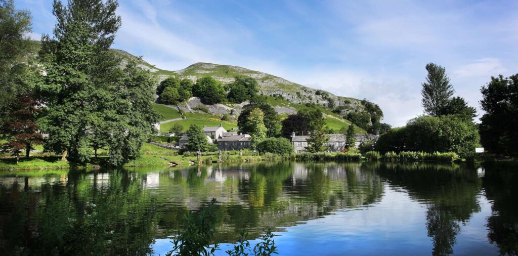
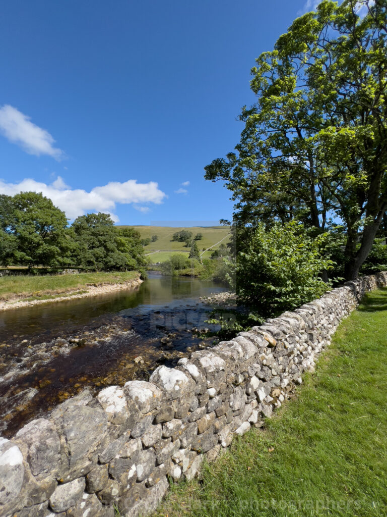
Upper Wharfedale is the part of the Yorkshire Dales that keeps its best secrets for anyone willing to leave the main road. Stretching from the limestone drama of Kilnsey Crag up through Kettlewell, Starbotton and Buckden to the quiet church at Hubberholme, this stretch of the River Wharfe feels like a different country from the crowded honeypots further south. Roads narrow, phone signal fades, and dry stone walls climb the fellsides in patterns laid down centuries ago.
This guide covers everything you need to plan a trip: the villages worth stopping in, the best short and long walks, where to eat and sleep, how to get here without a car, and the kind of practical detail that only comes from actually walking these paths. Whether you have a single afternoon or a full week, Upper Wharfedale rewards slow travel more than almost anywhere else in the Yorkshire Dales National Park.
Quick Facts: Upper Wharfedale
| Detail | Information |
|---|---|
| Location | North Yorkshire, Yorkshire Dales National Park |
| Main villages | Kettlewell, Starbotton, Buckden, Hubberholme, Kilnsey |
| Nearest town | Grassington (gateway to Upper Wharfedale) |
| Nearest railway station | Skipton, around 15 miles away |
| Best for | Walking, cycling, fishing, wildlife, quiet villages |
| River | River Wharfe |
| Highest fells | Great Whernside (704m), Buckden Pike (702m) |
| Ideal visit length | 2–4 days |
| Best seasons | Late spring (May–June) and early autumn (September) |
Where Is Upper Wharfedale and What Makes It Different
Upper Wharfedale is generally understood as the section of Wharfedale between the market town of Grassington and the head of the valley near Beckermonds, where the River Wharfe narrows into Langstrothdale. Lower down, past Addingham and Bolton Abbey, the dale broadens into gentler farmland on its way to the Vale of York. Up here, though, the landscape is defined by Great Scar Limestone, exposed in white outcrops that streak the hillsides and culminate in landmarks like Kilnsey Crag.
The valley sits entirely within North Yorkshire and falls inside the Yorkshire Dales National Park boundary, which means the villages, farms and moorland are protected from the kind of development that has changed other rural corners of England. Roads through the upper dale are often single-track with passing places, and several villages, including Hubberholme and Yockenthwaite, have no shop at all. That lack of infrastructure is precisely the appeal: this is a place people come to slow down.
Geologically, the dale tells a clear story. Millstone grit dominates around Kettlewell and to the north, while limestone takes over further south, which is why walkers doing the classic Kettlewell-to-Buckden route notice the underfoot terrain and vegetation change within a few miles. Calcareous grassland found on the valley sides supports plants such as common rockrose and early-purple orchid, and the estate around Kettlewell and Buckden, managed jointly by the National Trust and local farmers, protects ancient semi-natural woodland, herb-rich hay meadows and important moorland habitat.
Wildlife is a genuine draw here, not a marketing line. The River Wharfe and its becks support kingfisher, grey wagtail and goosander, while oystercatchers nest on shingle beaches along the riverbanks. Below the water, bullhead and brown trout are common. On the fell tops, look and listen for golden plover, meadow pipit, red grouse and, if you’re fortunate, a short-eared owl quartering the moor at dusk. Black grouse favour the fringes where woodland meets open pasture, particularly around the steep gills that cut into the valley sides.
History runs just as deep. Anglian settlers moved up the valley in the 6th and 7th centuries, founding many of today’s villages, while Norse settlers arriving later established the scattered farm-hamlets of the upper dale beyond Buckden. In the medieval period, Fountains Abbey and Bolton Priory held large estates here, and their monks laid out the network of roads and green lanes still used by walkers and farmers today. The Enclosure Acts of the late 18th and early 19th centuries then carved the valley bottom into the rectangular pastures bounded by dry stone walls that give Upper Wharfedale its distinctive chequerboard look from the fell tops.
Kettlewell: The Heart of Upper Wharfedale
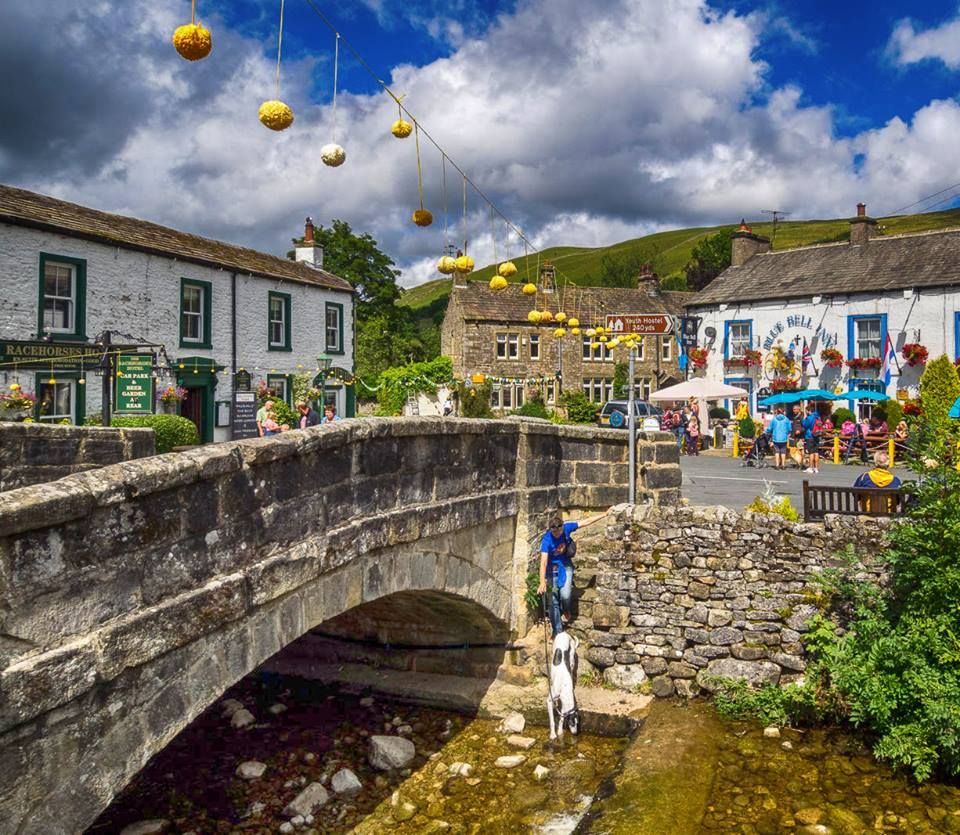
Kettlewell is the village most visitors treat as their base, and it earns that role. Set where the old coach road over Park Rash Pass from Coverdale meets the main dale road, this grey stone village once served as a transport hub, a history still visible in the number of inns packed into such a small settlement. The Blue Bell Inn is thought to be the oldest of the three, with hand-pulled ale and log fires that make it a natural stop after a wet walk. The Racehorses Hotel sits in an attractive 18th-century building beside the river, and the King’s Head, tucked slightly away from the main road, has built a reputation for locally sourced food.
The village itself rewards an unhurried wander. A short stroll along the riverside is enjoyable even for visitors not planning a full day’s walk, and the parish church, with its Norman font, is worth ducking into. Kettlewell’s annual Scarecrow Festival, held each summer, brings a burst of colour and community spirit to the whitewashed cottages, and is a popular reason for a return visit with children.
For walkers, Kettlewell is a genuine trailhead. Great Whernside rises to the east at 704 metres, a solid but manageable climb for anyone with reasonable fitness and good boots, rewarding effort with wide views back down the dale. Another well-loved route heads over Old Cote Moor towards Arncliffe in neighbouring Littondale, returning via Hawkscliffe, a viewpoint that looks straight down onto Kilnsey Crag from Knipe Scar. Those wanting a gentler day can simply follow the riverside path rather than climb.
Practically speaking, Kettlewell has a village store on Middle Lane that covers self-catering basics, useful if you’re staying in one of the area’s many holiday cottages rather than a B&B. There is a regular minibus service to and from Grassington on weekdays, with additional services on Sundays, and buses stop outside the National Park car park, which has toilets. Kettlewell sits roughly six miles from Grassington and around fourteen miles from Skipton, the nearest railway town, making it comfortably reachable without a car for anyone prepared to plan around the timetable.
Kilnsey Crag and Kilnsey Village
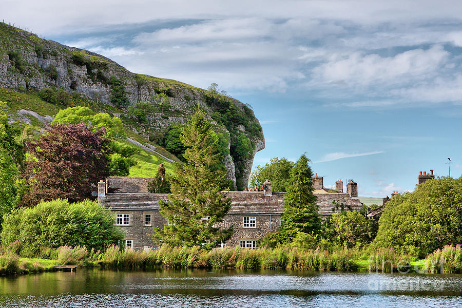
Few landmarks in the Yorkshire Dales are as instantly recognisable as Kilnsey Crag, a dramatic overhanging limestone cliff that looms above the B6160 between Grassington and Kettlewell. The crag formed as part of a reef system roughly 300 million years ago and was later carved into its current overhanging shape by glacial action, leaving a distinctive limestone nose that has become one of the most photographed features in the National Park.
Climbers travel from across the country specifically for Kilnsey, since the crag offers both bolted sport routes and traditional climbing on its steeper faces, though the rock is notoriously exposed and technical, better suited to experienced climbers than beginners. For everyone else, the crag is simply a spectacular thing to see from the roadside, and a short detour off the main path for photographs is well worth the few minutes it takes.
The hamlet of Kilnsey itself is tiny but well equipped for visitors. The Tennant’s Arms pub serves reliable food and local ales beneath the shadow of the crag, and Kilnsey Park, set on the historic Kilnsey Estate, offers a genuinely good family day out with trout fishing lakes suitable for beginners, a nature trail, a farm shop and a café. The parish is also home to red squirrels and, according to conservation groups working in the valley, the rarest orchid species found in the country, which makes careful, low-impact walking through the surrounding fields especially important.
Getting to Kilnsey without a car is straightforward by Dales standards. The number 72 bus runs daily from Skipton to Grassington, with a connecting minibus service (72B) continuing on to Buckden and calling at Kilnsey along the way, and there are additional weekend services from Leeds via Ilkley. Free parking is available at Kilnsey Park itself for those arriving by car, and the site sits directly on National Cycle Network Regional Route 10 and the Dales Cycleway, making it a natural stop for cyclists touring the dale.
Buckden and the Head of the Dale
Buckden marks, by most local definitions, the point where Upper Wharfedale ends and Langstrothdale begins. It’s a small village, home to just over 170 people at the last census, but it punches well above its size as a walking base thanks to its position at the junction of several classic routes. The Buckden–Cray–Hubberholme circuit is a low-level triangle that works even when the higher fells are hidden in cloud, while a full ascent of Buckden Pike via Starbotton makes for a satisfying seven-mile loop with genuine reward at the summit.
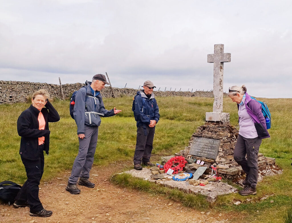
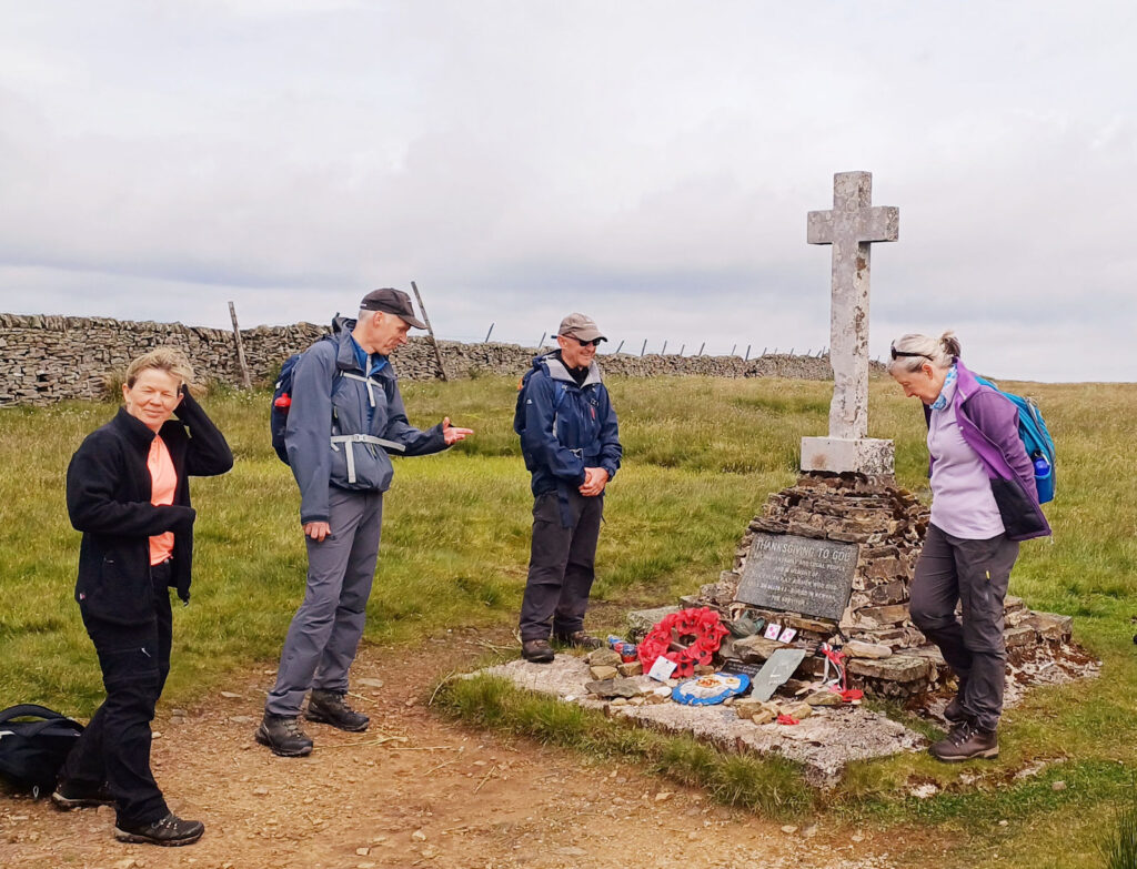
Buckden Pike itself carries a sobering wartime story. A memorial cross near the 702-metre summit is studded with fragments of a Wellington bomber that crashed here in a blizzard in 1942, killing four of the six Polish airmen on board. The tail gunner survived by following fox tracks down towards Cray, correctly reasoning they would lead to a farmhouse, though the sixth crew member died before help could reach him. Walkers still pause at the cross, and a small fox statue was later added nearby in tribute to the story.
The village itself has lost its shop in recent years, so self-caterers should stock up in Skipton or Grassington before heading up the dale. What remains is solid: the Buck Inn is a proper traditional pub offering both food and rooms, and there are several well-regarded bed and breakfasts nearby, including options just north of the inn on the road towards Cray. Camping pods and pitches are also available for those travelling with a tent or campervan, a popular option in summer given how limited indoor accommodation becomes at peak times.
From Buckden, the road and river continue north together into Langstrothdale, passing through increasingly remote and beautiful country. The B6160 also branches east here through Bishopdale towards Aysgarth in Wensleydale, which makes Buckden a useful pivot point for anyone planning to link Wharfedale with a wider Dales road trip rather than an out-and-back visit.
Hubberholme and Langstrothdale
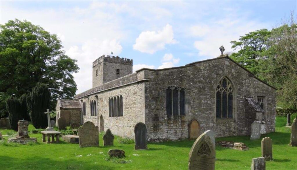
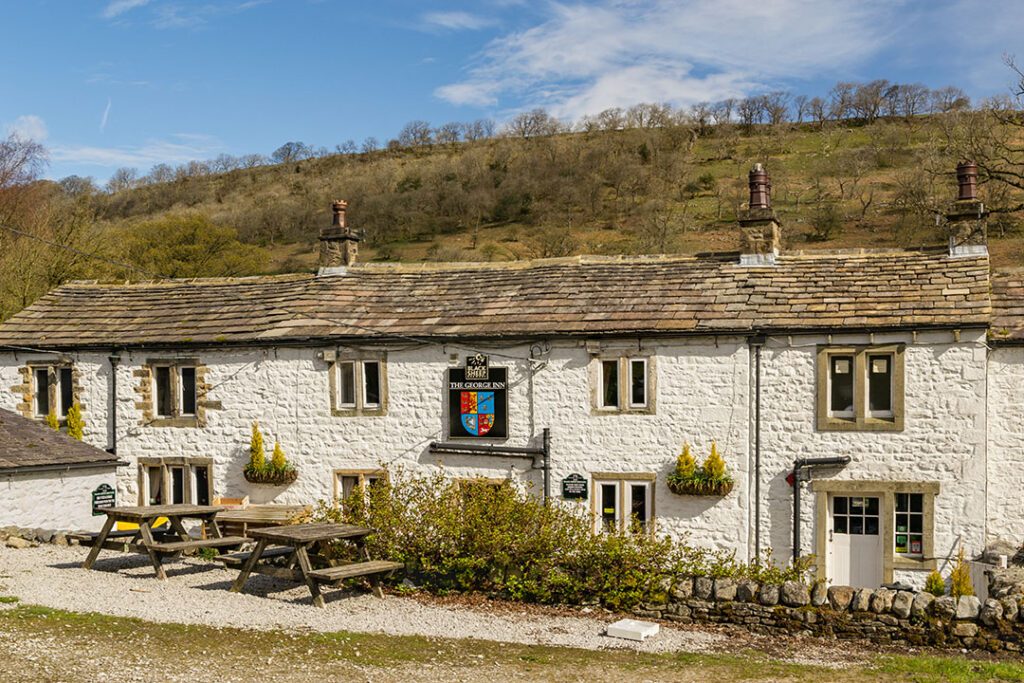
If Upper Wharfedale has a spiritual heart, most regular visitors would point to Hubberholme. This tiny settlement, really just a handful of farm buildings clustered around a bridge, sits at the very start of Langstrothdale Chase, once a Norman hunting ground with its own forest laws. The village centres on two buildings that face each other across the road: St Michael and All Angels Church, a Norman building with a rare surviving rood loft, and the George Inn, originally the vicarage.
The church holds the ashes of J.B. Priestley, the Bradford-born playwright and novelist, who described this stretch of the dale as one of the loveliest corners of England he had ever known and asked to be laid to rest here. It’s a modest, moving place to visit, largely because it feels so unstaged compared with more famous literary graves elsewhere in the country.
Hubberholme’s other claim to fame is stranger and older. Every New Year’s Day, an ancient auction takes place in the George Inn for the tenancy of the Poor Pasture, a sixteen-acre field behind the pub. A candle is lit, bids are called out, and the auction must be completed before the candle burns down, with proceeds going to support older residents of the parish. When the pub is open outside of that tradition, a candle is still sometimes lit in the window, echoing the old vicar’s signal to parishioners that he had returned home.
Beyond Hubberholme, the valley narrows and the river’s name changes, becoming Langstrothdale rather than Wharfedale, a shift that reflects Old English roots meaning roughly “long marsh.” The scattered hamlets of Yockenthwaite and Beckermonds sit further up, marking the approach to the river’s actual source high on Cam Fell. This upper section has almost no facilities and very limited parking, particularly around Yockenthwaite, so it suits walkers and cyclists better than casual sightseers arriving by car. The reward is real isolation: on a quiet weekday, it’s entirely possible to walk for an hour here without seeing another person.
The Best Walks in Upper Wharfedale
Walking is the primary reason most people visit Upper Wharfedale, and the dale offers routes for every level of fitness and ambition.
Kettlewell to Buckden (riverside): A gentle, well-signed route that follows the Wharfe closely in both directions, suitable for most walkers and often combined with a bus back to the starting point. Doing it in one direction takes you through millstone grit country, while the return leg crosses into limestone terrain, making the geological shift genuinely visible underfoot.
Buckden–Cray–Hubberholme triangle: A low-level loop of a few miles that works well as a half-day option or as a fallback when weather closes in on the higher fells. It passes Cray High Bridge, where a compact but attractive waterfall is worth the short detour from the White Lion Inn.
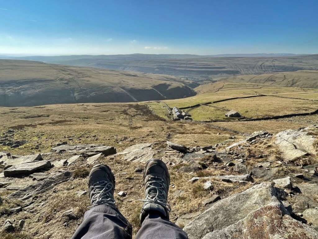
Great Whernside from Kettlewell: A proper fell walk at 704 metres, with a clear but occasionally boggy path. Allow around four to five hours round trip and take proper waterproof boots; this is open moorland with little shelter.
Buckden Pike via Starbotton: A seven-mile circuit combining a steady climb with genuine historical interest at the summit memorial. Views from the top stretch across much of Upper Wharfedale on a clear day.
Conistone Dib: A short but dramatic detour from the Dales Way near Conistone, dropping walkers into a narrow limestone gorge so tight in places that you’re forced to walk single file. It adds roughly a mile to a longer walk but delivers a disproportionate amount of drama for the effort involved.
Hubberholme to Yockenthwaite and back: A quieter riverside walk into Langstrothdale, good for spotting wildlife and appreciating the valley’s transition from farmed dale to open moor.
The Wharfedale Three Peaks: A more ambitious day centred on Kettlewell, taking in Great Whernside, Buckden Pike and Birks Fell in a single circuit. This is a serious undertaking best suited to experienced hillwalkers with a full day and good weather.
The Dales Way long-distance path also runs directly through the dale, linking Grassington, Kilnsey, Kettlewell, Buckden, Hubberholme and Langstrothdale on its way towards Ribblehead and eventually the Lake District, so multi-day walkers can join or leave the route at several convenient points.
Cycling and Other Outdoor Activities
Upper Wharfedale has become a genuinely popular cycling destination, helped by its inclusion on a stage of the 2014 Tour de France, which passed through the dale and left a lasting legacy of cycle-friendly infrastructure and local enthusiasm. The B6160 through the dale, while narrow, offers a rewarding road-cycling route with long climbs and equally long descents, while National Cycle Network Regional Route 10 and the wider Dales Cycleway both pass through Kilnsey.
Mountain bikers have plenty of options too, particularly on the bridleways and old drove roads across the moorland tops, including sections of the ancient route once used to move livestock between Wharfedale and Coverdale. Fishing is another well-established activity, especially around Kilnsey Park, where stocked lakes suit beginners, while more experienced anglers head for stretches of the River Wharfe itself, home to wild brown trout.
Horse riding is available through operators based around Kilnsey, and the valley’s quiet lanes make for pleasant, low-traffic routes. For a more relaxed day, birdwatching along the riverbanks near Kettlewell and Kilnsey is rewarding even without specialist equipment, particularly in spring and early summer when kingfisher and grey wagtail sightings are most likely.
Where to Eat and Drink in Upper Wharfedale
Dining in Upper Wharfedale is built almost entirely around traditional pubs rather than standalone restaurants, and that’s very much part of the character of the place. In Kettlewell, the Blue Bell Inn, the Racehorses Hotel and the King’s Head each offer solid, hearty food aimed squarely at walkers, from proper Sunday roasts to simple sandwiches for anyone passing through mid-hike.
In Buckden, the Buck Inn is the obvious choice, serving food alongside its rooms and functioning as the social centre of the village. Hubberholme’s George Inn, right beside the church, is arguably the most atmospheric spot in the entire dale for a pint after a walk, particularly in winter when the fire is lit. Down at Kilnsey, the Tennant’s Arms serves reliable pub food beneath the crag, and Kilnsey Park’s café is a good daytime option for families, offering lighter meals and locally sourced produce from the estate.
Self-caterers should plan ahead. With Buckden’s village shop now closed and many upper-dale hamlets having no shop at all, Kettlewell’s store on Middle Lane is genuinely useful, but a proper supermarket stock-up in Skipton or Grassington before heading into the dale is the safer option, particularly outside peak opening hours.
Where to Stay in Upper Wharfedale
Accommodation across Upper Wharfedale leans heavily towards traditional inns, bed and breakfasts and self-catering cottages rather than large hotels, which suits the character of the place but means booking ahead matters, especially in summer.
Kettlewell has the widest spread of options, from double rooms above its historic pubs to holiday cottages tucked into the village itself, many within easy walking distance of the surrounding fells. Buckden offers a smaller but well-regarded selection, including B&B rooms above the Buck Inn and nearby cottages, plus camping pods and pitches for those travelling more simply. Kilnsey Park also offers on-site accommodation, putting guests directly beneath the crag with immediate access to fishing, walking and the estate’s nature trail.
For a wider range of hotels and larger self-catering properties, Grassington, just outside the upper dale proper, makes a practical base with considerably more choice, while still leaving Kettlewell and Kilnsey within a short drive or bus ride.
Getting to Upper Wharfedale
Skipton is the gateway for most visitors, sitting on the main railway line from Leeds and served by regular direct trains, with the dale itself lying roughly eleven to fifteen miles further north. From Skipton, the number 72 bus service runs to Grassington, with a connecting 72B minibus continuing up the dale through Kilnsey and Kettlewell to Buckden, calling at most villages along the way. Weekend services also run from Leeds via Ilkley, useful for visitors without their own transport.
Drivers should be prepared for narrow, single-track sections with passing places once beyond Kilnsey, and should note that several roads, including the old coach road over Park Rash from Kettlewell, are unsuitable for larger vehicles or caravans. Parking is limited in the smaller villages, particularly Hubberholme, Cray and Yockenthwaite, so arriving early in peak season is worthwhile.
The nearest airport is Leeds Bradford, served by budget carriers, with a drive of around an hour to the edge of the dale. For anyone combining Upper Wharfedale with a wider Dales trip, the Settle–Carlisle railway line, which runs through the western side of the National Park, connects at Skipton and offers a scenic alternative route into the region.
Best Time to Visit Upper Wharfedale
Late spring, particularly May and June, is widely considered the best window to visit. Hay meadows are at their most colourful, the moorland tops are alive with breeding birds like curlew and lapwing, and the dale hasn’t yet reached its busiest summer footfall. Early autumn, especially September, offers a similar quiet window with the added bonus of turning bracken on the fellsides and clearer light for photography.
Summer brings the warmest weather and the longest days, ideal for tackling the higher fells like Great Whernside, but also the busiest roads and fullest accommodation, so booking well ahead is essential if visiting in July or August. Winter has a stark, quiet beauty of its own, particularly around Hubberholme and Buckden, though several of the higher routes become genuinely serious undertakings in snow and ice, and the Buckden Pike memorial is a reminder of how quickly weather can turn on these fells.
Whatever the season, layered clothing and proper waterproofs are non-negotiable. This is genuinely changeable upland weather, and conditions on the valley floor rarely match those on the tops.
Family, Solo and Accessibility Tips
Families tend to gravitate towards Kilnsey Park, where fishing lakes, a nature trail and a café make for an easy, low-stress day without demanding fitness or long distances from young children. The riverside paths around Kettlewell and Buckden are similarly manageable with a pushchair on dry ground, though surfaces become uneven quickly once you leave the valley floor.
Solo travellers will find Upper Wharfedale unusually welcoming. The pub culture here is sociable rather than clannish, and walking routes are well signed enough that solo hiking on the main paths feels safe with reasonable preparation. That said, mobile signal is patchy to non-existent in much of the upper dale, so telling someone your planned route, especially before tackling Great Whernside or the Wharfedale Three Peaks, is sound practice rather than overcaution.
Couples looking for a quieter, more romantic base often favour Hubberholme or Buckden over busier Kettlewell, trading a slightly longer drive to amenities for genuine peace in the evenings. Accessibility across the dale is limited by the terrain itself; most riverside paths near the villages are relatively level, but the National Park has few purpose-built accessible trails once you move away from the valley floor, so anyone with mobility needs should check specific route conditions in advance through the National Park Authority.
Photography Tips for Upper Wharfedale
Kilnsey Crag is the single most photographed feature in the dale, and it photographs best in early morning or late afternoon light, when the low sun rakes across the limestone and throws the crag’s overhang into sharp relief. Buckden Pike’s summit cross offers a striking foreground against wide valley views on a clear day, though reaching it demands a proper walk with time built in either side for weather changes.
For village photography, Hubberholme’s church and the George Inn facing each other across the narrow road make a classic, uncluttered composition, particularly with autumn colour on the surrounding trees. Riverside spots near Kettlewell and Starbotton work well for reflections in calm water, best attempted early in the morning before wind picks up. Wildlife photographers should focus patience on the becks and gills for kingfisher sightings, and on the moorland fringes near dusk for a chance at short-eared owl or black grouse, though a long lens and genuine stillness are essential for either.
A Suggested Two-Day Itinerary
Day One: Start in Kilnsey, photographing the crag in the morning light before a stop at Kilnsey Park for coffee. Continue to Kettlewell for lunch at one of the village inns, then walk the riverside path towards Starbotton and back, or tackle Great Whernside if time and fitness allow. Overnight in Kettlewell.
Day Two: Head up the dale to Buckden, walking the Buckden–Cray–Hubberholme triangle at a relaxed pace, pausing at Cray High Bridge waterfall and spending proper time at Hubberholme church and the George Inn. If energy allows, push on a little further into Langstrothdale towards Yockenthwaite before heading back to Buckden or Skipton for the return journey.
This pace leaves room for weather delays, unhurried pub stops and the kind of wandering that tends to produce the best memories of a trip like this.
Conclusion
Upper Wharfedale rewards visitors who are willing to slow down and let the dale set the pace, rather than treating it as a checklist of viewpoints. From the drama of Kilnsey Crag to the quiet dignity of Hubberholme’s church, this stretch of the Yorkshire Dales National Park offers some of the best walking, wildlife and village character in the whole of Yorkshire. Plan around the bus timetables or bring good boots, book accommodation ahead in summer, and give yourself at least two full days if you can. Once you’ve found Upper Wharfedale, as regular visitors often say, you won’t forget it.
Frequently Asked Questions
Where does Upper Wharfedale start and end? Most guides define Upper Wharfedale as the section between Grassington and the head of the dale near Beckermonds, where the valley narrows and becomes Langstrothdale. Below Grassington, the valley is generally described as Central or Lower Wharfedale.
What is the best village to stay in for Upper Wharfedale? Kettlewell is the most popular base thanks to its central position, choice of pubs and inns, and easy bus links to Grassington and Skipton. Buckden and Kilnsey suit visitors wanting a quieter, more remote experience.
Is Upper Wharfedale good for walking without much experience? Yes. Riverside routes between Kettlewell, Starbotton and Buckden are gentle and well signed, suitable for most fitness levels. Higher routes onto Great Whernside or Buckden Pike require proper footwear and fitness.
Can you visit Upper Wharfedale without a car? Yes, though it takes planning. Trains run to Skipton, then buses (including the 72 and connecting 72B) run up the dale through Grassington, Kilnsey, Kettlewell and on to Buckden, with reduced services on Sundays.
What is Kilnsey Crag and can you climb it? Kilnsey Crag is a large overhanging limestone cliff beside the B6160, popular with experienced rock climbers for both bolted and traditional routes. It is not suitable for beginners and is best appreciated from the roadside by most visitors.
Why is J.B. Priestley connected to Hubberholme? The writer J.B. Priestley considered this part of Wharfedale among the most beautiful in England and asked for his ashes to be interred at St Michael and All Angels Church in Hubberholme, where a small memorial can still be visited.
Are there shops in the upper dale villages? Very few. Kettlewell has a village store, but Buckden’s shop has closed and hamlets like Hubberholme and Yockenthwaite have no shops at all. Stocking up in Skipton or Grassington beforehand is recommended.
What is the best time of year to visit Upper Wharfedale? Late spring (May–June) and early autumn (September) offer the best balance of good weather, colourful landscapes and lighter crowds. Summer is busiest and requires early accommodation booking.
Is Upper Wharfedale suitable for families? Yes, particularly around Kilnsey Park, which offers fishing, a nature trail and a café suited to children, alongside gentle riverside walks near Kettlewell and Buckden.
What wildlife might I see in Upper Wharfedale? Kingfisher, grey wagtail and goosander are found along the river, oystercatchers nest on shingle riverbanks, and the moorland tops support red grouse, golden plover and occasionally short-eared owl, alongside red squirrels near Kilnsey.