
Table of Contents
Swaledale
Introduction
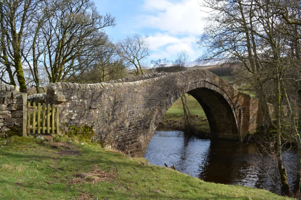
Swaledale is the northernmost and, by most accounts, the most dramatic of the Yorkshire Dales. Carved by the River Swale and fenced in by high heather moorland, it feels noticeably wilder and quieter than its better-known neighbours like Wensleydale or Wharfedale. Traditional stone barns dot every meadow, dry-stone walls climb impossibly steep hillsides, and hardy black-faced Swaledale sheep graze fields that have barely changed in centuries.
This guide covers everything you need for a first visit or a return trip: the villages worth basing yourself in, the best walks and waterfalls, where to eat and what to eat, the wildflower hay meadows that draw photographers every June, and a practical two-day itinerary. Whether you’re planning a short weekend break or a full week exploring Swaledale on foot or by bike, you’ll find the details here to plan a trip that goes beyond the obvious tourist stops.
Where Is Swaledale and How Do You Get There
Swaledale sits in the northern part of the Yorkshire Dales National Park, running roughly from the high moors near the Cumbrian border in the west down to the market town of Richmond in the east. <cite index=”17-1″>The dale runs west from the high moors on the Cumbrian border to the market town of Richmond, and from the upper reaches around Keld the valley runs south before turning east at Thwaite, passing through Muker, Gunnerside, Low Row and Reeth before reaching Richmond.</cite> Swaledale sits parallel to neighbouring Wensleydale, and the two dales are connected by the famous Buttertubs Pass road.
By car, the dale is most easily reached via the A1(M) to Scotch Corner, then the B6270 through Richmond and along the valley. If you’re coming from the west, the A66 near Kirkby Stephen connects to Swaledale via the Tan Hill road. There’s no railway line running directly through the dale itself, so most visitors either drive or arrive by bus from Richmond, Darlington, or Northallerton, all of which have mainline rail connections.
A car is genuinely the most practical way to see Swaledale, since the villages are spread out and public transport is limited, especially outside summer. If you don’t drive, Reeth is the best base, as it has the most regular bus links and enough facilities to explore on foot or by bike.
Swaledale’s Villages: Where to Base Yourself
Reeth: The Gateway Village
Reeth is Swaledale’s largest and most visited village, arranged around a wide, sloping green that has hosted a market since medieval times. <cite index=”6-1″>Reeth is a bustling village known for its green, artisan shops, pubs, and weekly market on Fridays</cite>, and it makes an excellent first stop for orientation. The Swaledale Museum, housed in a former Methodist school room, gives a genuinely interesting introduction to the dale’s lead-mining and farming history before you head further up the valley. Reeth also has the best concentration of pubs, cafes, and small shops in Swaledale, along with the Dales Bike Centre for cycle hire and repairs.
Gunnerside
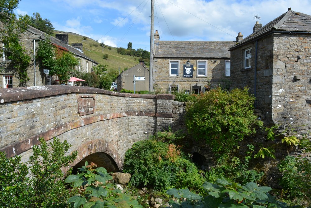
A smaller, prettier village strung along Gunnerside Beck, Gunnerside is the starting point for one of Swaledale’s best-known walks up Gunnerside Gill, past the ruins of old lead mines. The King’s Head is a reliable stop for a pint with a view, and the village itself, with its stone bridge and cluster of cottages, is one of the most photogenic in the dale.
Muker
Muker is a tiny, tightly packed village of stone cottages that becomes genuinely spectacular in late spring and early summer, when the surrounding hay meadows fill with wildflowers. St Mary’s Church, consecrated in 1580, sits at the heart of the village, and the Farmers Arms and a village shop provide welcome refreshment for walkers coming off the fells. Muker’s wool shop, Swaledale Woollens, sells hand-knitted garments made from local wool.
Keld
The remote hamlet of Keld marks the point where several of England’s great long-distance trails converge, and it’s the quietest and most atmospheric of Swaledale’s settlements. There’s a small shop, public toilets, and limited accommodation, but the real draw is the surrounding landscape: waterfalls, gorges, and high moorland in every direction.
Arkengarthdale and the Smaller Hamlets
Branching north from Reeth, Arkengarthdale is Swaledale’s quieter sister valley. <cite index=”7-1″>The Arkengarthdale road rises steeply from Reeth into former lead-mining country, and the valley has a bleak, dramatic appeal with the small villages of Arkle Town and Langthwaite blending into the landscape.</cite> Langthwaite appeared in the opening shots of the television series “All Creatures Great and Small,” and the hamlet of Booze, tucked in a side valley above Arkengarthdale, has one of the more memorable place names in England.
The Best Walks in Swaledale
Gunnerside Gill and the Old Lead Mines
This is the classic Swaledale industrial-heritage walk. <cite index=”11-1″>The route follows Gunnerside Beck through a beautiful valley with imposing scars, woodland, and waterfalls, passing the ruins of Blakethwaite Smelt Mill and old mine offices from the area’s significant eighteenth and nineteenth-century lead-mining industry.</cite> For a longer version, continue west and uphill onto the moorland tracks toward Swinner Gill, where more waterfalls and mine ruins wait among the heather.
Keld to Muker via Kisdon Force
<cite index=”12-1″>This stretch of Upper Swaledale, taking in Keld, Thwaite, and Muker, is crisscrossed by the Coast to Coast Path, the Pennine Way, and the Swale Trail, with tranquil riverside walking past dramatic waterfalls such as Kisdon Force near Keld.</cite> The walk between the two villages can be done as a there-and-back or extended into a circular route of around six miles, and it’s one of the most rewarding half-day walks in the entire national park.
The Swale Trail
<cite index=”6-1″>The Swale Trail is a 20km off-road route running from Reeth to Keld along the River Swale, following the valley through quaint villages and is well suited to families and leisure cyclists.</cite> You don’t need to ride the whole thing; sections can be walked or cycled independently, making it one of the most flexible routes in the dale.
Fremington Edge
For sweeping views without a full day’s commitment, the climb up Fremington Edge from Reeth is steep but short. <cite index=”6-1″>The climb rewards walkers with panoramic views across the valley, making it a perfect spot to rest, eat a sandwich, and take in the wild beauty of the Dales.</cite>
Keld’s Waterfall Circuit and Wain Wath Force
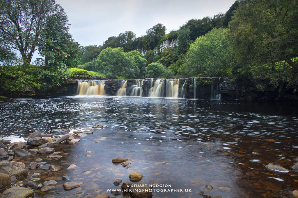
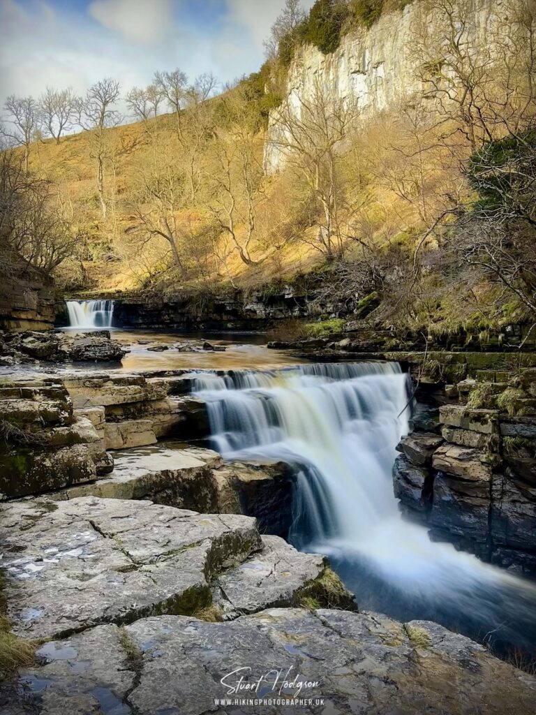
Keld sits at the centre of a small cluster of waterfalls, including Catrake Force and Wain Wath Force, most of which are reachable on short walks of under an hour. <cite index=”6-1″>A short walk from Keld leads to several hidden waterfalls that are both beautiful and easily accessible.</cite> This makes Keld an excellent base for anyone who wants dramatic scenery without committing to a full-day hike.
Ravenseat and Tan Hill
For a longer, wilder day out, the walk from Keld across Stonesdale Moor to Ravenseat Farm and on to the Tan Hill Inn, England’s highest pub, takes in some of Swaledale’s most exposed and beautiful high-fell scenery. <cite index=”14-1″>This route takes in Kisdon Force and Ravenseat Farm, the home made famous by television’s Yorkshire Shepherdess, before crossing high exposed fells to reach the historic Tan Hill Inn, with the return leg following the renowned Pennine Way.</cite> Allow a full day and check the weather carefully, since the moor offers little shelter.
Swaledale’s Hay Meadows and Wildlife
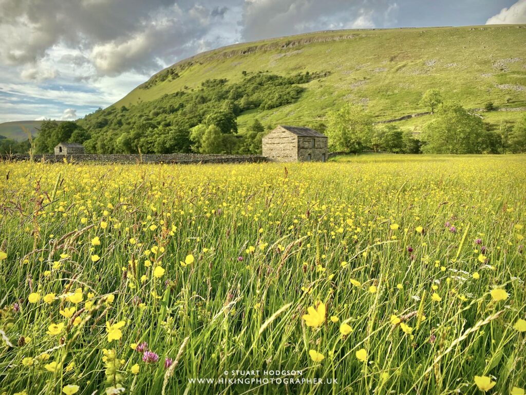
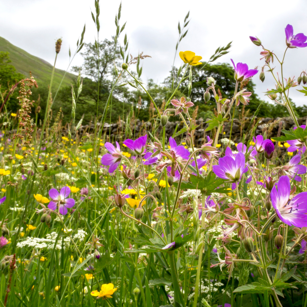
Few landscapes in England are as fragile or as celebrated as Swaledale’s traditional hay meadows. <cite index=”20-1″>Swaledale lies within the Pennine Dales Environmentally Sensitive Area, part of the Yorkshire Dales National Park, and contains some of the best surviving examples of Britain’s most fragile habitats, the hay meadows.</cite> In late May and June, these unimproved meadows around Muker and Keld erupt with wood cranesbill, yellow rattle, and buttercups, drawing walkers, botanists, and photographers from across the country. The meadows are cut for hay in July, so the display is strictly seasonal; if wildflowers are your priority, plan a visit for late May into mid-June and always keep to the marked footpaths, since these habitats are easily damaged.
Beyond the meadows, keep an eye out for curlew and lapwing on the moorland edges, red squirrels in the wooded gills, and the iconic black-faced Swaledale sheep, a hardy breed developed specifically for the dale’s harsh upland conditions and now farmed across northern England.
Local Food and Drink
Swaledale Cheese
No trip to the dale is complete without trying the cheese that shares its name. <cite index=”21-1″>Swaledale farm wives took up cheesemaking from the seventeenth century onward, each household developing its own methods and reputation, with the milk from cows grazing the dale’s varied hay meadows giving the cheese its distinctive character.</cite> <cite index=”21-1″>Swaledale’s tougher terrain and wilder grasses produced a richer, earthier cheese than the softer, sweeter cheese made in neighbouring Wensleydale.</cite> Today, the Swaledale Cheese Company continues the tradition using an old recipe, and its cheeses are sold in specialist shops and farmers’ markets around the dale.
Pubs and Tea Rooms
Every village in Swaledale has at least one good pub or tea room, and they’re worth building your day around. The Farmers Arms in Muker, the King’s Head in Gunnerside, and the pubs around Reeth’s green all serve hearty, unfussy food that suits a day of walking: stews, pies, and generous puddings. In Keld, small shops and campsites sell home-baked goods that make an ideal mid-walk stop.
Yorkshire Dales Cheese Festival
If your visit coincides with autumn, the wider Dales cheese festival is worth the short drive to Hawes. <cite index=”22-1″>The festival celebrates the produce of the Dales, with local businesses throughout the national park hosting their own events, special menus and tastings to mark the occasion.</cite> It’s a good excuse to combine a Swaledale walking trip with a visit to neighbouring Wensleydale.
Best Time to Visit Swaledale
Spring (April–May): Lambing season and the start of the wildflower displays. Quieter than summer, with cooler weather and a good chance of dramatic light for photography.
Early summer (late May–June): Peak hay meadow season around Muker and Keld. Book accommodation well ahead, as this is the busiest and most photographed period of the year.
Summer (July–August): Long days and the best chance of settled weather for high-level walks like Tan Hill. Also the busiest period on the roads and in village car parks.
Autumn (September–October): The bracken turns gold on the fellsides and the moors take on a russet colour, making this one of the most beautiful and least crowded times to visit.
Winter (November–March): Genuinely remote and often snowbound at higher elevations. Some roads over the tops can close in bad weather, but the villages themselves are cosy, and log fires in the pubs make it a good time for shorter, lower-level walks.
Where to Stay in Swaledale
Accommodation ranges from farmhouse bed and breakfasts to self-catering cottages and simple campsites, and the choice largely depends on which part of the dale you want as your base.
- Reeth offers the widest range of options and the most facilities within walking distance, making it the easiest base for a first visit.
- Gunnerside and Low Row suit visitors who want a quieter, more central location for walking without sacrificing easy access to Reeth.
- Muker and Thwaite are ideal if the hay meadows and Upper Swaledale walks are your priority.
- Keld is the choice for walkers tackling the Coast to Coast Path or Pennine Way, or anyone who wants true remoteness.
Camping and caravan sites are dotted throughout the dale, including options in Thwaite and Redmire, and several working farms offer simple, well-located pitches for walkers and cyclists.
Suggested Two-Day Swaledale Itinerary
Day One: Reeth to Gunnerside
Start in Reeth, visiting the Swaledale Museum and browsing the shops around the green before a late-morning coffee. Drive or cycle up the valley to Gunnerside, then walk the Gunnerside Gill route past the old lead-mine ruins, allowing two to three hours depending on how far you go. Finish with a pint at the King’s Head before heading back to your accommodation. If you have energy left, climb Fremington Edge from Reeth in the early evening for sunset views over the valley.
Day Two: Muker, Keld and the Waterfalls
Head up to Muker in the morning, ideally in late May or June to catch the hay meadows in bloom, and walk the riverside path from Muker to Keld, stopping at Kisdon Force along the way. In Keld, explore the short waterfall circuit around Catrake Force and Wain Wath Force before lunch at one of the village’s small cafes or shops. In the afternoon, drive the short but spectacular Buttertubs Pass toward Wensleydale, stopping at the limestone potholes at the summit, before looping back into Swaledale.
Practical Travel Tips
- Weather changes fast. Even in summer, take waterproofs and warm layers for any walk above the valley floor, particularly toward Tan Hill and the open moors.
- Mobile signal is patchy. Download offline maps before setting off on longer walks, and tell someone your planned route.
- Parking is limited in the smaller villages. Arrive early in summer, especially around Muker and Keld during the wildflower season.
- Stick to footpaths in the hay meadows. These habitats are protected and easily damaged; the marked paths exist to keep both the meadows and the farmers happy.
- Dogs are welcome on most routes but should be kept on leads around livestock, which is present on almost every walk in the dale.
- Fuel up in Reeth or Richmond. Fuel stations are scarce further up the valley.
Accessibility and Family Considerations
Swaledale is a genuinely hilly landscape, and many of its best walks involve steep or uneven terrain, so it’s worth planning carefully if mobility is a concern. The Swale Trail between Reeth and Keld is the most accessible long route, with relatively gentle gradients suitable for hybrid bikes and confident wheelchair or mobility-scooter users on its firmer sections, though surfaces vary and some stretches are unsuitable. Reeth’s village green and museum are level and easy to explore on foot.
For families, the riverside stretch from Muker to Keld is gentle enough for younger children, and the shallow sections of the River Swale near Keld are popular for paddling and picnics in summer. <cite index=”13-1″>Older children who enjoy more of a challenge can try the eight-mile circular route from Gunnerside up onto the high moors, which offers stunning views across the valley.</cite> Solo travellers and couples alike will find Swaledale’s network of well-signposted trails easy to navigate independently, and the dale’s pubs make sociable, low-key evening spots after a day on the fells.
Photography Tips
Swaledale rewards early starts. The best light on the drystone-walled fields and stone barns comes in the first two hours after sunrise, particularly from the road above Muker looking back down the valley. For the hay meadows, a wide-angle lens close to the ground captures the density of the wildflowers, while a longer lens compresses the layered fields and walls on the valley sides. Gunnerside Gill and Swinner Gill are best photographed on overcast days, when the flat light picks out the texture of the old mine ruins without harsh shadows. Buttertubs Pass offers some of the most reliably dramatic wide shots in the dale, especially in low autumn light.
Nearby Places to Combine With Swaledale
- Richmond: A handsome market town at the eastern end of the dale, with a Norman castle and cobbled market square, and a natural bookend to a Swaledale itinerary.
- Wensleydale: Reached via the Buttertubs Pass, home to the Wensleydale Creamery and the waterfalls at Aysgarth.
- Arkengarthdale: Swaledale’s quieter northern neighbour, easily combined with a visit to Reeth.
- Hawes: The unofficial capital of Upper Wensleydale, good for a cheese-focused day trip.
Frequently Asked Questions
Where exactly is Swaledale? Swaledale is in the northern Yorkshire Dales National Park, running from the high moors near the Cumbrian border down to Richmond in North Yorkshire, roughly 45 minutes from Darlington.
What is Swaledale famous for? Swaledale is known for its dramatic upland scenery, traditional hay meadows, historic lead-mining remains, its own breed of hardy sheep, and Swaledale cheese, made in the dale for centuries.
Which village is best to stay in for exploring Swaledale? Reeth is the best all-round base thanks to its shops, pubs, and transport links, while Muker or Keld suit walkers who want to be closer to the wildest scenery.
When is the best time to see the Swaledale hay meadows? Late May through mid-June is peak wildflower season, before the meadows are cut for hay in July.
Is Swaledale suitable for a day trip? Yes, though you’ll only see a fraction of it. A day trip works well if you focus on Reeth, Gunnerside, and one walk, saving Muker and Keld for a return visit.
Can you cycle in Swaledale? Yes, the Swale Trail between Reeth and Keld is a dedicated multi-use route suited to families and leisure cyclists, and the surrounding lanes are popular with road cyclists.
Are there waterfalls in Swaledale? Yes, notably Kisdon Force, Catrake Force, and Wain Wath Force near Keld, along with smaller falls in Gunnerside Gill and Swinner Gill.
Is Swaledale good for families? Yes, particularly the gentler riverside walks between Muker and Keld and the Swale Trail, though many of the more scenic routes involve steep or uneven ground.
How do I get to Swaledale without a car? Buses run from Richmond, which has good rail connections to Darlington, but services within the dale are limited, so a car offers far more flexibility.
What is the difference between Swaledale and Wensleydale? The two dales run parallel and are connected by Buttertubs Pass. Swaledale is generally wilder and less developed, while Wensleydale is broader and home to the Wensleydale Creamery.
Conclusion
Swaledale rewards visitors who slow down. Its appeal isn’t a single headline attraction but the accumulation of small details: a stone barn against a green field, a hay meadow full of wildflowers, a pint after a long walk up a gill lined with old mine ruins. Base yourself in Reeth for convenience or push further up the valley to Muker and Keld for real remoteness, and build your visit around walking, since that’s where Swaledale reveals itself best. Whether you have a single day or a full week, this corner of the Yorkshire Dales National Park is one of England’s most rewarding landscapes to explore on foot.