
Table of Contents
Pembrokeshire Coast Path
The Pembrokeshire Coast Path is one of the best-known long-distance walks in Britain, and it earns that reputation within the first few miles. The trail runs for 186 miles (299 km) between Amroth in the south and St Dogmaels in the north, following cliff tops, sandy coves, harbours and estuaries for almost the whole way. Nearly all of it lies inside the Pembrokeshire Coast National Park, often described as Britain’s only truly coastal national park.
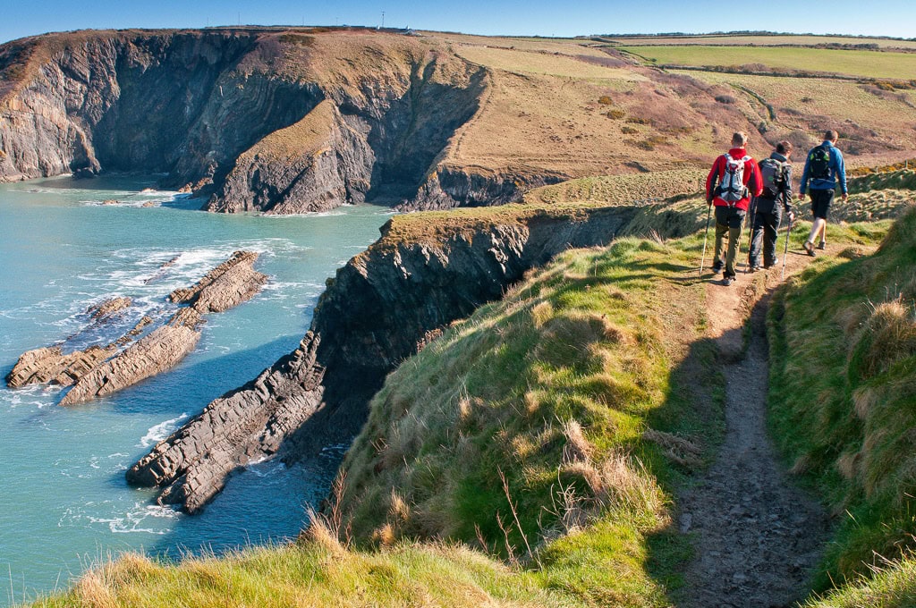
What surprises many first-time walkers is the variety. One day you may be on a level clifftop with the sea far below. The next, you could drop into a steep valley and climb straight out again. The path mostly stays at cliff-top level, yet the ups and downs add up to around 35,000 feet (11,000 m) of ascent and descent over the full length. That is why a route that looks gentle on a map can feel much harder on foot.
You do not have to walk all of it. Many visitors take on a single headland, a beach-to-beach stretch or a circular route of a few hours. Others link the whole trail over roughly two weeks. Dedicated coastal buses make short one-way walks far easier to plan.
This guide is written for anyone planning a visit, from first-timers to experienced long-distance walkers. It explains what makes the route special, how long it takes, which sections are worth your time, when to go, how to get around, where to stay and how to stay safe. Read on to decide which part of the Pembrokeshire Coast Path suits you best.

Why the Pembrokeshire Coast Path Is Worth Walking
The biggest draw is variety. Within a few days you can pass limestone cliffs, red sandstone beaches, wide sands, wooded estuaries and working harbours. The route also runs through towns such as Tenby, Pembroke and Fishguard and reaches St Davids, so there are places to eat and rest between the wilder stretches.
The trail opened in 1970 and is now a designated National Trail. It also forms part of the Wales Coast Path, which follows the whole Welsh coastline. Look for the National Trail acorn on signposts and gates. You may also see the dragon shell symbol used for the Wales Coast Path.
Wildlife is another reason to go. The islands off the coast, including Skomer and Ramsey, are known for their seabirds, and puffins return to the islands from around April. Boat trips around Ramsey Island are available from the St Davids area, where visitors may spot seals and nesting birds from the water.
Best of all, the path is open all year and works in either direction. That flexibility suits different fitness levels and budgets, which is a big reason why many walkers come back to tackle another section.
How Long the Pembrokeshire Coast Path Takes and How Hard It Is
Official National Trails guidance suggests around 12 days to walk the whole route at an average of 15 miles (24 km) a day. Many people allow longer, particularly if they want time for beaches, boat trips or a wet-weather rest day. Others complete the trail in sections over several visits.
Most walkers travel north to south, starting at St Dogmaels and finishing at Amroth. Guidebooks are commonly written in that direction and the gates and stiles are numbered that way, but signposts show the route both ways, so you can choose.
Difficulty depends on the day. The highest point is Pen yr afr on Cemaes Head at 175 metres, so this is not a high-mountain walk. It is a stamina walk, with short, steep climbs into and out of coves. The northern section from St Dogmaels to Newport is noted for its many steep hills, so plan shorter days there. A common mistake is judging a day by distance alone. On this coast, ten miles with constant climbs can take far longer than ten miles on flat ground.
| Information | Details |
|---|---|
| Length | 186 miles (299 km) |
| Route | Amroth to St Dogmaels |
| Full trail | Around 12 days at 15 miles a day |
| Ascent and descent | About 35,000 ft (11,000 m) |
| Highest point | Pen yr afr, Cemaes Head (175 m) |
| Open | All year |
Best Sections of the Pembrokeshire Coast Path
With 186 miles to choose from, the best sections depend on your time, fitness and interests. These three areas are popular starting points for shorter walks.
North Pembrokeshire: St Dogmaels to St Davids
The northern coast is wilder and quieter. The stretch from St Dogmaels to Fishguard is about 28 miles and is often split into two or three days. It includes a collapsed sea cave known as the Witches’ Cauldron and the harbourside settlement of Lower Fishguard. Between Fishguard and St Davids the path passes Strumble Head, Abercastle, Trefin, Porthgain and Abereiddi. Facilities can be limited on this coast, so carry water and snacks and allow more time than the distance suggests.
St Davids and St Brides Bay
St Davids works well as a walking base. To the south, the path passes Caerfai Bay and Porth Clais on its way towards Solva. The Puffin Shuttle links St Davids with Martin’s Haven at the southern end of St Brides Bay, where boats to Skomer Island leave in season. Boat and landing arrangements change, so check current booking rules before planning a day around the island. This area suits walkers who want a mix of beaches, small harbours and easy transport links.
South Pembrokeshire: Stackpole to Tenby
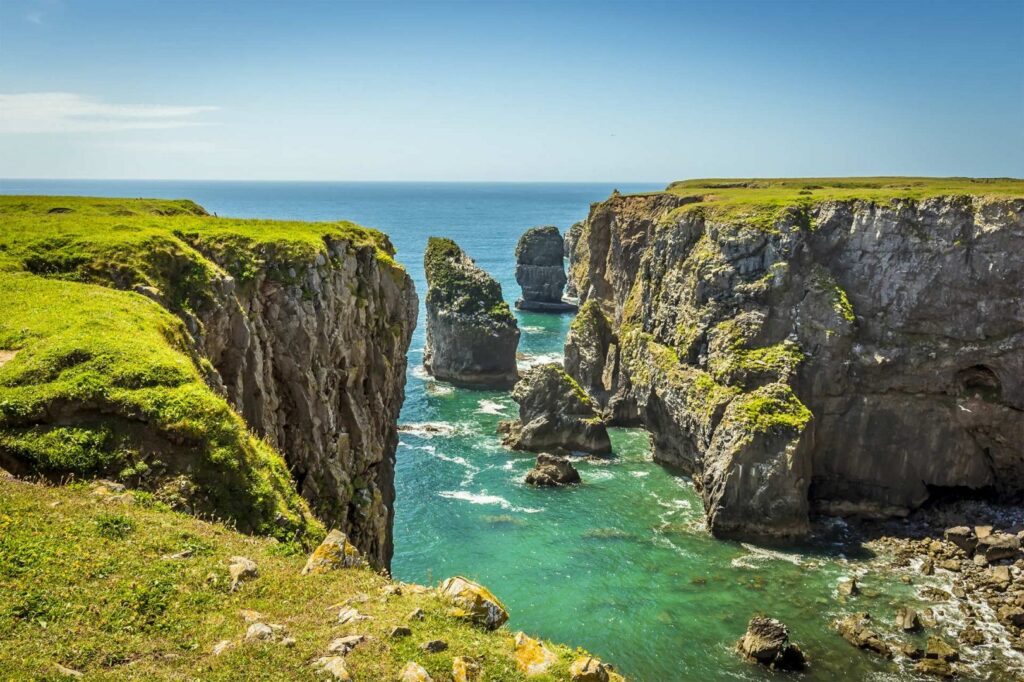
The south has some of the most photographed scenery on the route, including the Green Bridge of Wales, St Govan’s Chapel and Barafundle Bay near Stackpole. Part of the path crosses the Castlemartin Range, a military training area, and is open only when firing is not taking place, so check the published firing times before you travel. Further east the trail passes Manorbier and Tenby before finishing at Amroth. Tenby is a handy base with plenty of places to eat.
Best Time to Walk the Pembrokeshire Coast Path
The trail is open all year, so the right season depends on what you want from your trip.
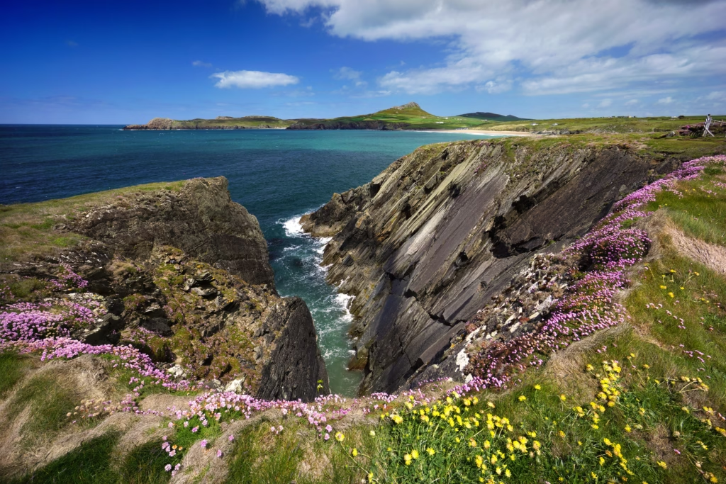
Spring and early summer are popular for coastal flowers and returning seabirds, with puffins arriving on the islands from around April. Days are getting longer, which gives you more flexibility for longer walks.
Summer is the busiest period. Coastal bus services run daily from May to September, which makes linear walks much easier, and boat trips to the islands are more widely available. The trade-off is that beaches, car parks and accommodation fill up early, so book ahead for popular places such as Tenby and St Davids.
Autumn can be quieter, although daylight is shorter and the weather changes quickly. In winter, buses run to a reduced timetable from October to April, and the exposed cliffs can be windy and wet. Winter walking is possible, but it needs careful planning, warm layers and a flexible schedule.
Whatever the month, pack waterproofs. The path faces the open sea for long stretches and the weather can change within hours.
Getting There and Using the Coastal Buses
Pembrokeshire is in south-west Wales, and the Pembrokeshire Coast Path begins at Amroth in the south and ends at St Dogmaels in the north. Many visitors drive to the county, but leaving your car at the start of a one-way walk is awkward. The coastal buses solve most of that problem.
Several dedicated walkers’ services run along the coast. The Poppit Rocket links Cardigan, St Dogmaels, Poppit Sands, Newport and Fishguard. The Strumble Shuttle runs between Fishguard and St Davids. The Puffin Shuttle serves the St Davids and St Brides Bay area, while the Coastal Cruiser, the Celtic Coaster and a St Davids peninsula shuttle cover other parts of the coast.
In rural areas the buses operate on a hail-and-ride basis, so you can flag one down at a safe place. Services run daily from May to September and to a reduced timetable in winter. Routes and times change, so check the latest timetable before you plan a walk around a specific bus.
If you do drive, use signed car parks and avoid blocking narrow lanes or gateways. With the buses, many walkers stay in just a few bases instead of moving on every night.
Where to Stay Along the Route
There are two main ways to organise accommodation. The first is to move on each night, staying in bed and breakfasts, inns, hostels or campsites as you go. This suits walkers who want to complete the full trail, and some operators offer luggage transfer so you can carry a lighter pack. The second is to use a base and take buses to and from your start point each day.
Larger settlements give the widest choice of places to stay, food and shops. Useful bases include Tenby and Pembroke in the south, Solva and St Davids in the west, and Fishguard and Newport in the north. Smaller villages have fewer options, and some remote stretches have no accommodation at all, so plan each day’s finish before you set out.
Book early for summer, school holidays and weekends, particularly in popular coastal towns. If you are travelling with children, choose a base close to a bus stop or a sheltered beach, and pick short sections with a clear finish point.
Match your daily distance to the accommodation you can actually find, rather than the other way round. A slightly shorter day with a comfortable finish is better than a long one that ends miles from a bed.
Safety, Tides and Practical Tips
The Pembrokeshire Coast Path is well signposted, but it is a real coastal walk, so preparation matters.
- Check tide times for the crossings at Dale and Sandy Haven. They must be timed accurately or you may face a long detour.
- Stay well back from cliff edges, especially in wind, and keep children close.
- Check firing times before walking through the Castlemartin Range.
- Carry water, snacks and a map or offline route, because some stretches are remote and mobile signal may be patchy.
- Wear sturdy footwear and pack layers, a waterproof jacket and a small first-aid kit, even on bright days.
- If someone is in danger on the coast, call 999 and ask for the Coastguard.
Accessibility varies. Many sections are steep and uneven, but the national park authority provides information on walks for all, easy-access viewpoints reachable by car, and free hire of beach wheelchairs and all-terrain equipment. At low tide you can also walk on some beaches.
Follow local signs about dog restrictions on beaches and keep dogs under close control near livestock and cliffs. Take your rubbish home and stay on the marked path to reduce erosion.
FAQ
How long is the Pembrokeshire Coast Path?
The Pembrokeshire Coast Path is 186 miles (299 km) long and runs between Amroth and St Dogmaels. National Trails guidance suggests around 12 days for the full route at roughly 15 miles a day, although many walkers allow longer for rest days, weather and sightseeing.
Which direction should I walk it?
Either direction works because signposts show the route both ways. Many people walk north to south, from St Dogmaels to Amroth, because most guidebooks are written that way and the gates and stiles are numbered in that direction. Choose based on transport, accommodation and the weather forecast.
Is the path suitable for beginners?
Shorter sections are suitable for most reasonably fit walkers. The path mostly follows cliff tops, but frequent steep climbs and descents make it tiring. Start with a short circular or bus-linked walk, and take extra care on the northern stretch between St Dogmaels and Newport, which has many steep hills.
Can I walk the route using public transport?
Yes. Dedicated coastal buses, including the Poppit Rocket, Strumble Shuttle and Puffin Shuttle, serve much of the path. They run daily from May to September and to a reduced timetable in winter. Timetables change, so check the latest information before you travel.
When is the best time to walk the Pembrokeshire Coast Path?
The path is open all year. Spring and early summer suit walkers who want coastal flowers and seabirds, while summer has the most frequent buses and boat trips. Winter walking is possible, but the cliffs are exposed, days are short and bus services are reduced.
Conclusion
The Pembrokeshire Coast Path rewards almost every kind of walker, from someone with a spare afternoon to a hiker planning a two-week journey. The key points are simple. Choose a section that matches your fitness, allow extra time for the steep ups and downs, check tides and firing times, and use the coastal buses to avoid doubling back.
If you are unsure where to begin, pick one area, such as the St Davids peninsula or the coast around Tenby, and treat it as a test walk. You can always return for another stretch later, and many people do. If you want to add another Welsh coastal walk to the same trip, the Gower Peninsula is worth considering.
Whichever section you choose, pack for changeable weather and confirm transport and accommodation before you set off. With sensible planning, the Pembrokeshire Coast Path can be a relaxed weekend break or a rewarding long-distance challenge. Start planning your trip today.