
Table of Contents
Howgill Fells
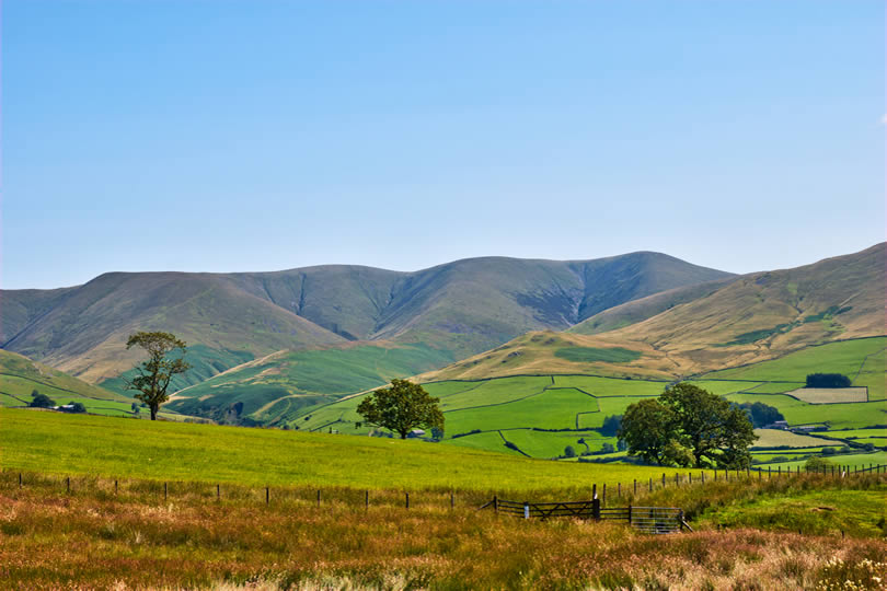
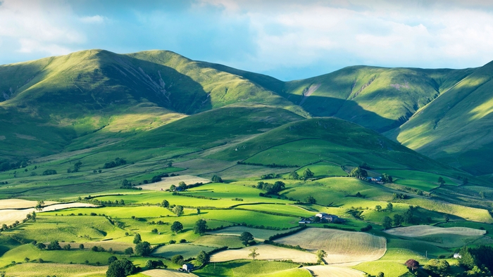
Tucked between the Lake District and the Yorkshire Dales, the Howgill Fells are easy to miss and even easier to fall for once you’re on them. These rounded, grassy hills sit mostly in Cumbria, though they’re officially part of the Yorkshire Dales National Park, and they offer something that’s becoming rarer in northern England: genuine solitude. Alfred Wainwright famously compared their smooth, domed shapes to a herd of sleeping elephants, and it’s a description that sticks the moment you see them from the M6 or the West Coast Main Line.
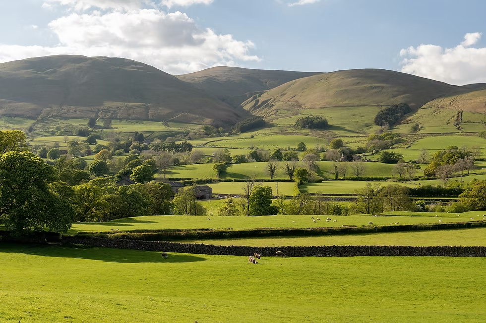
Unlike the Lakeland fells to the west, the Howgills have no scree, no scrambles, and few sharp ridgelines. What they offer instead is space — wide, open grass tops, deep grassy gills cut by fast-flowing becks, and views that stretch from the Lakeland peaks to the Yorkshire Three Peaks on a clear day. The market town of Sedbergh, England’s official “Book Town,” sits right at their foot and makes a natural base for exploring.
This guide covers the best walks in the Howgill Fells, including the classic route to The Calf and Cautley Spout, England’s highest waterfall above ground. It also covers when to visit, how to get there, where to stay, and what to know before setting off, so you can plan a day (or a weekend) in one of Cumbria’s most underrated walking areas.
Why Visit the Howgill Fells?
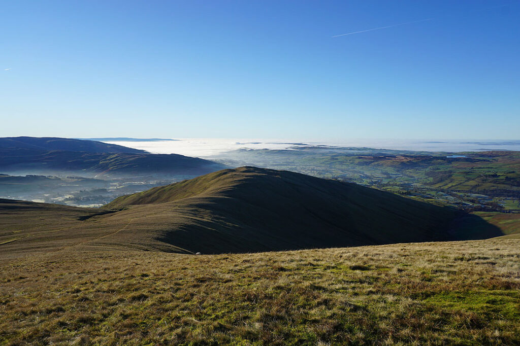
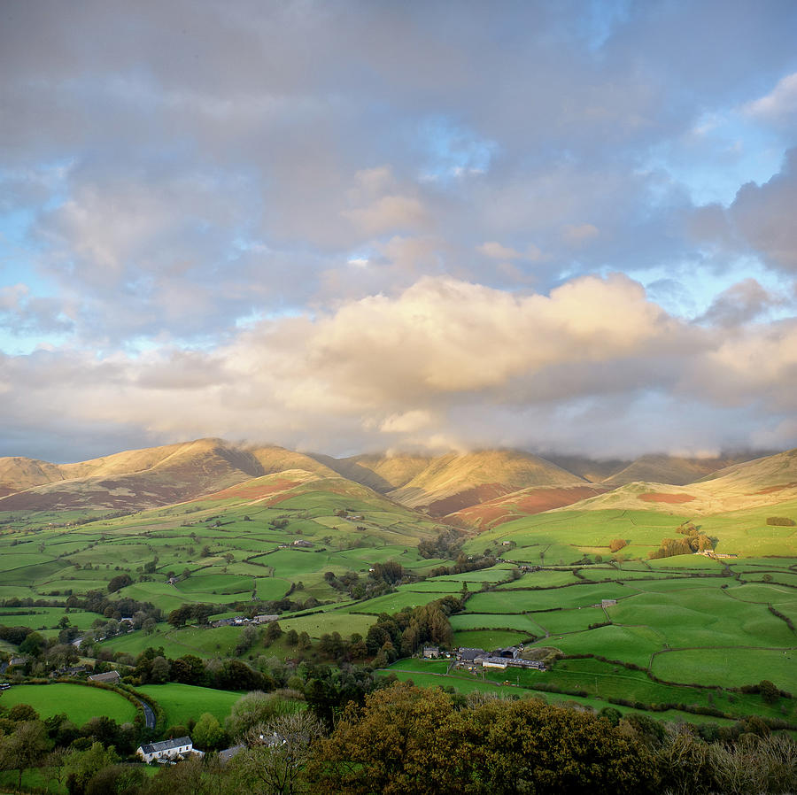
The Howgill Fells reward walkers who want quiet more than drama. Their smooth, treeless slopes look deceptively gentle from a distance, but the ridgelines deliver genuinely wide-reaching views once you’re up top, taking in the Lake District to the west, the Yorkshire Dales to the south and east, and the Pennines to the north.
Because the Howgills sit slightly apart from both national park honeypots, they see far fewer visitors than Lakeland classics like Scafell Pike or the Dales’ Three Peaks. That makes them a good choice for walkers who prefer their own company on the hill, or who simply want to avoid queuing for a summit photo.
The underlying geology also sets them apart. North of the Dent Fault, the Howgills are formed from older Silurian and Ordovician rock rather than the limestone typical of the wider Dales, which helps explain their distinctive rounded profile and lack of the pavement and scars seen elsewhere in the national park.
Best Walks in the Howgill Fells
Most routes into the Howgills start from Sedbergh, which sits directly beneath the range and has good parking and facilities. The classic circular walk climbs from town over Winder and Arant Haw to Calders, then on to The Calf, the highest point in the range at 676 metres, before looping back down past Settlebeck Gill. It’s a long day out, generally reckoned at around 10 to 11 miles with roughly 800 to 900 metres of ascent, so it suits fit, experienced walkers rather than a casual family outing.
Shorter options exist too. A walk from Sedbergh onto Winder alone, or a there-and-back to Arant Haw, gives a taste of the open fell tops without committing to the full ridge traverse. For something quieter still, routes from the Ravenstonedale and Weasdale side approach the range from the north and see even fewer walkers.
Classic Sedbergh to The Calf Route
This is the route most guidebooks describe as the definitive Howgills walk. It leaves Sedbergh via Joss Lane or Howgill Lane, climbs steadily onto the ridge, and takes in Winder, Arant Haw, and Calders before reaching the trig point at The Calf. Paths are generally clear and well-trodden in good visibility, though the featureless grass tops can become disorientating in mist, so a map and compass (or a reliable GPS app) are worth carrying even in summer.
Cautley Spout and The Calf
No visit to the Howgills is complete without factoring in Cautley Spout, a cascading waterfall with a drop of around 180 metres, often cited as England’s highest waterfall above ground (as opposed to underground systems). It sits below Cautley Crag on the eastern side of the range and is usually approached from the Cross Keys Inn on the A683, making it accessible as a shorter walk in its own right, or combined with a climb up to The Calf for a longer loop.
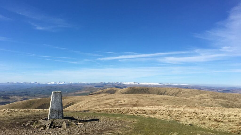
The Calf itself, at 676 metres, is the highest point in the Howgill Fells and the natural target for most serious walks in the area. The final approach is a steady pull up open grass rather than a scramble, and the summit trig point gives a genuine 360-degree panorama on a clear day, taking in the Lakeland fells, the Yorkshire Three Peaks, and the Pennines. Some routes combine Cautley Spout and The Calf into a single loop of around 10 kilometres, which is a good way to see both highlights without a full ridge traverse.
Best Time to Visit
The Howgill Fells can be walked year-round, and their gentle, mostly grassy terrain makes them a reasonable winter option compared with rockier Lakeland routes, though snow and ice on the higher ground still call for proper winter kit and navigation skills. Spring and autumn tend to offer the best balance of settled weather and quieter paths, while summer brings the longest daylight hours for tackling the full ridge walk.
Whatever the season, weather on the open tops can change quickly, and low cloud is common even when it’s clear in Sedbergh below. Checking a fell-specific forecast before setting out, rather than a general town forecast, is worth the extra few minutes. The featureless nature of the grass summits means visibility matters more here than the modest height of the hills might suggest.
How to Get There and Parking
Sedbergh is the main gateway to the Howgill Fells and sits just off the A684, close to Junction 37 of the M6, making it straightforward to reach by car from both Cumbria and the wider North West. There are pay-and-display car parks in the town, including one on Joss Lane that’s commonly used as a starting point for routes onto Winder and the main ridge.
For those without a car, Sedbergh has limited bus connections from Kendal and the surrounding area, though services can be infrequent, so checking current timetables in advance is sensible. Oxenholme, on the West Coast Main Line, is the nearest mainline train station, with a taxi or bus connection needed to reach Sedbergh itself. Walkers approaching from the north can also start from Ravenstonedale or Newbiggin-on-Lune, both of which offer quieter access points onto the range.
Where to Stay Near Sedbergh
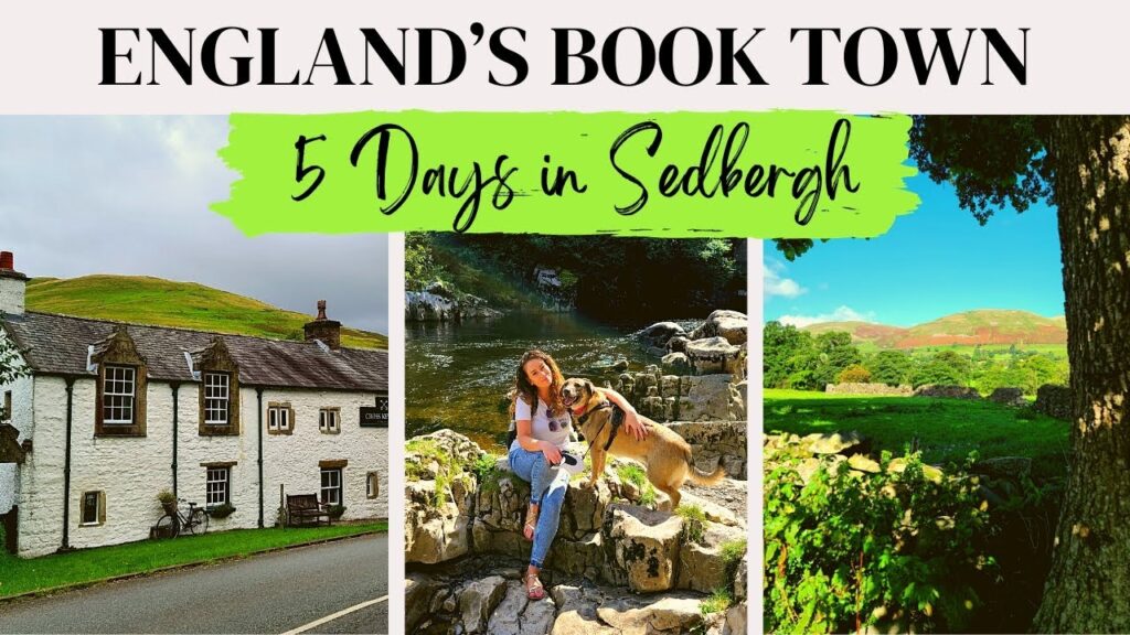
Sedbergh itself has a reasonable spread of accommodation for a small town, including pubs with rooms, guesthouses, and self-catering cottages, many of which cater specifically to walkers with drying facilities and early breakfasts. Its status as England’s Book Town also means a good choice of cafés and a handful of independent shops for a rest day.
For something closer to the fells themselves, farm stays and campsites around the edge of the range, including sites near Sedbergh and along the Dales Way corridor, put you within walking distance of the hills without needing to drive to a trailhead each morning. The Cross Keys Inn, near the foot of Cautley Spout, is a popular stop for walkers finishing routes on the eastern side of the range and is worth booking ahead during busier weekends.
What to Know Before You Go
The Howgills are gentler underfoot than the Lake District’s rockier fells, but they shouldn’t be underestimated. Paths can be boggy after rain, several routes involve stream crossings that are best avoided in high water, and the open, largely featureless tops make navigation genuinely tricky in poor visibility. Proper footwear, waterproofs, and a map and compass are sensible for anything beyond the shortest routes.
Mobile signal is patchy across much of the range, so it’s worth telling someone your planned route before setting off. Facilities are limited once you leave Sedbergh, with no cafés or toilets on the fells themselves, so it’s worth planning for a full day out with food, water, and layers for changeable weather.
Walking with Dogs and Children
The Howgills are largely open access land grazed by sheep, so dogs need to be kept under close control, especially during lambing season in spring. Shorter routes onto Winder or the lower slopes near Sedbergh work well for families with younger children, while the full ridge to The Calf is a long day better suited to older, more experienced young walkers used to sustained hill walking.
| Information | Details |
|---|---|
| Best time to visit | Spring and autumn for settled weather and quieter paths |
| Typical visit length | Half day for shorter routes; full day for The Calf and Cautley Spout |
| Best for | Experienced walkers seeking quiet, open-fell hiking |
| Parking | Pay-and-display car parks in Sedbergh, including Joss Lane |
| Difficulty | Moderate to hard depending on route; navigation harder than terrain suggests |
How long does it take to walk the Howgill Fells?
The classic Sedbergh to The Calf circuit typically takes 6 to 7 hours, covering around 10 to 11 miles with significant ascent. Shorter routes onto Winder or Arant Haw can be done in 2 to 3 hours.
Is Cautley Spout worth visiting on its own?
Yes. It can be reached as a standalone there-and-back walk from the Cross Keys Inn, without continuing up to The Calf, making it a good option for a shorter visit.
Are the Howgill Fells suitable for beginners?
Lower routes near Sedbergh suit less experienced walkers, but the full ridge to The Calf is a long, exposed day that’s better suited to those comfortable with sustained hill walking and basic navigation.
Do I need a map for the Howgill Fells?
Yes. The grassy summits are notably featureless, and mist can make navigation difficult even for experienced walkers, so a physical map and compass are recommended alongside any GPS device.
Are dogs allowed on the Howgill Fells?
Dogs are generally welcome on the open fell paths but must be kept under close control around grazing sheep, particularly during the spring lambing season.
Conclusion
The Howgill Fells won’t give you the drama of a Lakeland scramble or the crowds of the Yorkshire Three Peaks, and that’s precisely the appeal. What you get instead is wide, open walking country, genuine quiet, and views that rival either neighbour on a clear day. Whether you’re tackling the full ridge to The Calf, detouring to Cautley Spout, or keeping things shorter on Winder, Sedbergh makes an easy, well-placed base for exploring. Pack a map, check the forecast for the tops rather than the town, and the Howgill Fells offer one of the best low-key walking days left in northern England.