
Table of Contents
Langdale Pikes
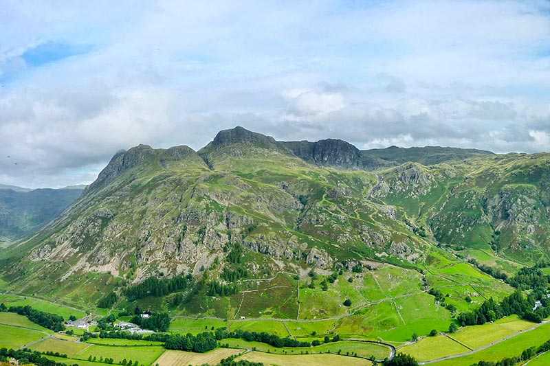
There is one skyline that sums up the Lake District better than any other, and it belongs to the Langdale Pikes. Stand in the village of Elterwater on a clear evening and look north-west, and you will see it: a jagged wall of rock rising straight out of the valley floor, its peaks catching the last of the light long after everything else has fallen into shadow. Locals rarely need to point it out to visitors. It simply announces itself.
I have walked the Langdale Pikes in driving rain, in still winter frost, and on the kind of blue-sky August morning that makes the car park fill up by nine. Every version of this walk has something to offer, which is part of why it draws so many people back year after year. This guide pulls together everything a first-time visitor or a returning hillwalker needs: which peaks make up the group, how to plan a route that matches your fitness and experience, where Jack’s Rake fits into the picture, and the practical details around parking, weather and timing that too many guides skip over.
Whether you are booking a Lake District weekend around this single walk or slotting it into a longer Cumbria itinerary, the Langdale Pikes reward a bit of planning. Read on for a route-by-route breakdown, honest safety advice, and the local knowledge that turns a good walk into a memorable one.
Where Are the Langdale Pikes? Location and Geography
The Langdale Pikes sit in the central fells of the Lake District National Park, in Cumbria, directly above the valley of Great Langdale. They form the northern wall of the valley, a dramatic rampart of rock that has become one of the most photographed mountain views in northern England. From the valley floor near the Old Dungeon Ghyll Hotel, the Pikes look almost vertical, a cluster of pointed summits and crags stacked one behind the other.
Geologically, the group belongs to what is technically a raised parapet around the southern and eastern edge of a high plateau centred on Thunacar Knott. Most guidebooks count four principal summits as the Langdale Pikes proper: Harrison Stickle, Pike of Stickle, Loft Crag and Pavey Ark, though some writers also include Thorn Crag as a fifth, minor top between Loft Crag and Harrison Stickle. The debate over how many peaks “count” is a long-running one among Lakeland fellwalkers, and honestly, it does not affect the walking experience much either way.
The terms used locally are worth knowing before you arrive, because they will crop up constantly on signposts, in pub conversations and in older guidebooks. A “pike” refers to a hill with a pointed or peaked summit. A “stickle” describes a hill topped with a steep, rocky outcrop. A “knott” is a rounded or rocky hilltop, and a “crag” is simply a steep or rugged rock face. Put together, Harrison Stickle, Pike of Stickle, Loft Crag, Thunacar Knott and Pavey Ark read less like arbitrary place names and more like a physical description of the landscape itself.
In terms of height, Harrison Stickle is the tallest of the group at 736 metres (2,415 feet) above sea level, though it ranks only 71st among the 214 Wainwright fells overall. Pike of Stickle reaches 709 metres (2,326 feet), Pavey Ark comes in at 700 metres (2,300 feet), and Loft Crag sits at 682 metres (2,238 feet). None of these are the giants of the district in pure altitude terms; Scafell Pike, England’s highest mountain, tops out considerably higher. What the Langdale Pikes lack in raw elevation, they more than make up for in drama, thanks to the steep crags that plunge almost 610 metres down to the valley floor below.
Below the Pikes, cradled in a glacial hollow between Harrison Stickle and Pavey Ark, sits Stickle Tarn, a small mountain lake enlarged by a stone dam built in 1838 to supply water to the Langdale valley. The tarn is a landmark in its own right and a natural halfway point for most routes onto the Pikes, sitting at roughly 473 metres above sea level with a maximum depth of around 15 metres.
Quick Facts: Langdale Pikes
| Detail | Information |
|---|---|
| Location | Central Fells, Lake District National Park, Cumbria |
| Nearest valley | Great Langdale |
| Highest summit | Harrison Stickle, 736m (2,415ft) |
| Other summits | Pike of Stickle (709m), Pavey Ark (700m), Loft Crag (682m) |
| Nearby tarn | Stickle Tarn (473m elevation) |
| Nearest villages | Chapel Stile, Elterwater, Ambleside |
| OS Map | Explorer OL6 – The English Lakes (South Western Area) |
| Managed by | The National Trust |
| Difficulty | Moderate to challenging (routes vary) |
| Typical walking time | 4–8 hours depending on route |
A Brief History of the Langdale Pikes
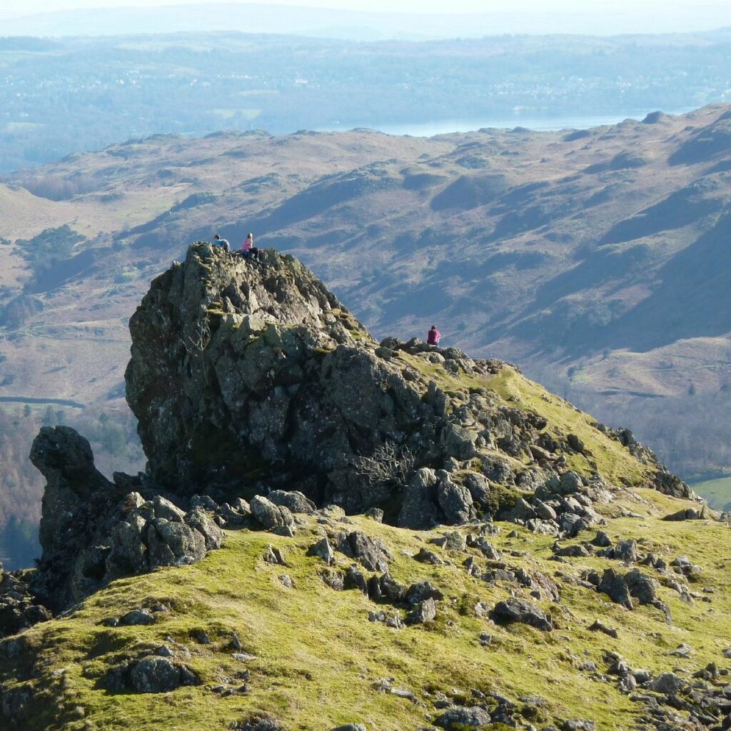
Long before the Langdale Pikes became a walking destination, they were an industrial site. Pike of Stickle is home to one of the most significant Neolithic axe factories discovered in Britain. Around 6,000 years ago, prehistoric toolmakers climbed the steep scree slopes below the summit to extract volcanic tuff, a fine-grained rock ideal for shaping into polished stone axes. Archaeologists have found rough-outs and finished axe heads from this site scattered as far afield as the south coast of England, suggesting a trade network that stretched across the country during the Neolithic period. Standing on that scree today, it is worth pausing to think about the sheer effort involved in quarrying rock at this height using nothing but stone tools.
The valley below has a different but equally deep history rooted in farming. Great Langdale has been grazed by Herdwick sheep for centuries, and the drystone walls that criss-cross the valley floor date back generations, some of them predating written records of the area. The National Trust now owns and manages much of Great Langdale and the surrounding fells, having acquired land here through a combination of gifts and purchases across the twentieth century, with the explicit aim of protecting the landscape from development.
The name most closely tied to modern appreciation of the Langdale Pikes is Alfred Wainwright, the guidebook author whose seven-volume “Pictorial Guide to the Lakeland Fells” remains the reference point for hillwalkers exploring this area. Wainwright described Harrison Stickle as a peak of singular distinction, and his hand-drawn route diagrams for the Central Fells, published in the 1950s, are still followed closely by walkers today. The 214 fells he catalogued, including all of the Langdale Pikes, are now informally known as “the Wainwrights,” and completing all of them is a long-term goal for many dedicated Lake District walkers.
Rock climbing also has deep roots here. Gimmer Crag, near Loft Crag, has been a testing ground for climbers since the early twentieth century, and routes first pioneered in the 1920s and 1930s are still climbed today. The combination of accessible scrambling, serious rock climbing, and straightforward fell walking within a compact area is part of what makes the Langdale Pikes such a well-loved destination for such a broad range of outdoor enthusiasts.
The Langdale Pikes Summits Explained
Understanding the individual character of each summit helps enormously when planning a route, since the Pikes are rarely walked in isolation. Most routes link two, three or all four together in a single outing.
Harrison Stickle is the highest point of the group at 736 metres and the summit most people aim for first. Its crags fall away sharply to the south and east, giving it commanding views back down over Great Langdale, across to the Coniston fells, and on a clear day, as far as Windermere. The final approach involves a rocky but non-technical scramble that most fit walkers manage without difficulty.
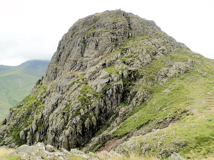
Pavey Ark is arguably the most striking face in the entire group when viewed from Stickle Tarn, presenting a cliff a little over 400 metres wide and around 120 metres high. Despite this imposing appearance, the summit itself is a gently undulating plateau dotted with small tarns and bilberry terraces, a world away from the drama of the cliff face below. Pavey Ark is the fell most associated with Jack’s Rake, covered in detail further down this guide.
Pike of Stickle is the most visually distinctive summit, a conical peak that from a distance resembles, as one local writer put it, a giant molehill thrust up from the surrounding moor. It sits slightly apart from the others, connected by a broad expanse of high ground called Harrison Combe, and the final pull to the top involves a short, steep scramble over loose scree that demands care, particularly on the descent.
Loft Crag is the smallest of the four principal Pikes at 682 metres, positioned between Pike of Stickle and Harrison Stickle. Its summit echoes the peaked shape of Pike of Stickle on a smaller scale, and it is usually climbed as part of a longer traverse rather than as a standalone objective.
Between Loft Crag and Harrison Stickle lies Thorn Crag, sometimes counted as a fifth, minor Pike, though most major guidebooks exclude it from the core group. A little further north, Thunacar Knott forms the high, boggy plateau at the centre of the whole system, the point from which the ridge continues towards High Raise and the wider Central Fells.
Each of these summits can technically be climbed on its own, but the terrain naturally lends itself to combining two or more in a circuit, which is exactly how most established routes are structured.
Best Langdale Pikes Walking Routes
There is no single “correct” way to walk the Langdale Pikes, and the right route for you depends heavily on fitness, scrambling experience, and how much time you have. Below are the four most established options, ranked roughly from easiest to hardest.
1. Stickle Tarn and Back (Easy, 2–3 hours) For a shorter outing, or if you simply want to see the most photographed spot in the area without tackling a summit, the walk up Stickle Ghyll to Stickle Tarn and back is a well-maintained, popular route suitable for families and less experienced walkers. The path follows the ghyll past several small waterfalls, climbing steadily but without any exposure, and rewards you with one of the finest mountain lake views in the district.
2. The Langdale Pikes Circular via Blea Rigg (Moderate to Challenging, 6 miles) This is one of the most popular full routes, taking in Blea Rigg, Sergeant Man, Thunacar Knott, Pavey Ark, Harrison Stickle, Pike of Stickle and Loft Crag in a single long circuit. It covers rough, rugged terrain throughout and demands sturdy walking boots with good ankle support, plus proper layers, since the ridge is exposed to the weather for long stretches.
3. New Dungeon Ghyll to All Four Pikes (Moderate, roughly 870m of ascent) Starting and finishing at the New Dungeon Ghyll car park, this route climbs up close to the towering face of Pavey Ark before continuing over the remaining summits without tackling Jack’s Rake. It is a shorter and less technical alternative to the full circular, while still bagging all four main Pikes, and is a sensible choice for walkers who want the complete set of summits without the longest mileage.
4. The Grasmere to Langdale Pikes Traverse (Hard, nearly 20km) For experienced hillwalkers looking for a full day out, this route starts in Grasmere and links all of the Langdale Pikes with several additional Wainwrights, climbing a total elevation of around 1,139 metres. It requires a full day, careful navigation and good weather, but it is regarded by many as one of the finest ridge walks in the Lake District.
Whichever route you choose, the AllTrails-recorded version that adds Bowfell to the circuit covers 11.3 miles with roughly 4,117 feet of elevation gain and takes around eight hours, giving you a sense of just how far the ambition of a Langdale Pikes walk can be stretched for those wanting a proper mountain day.
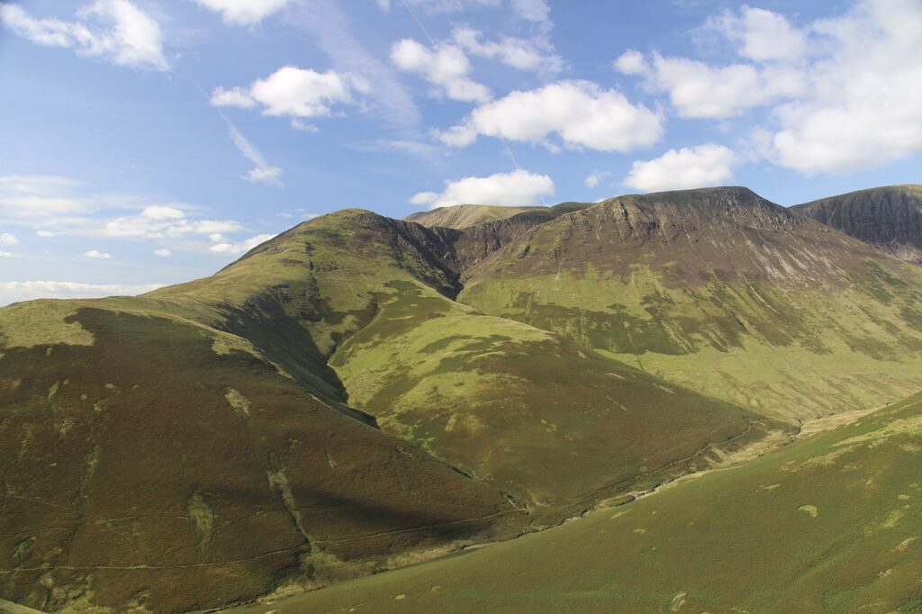
The Langdale Pikes Circular Walk: Step-by-Step Route Guide
For walkers wanting a clear, structured route, this step-by-step outline follows one of the most popular circular options, starting and finishing at the New Dungeon Ghyll car park.
From the car park, head towards the New Dungeon Ghyll buildings and pass between them onto a bridleway through a gate. Follow the left field edge behind the pub, then join a path rising beside a wall. Pass through a kissing gate, continue ahead and descend by the wall towards a bridge. After crossing, pass through another gate and continue past the Old Dungeon Ghyll Hotel, descending to a track via a kissing gate. This track follows the valley of Mickleden for roughly two miles, crossing a bridge to a sheepfold and a cairned path junction, where the real climbing begins.
From here, the path climbs steeply through rugged terrain towards Stickle Tarn or directly up towards the col below Harrison Stickle, depending on your chosen variation. Once on the high ground, the route traverses between the summits: Harrison Stickle first for many walkers, given its status as the highest point, followed by a descent to a col and a climb up to Pavey Ark. If you are including Jack’s Rake, this is the point where the scramble begins; otherwise, a safer path around to the east of Stickle Tarn avoids the exposure entirely.
From Pavey Ark, most routes continue north towards Thunacar Knott before looping back west and south towards Pike of Stickle. The ground on this plateau is rocky, uneven, and dotted with boggy patches, so waterproof boots make a real difference here. The final approach to Pike of Stickle involves a short, steep pull, after which the route continues to Loft Crag, the last of the four main summits.
The descent from Loft Crag typically drops back down towards the col with Thorn Crag, joining the path that leads past Dungeon Ghyll Force waterfall and back down to the New Dungeon Ghyll Hotel. Alternatively, many walkers prefer to descend via the well-maintained Stickle Ghyll path back past Stickle Tarn, which is steep and demanding on the knees but avoids retracing already-walked ground and passes the waterfalls of Stickle Ghyll on the way down.
Total distance for this circuit is typically in the region of 6 to 8 miles depending on the exact combination of summits and paths chosen, with most walkers completing it in 5 to 7 hours including stops. Always allow extra time in poor visibility, since the plateau around Thunacar Knott has few distinctive features and can be disorientating in mist.
Jack’s Rake: Scrambling Pavey Ark
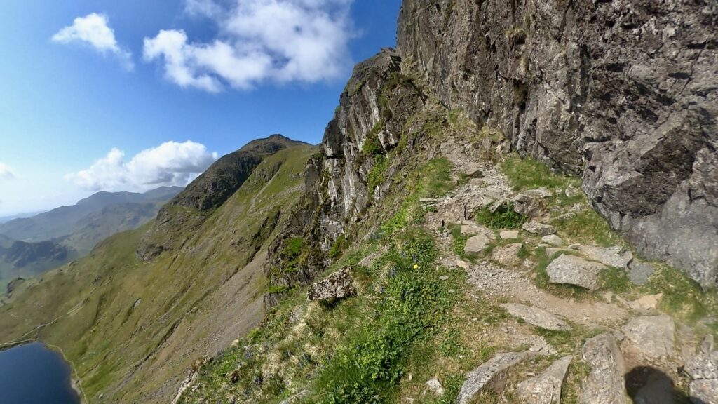
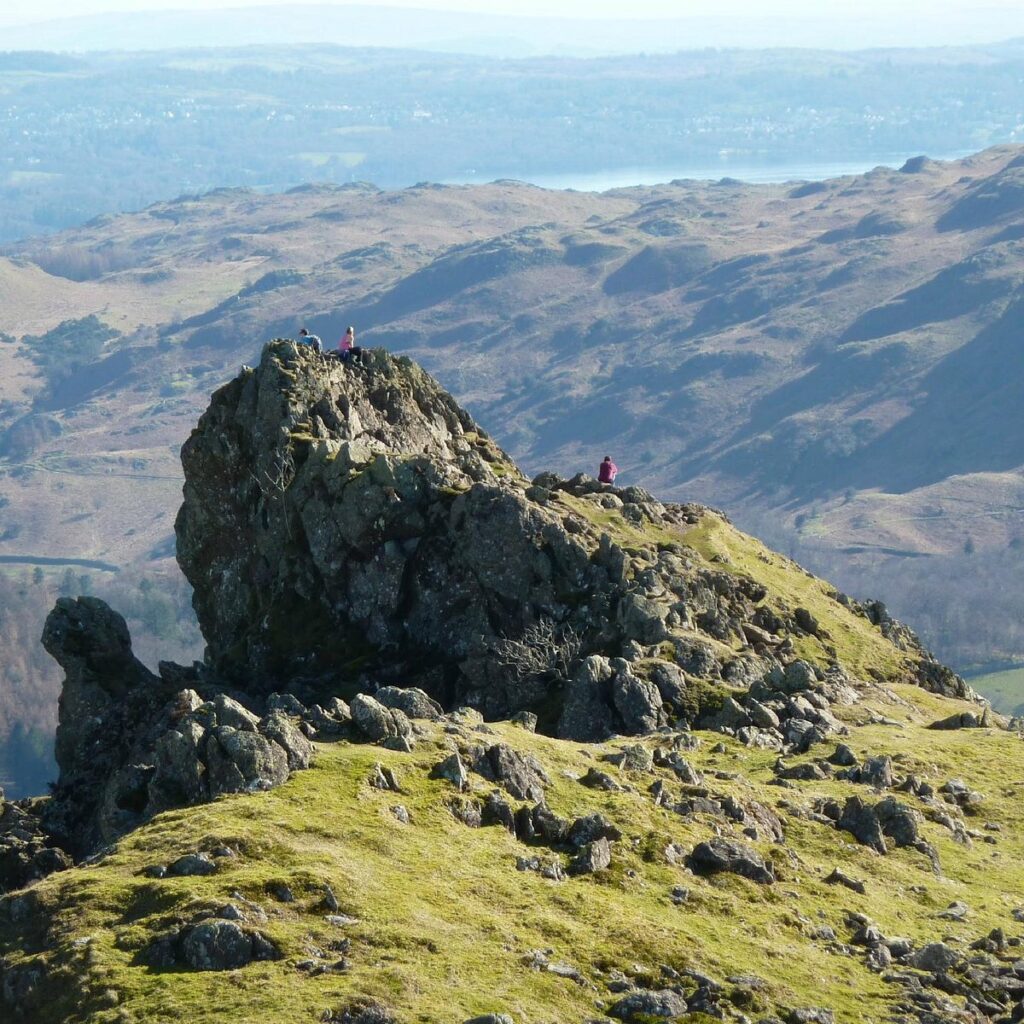
No guide to the Langdale Pikes would be complete without a proper look at Jack’s Rake, the single most talked-about feature of the entire group. This is a narrow, diagonal groove cutting across the towering, craggy east face of Pavey Ark, rated as a Grade 1 scramble, meaning it sits at the easier end of the scrambling scale but still requires proper handholds, good balance and a head for heights.
Wainwright himself described Jack’s Rake as a steep groove that tests both nerve and skill, and that description holds up well today. The route requires awkward contortions to squeeze through certain gaps in the rock, and there is a narrow, unprotected ledge near the top that can feel intimidating for anyone uncomfortable with exposure. That said, most of the climb sits within the groove itself, with rock on either side, which means the sense of exposure is often less severe than photographs suggest, particularly compared to fully open scrambles elsewhere in the Lake District.
Conditions matter enormously on Jack’s Rake. The rock can become slippery when wet, and rain transforms what is a fun, engaging scramble in dry weather into a genuinely hazardous undertaking. It is not a route to attempt in poor visibility, strong wind, or with young children who lack scrambling experience. Helmets are recommended by many experienced hillwalkers, given the risk of loose rock dislodged by walkers above.
For those who want the thrill of Jack’s Rake but are less confident, it is entirely acceptable, and common practice, to walk up to the base of the crag, look at it, and decide against it on the day. The alternative path around to the east of Stickle Tarn reaches the same plateau without any scrambling at all, and there is no shame in taking it. Several experienced local guides note that Jack’s Rake is best treated as a bonus for a good-weather day with time to spare, rather than a fixed part of every Langdale Pikes itinerary.
If you do attempt it, allow considerably more time than you might expect. What looks like a short section on the map can easily take 45 minutes to an hour for a party moving cautiously, especially if there are other walkers ahead sharing the same narrow groove.
Getting to the Langdale Pikes
The Langdale Pikes sit within Great Langdale, roughly 30 to 40 minutes’ drive south-west of Keswick, and around 20 minutes from Ambleside. The main approach road is the B5343, which runs the length of the valley and is the sole vehicle access route, so allow extra time during busy summer weekends when traffic can back up.
By car, the two main starting points are the Stickle Ghyll car park (OS grid reference NY294065, postcode LA22 9JU) and the New Dungeon Ghyll car park slightly further up the valley. Both are managed by the National Trust and operate a pay-and-display system, with parking free for National Trust members and Blue Badge holders but chargeable for everyone else. The Stickle Ghyll car park has toilet facilities, an information board, three designated disabled parking bays, and is the more popular starting point for routes onto Harrison Stickle and Pavey Ark. Note that overnight stays and camping in these car parks are not permitted.
By public transport, the Stagecoach 516 service, known as the Langdale Rambler, runs from Windermere railway station through Ambleside and into the Langdale valley, stopping close to both main car parks. This is a genuinely practical option for walkers without a car, and it removes the need to complete a circular route back to a specific parking spot, since you can simply catch the return bus from wherever your walk finishes along the valley road. Windermere station itself is roughly 9 to 11 miles from the valley head, so factor in the bus journey time when planning your day.
There is no coach parking available at the Stickle Ghyll or New Dungeon Ghyll car parks except by prior arrangement with the National Trust, and even then it is unavailable during the summer school holidays, so large groups should plan alternative transport arrangements well in advance.
Best Time to Visit the Langdale Pikes
The Langdale Pikes can be walked throughout the year, but each season offers a genuinely different experience, and the right time for you depends on what you want from the day.
Spring (March to May) brings longer daylight hours and generally drier conditions than winter, though snow can still linger on the higher ground into April in colder years. This is a good period for spotting new lambs in the valley fields and for relatively quiet trails compared to peak summer.
Summer (June to August) is by far the busiest period, and for good reason: long daylight hours mean an early start can have you on the summits well before the car parks fill up, and settled weather windows offer the best chance of the clear, far-reaching views the Pikes are famous for. Expect the Stickle Ghyll car park to be full by mid-morning on fine weekends, so arrive early or consider the bus.
Autumn (September to November) is, in my experience, the finest season for this walk. The bracken across the lower slopes turns a rich copper colour, the light is softer, and the crowds thin out noticeably after the school summer holidays end. Days shorten quickly through October and November, so plan your start time carefully and carry a head torch as a precaution.
Winter (December to February) transforms the Langdale Pikes into a genuinely serious mountain environment. Snow and ice are common on the summits and on the approach to Jack’s Rake, which should be avoided entirely in winter conditions unless you are equipped and experienced with an ice axe and crampons. Winter ascents of Harrison Stickle and the other Pikes can be spectacular on a clear, crisp day, but they demand proper preparation, and mountain weather forecasts should always be checked beforehand.
Whatever the season, mist can descend on the plateau around Thunacar Knott with little warning, so a map, compass and the knowledge to use them remain essential year-round, regardless of how settled the weather looks from the valley floor.
What to Pack for the Langdale Pikes
The terrain on the Langdale Pikes is rocky, uneven and exposed for long stretches, which makes proper kit non-negotiable rather than optional.
Footwear should be sturdy walking boots with good ankle support and a grippy sole. Trail shoes may suffice on the lower Stickle Tarn path, but anyone continuing onto the summits or attempting Jack’s Rake needs boots capable of handling loose rock and wet stone.
Clothing should follow a proper layering system: a moisture-wicking base layer, an insulating mid layer such as fleece or softshell, and a full waterproof shell for both jacket and trousers. Even on a warm valley day, temperatures on the exposed ridge can be significantly cooler, and wind chill is a real factor on the plateau. Pack a hat and gloves outside of high summer, since conditions can change quickly at altitude.
Navigation essentials include the OS Explorer OL6 map covering this area, a compass, and the confidence to use both, since phone signal and GPS reliability cannot be guaranteed on the plateau. A physical map remains the most dependable backup when batteries fail or screens become hard to read in bright sunlight or rain.
Other essentials include enough food and water for the full day, since there are no facilities once you leave the valley floor; a basic first aid kit; a head torch, particularly important in autumn and winter when daylight is limited; sun protection for exposed summer days; and a fully charged phone, ideally with the OS Maps or a similar offline mapping app downloaded in advance.
For anyone attempting Jack’s Rake, a lightweight climbing helmet is a sensible addition, given the risk of loose rock on a route used by many walkers each day.
Where to Eat and Stay Near the Langdale Pikes
Great Langdale has a small but well-loved collection of places to eat, drink and stay, most clustered around the valley head near the car parks.
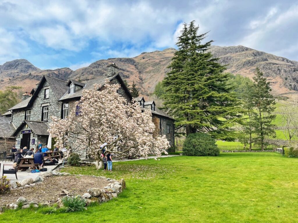
Sticklebarn, owned and run by the National Trust, sits right beside the Stickle Ghyll car park and is the classic post-walk stop for many hikers, with a strong selection of local beers, hearty food including loaded fries, and a genuinely warm welcome for muddy boots and wet dogs alike. The Old Dungeon Ghyll Hotel and New Dungeon Ghyll Hotel further up the valley are both long-established walkers’ pubs with real character, serving food and drink to hikers coming off the fells, and both offer accommodation for those wanting to stay in the valley itself.
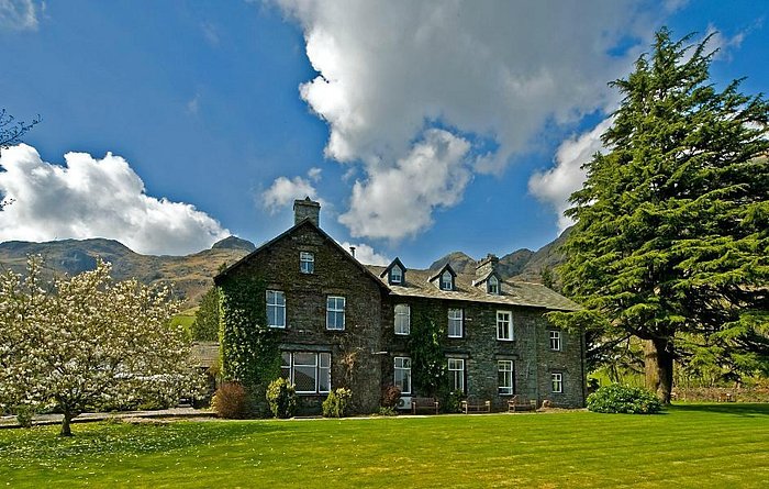
For a wider choice of accommodation, the villages of Chapel Stile and Elterwater, a short drive or bus ride down the valley, offer bed and breakfasts, self-catering cottages and additional pub options, including the Wainwright’s Inn at Chapel Stile and the Britannia Inn at Elterwater. Staying in one of these villages puts you within easy reach of the Pikes while offering a slightly wider range of evening options than the valley head itself. Ambleside, roughly 20 minutes away by car or bus, offers the fullest range of hotels, restaurants and shops if you want a base with more amenities, at the cost of a slightly longer journey to the trailhead each day.
Camping is available at several sites within Great Langdale itself, including a National Trust-run campsite, making it possible to walk straight from your tent onto the fells without any drive at all, a popular option among dedicated hillwalkers looking to make an early start.
Safety Tips for Hiking the Langdale Pikes
The Langdale Pikes have a reputation as a moderate to challenging walk, and that reputation is well earned. A handful of safety principles make a genuine difference to how enjoyable, and how safe, your day turns out to be.
Always check a dedicated mountain weather forecast before setting out, rather than relying on a general valley forecast. MWIS (Mountain Weather Information Service) is widely regarded as the most reliable source for Lake District fell conditions, since weather at altitude can differ dramatically from conditions in the valley below.
Tell someone your planned route and expected return time before you set off, particularly if you are walking solo. Mobile phone signal is unreliable across much of the plateau, so this simple step remains one of the most effective safety measures available to any hillwalker.
Turn back if conditions deteriorate. Mist, high wind or rain can turn an enjoyable scramble on Jack’s Rake or an exposed ridge walk into a genuinely dangerous undertaking, and the Pikes will still be there on a better day. Experienced local walkers consistently rate this as the single most important piece of advice they would give a first-time visitor.
Allow more time than you think you need. Rocky, rugged terrain slows progress considerably compared to well-made lowland paths, and groups moving at different paces should factor this into their planning. A route that looks like four hours on paper can easily take six with stops, photography, and a group navigating loose scree together.
Finally, respect the mountain rescue services who operate here on a voluntary basis. Langdale/Ambleside Mountain Rescue Team responds to a significant number of incidents on the Pikes each year, many involving walkers who underestimated the terrain or were caught out by sudden weather changes. Carrying the right kit and making sensible decisions on the day is the best way to ensure you never need their help.
Nearby Attractions and Alternative Walks
If you have more than a day to spend in the area, or want to build in a rest day between fell walks, Great Langdale and its surroundings offer plenty beyond the Pikes themselves.
Blea Tarn, a short drive over into Little Langdale, is a beautiful, gentle spot with a National Trust car park and an easy circular path around the tarn, framed by views of the Langdale Pikes on one side. It makes an excellent low-effort day when legs need a rest from steeper ground.
Loughrigg Fell, near Grasmere, offers wide views over Windermere and the surrounding fells for considerably less effort than the Pikes, making it a sensible option for families or less experienced walkers wanting a taste of Lakeland fell walking.
Skelwith Force, a compact but powerful waterfall near Skelwith Bridge, sits on an easy, largely flat path suitable for most fitness levels and pairs well with a visit to nearby Elterwater village.
Bowfell and Crinkle Crags, visible from the Langdale Pikes across the valley of Mickleden, offer a natural next challenge for walkers who complete the Pikes and want to extend their exploration of the Central and Southern Fells on a future visit.
For those interested in history, the Neolithic axe factory sites on Pike of Stickle connect naturally to Cumbria’s wider prehistoric heritage, and the Kendal Museum, roughly 40 minutes away, holds artefacts and displays relating to the axe trade uncovered across the region.
Frequently Asked Questions
How long does it take to walk the Langdale Pikes? Most circular routes covering the main summits take between 5 and 8 hours, depending on which peaks and paths you include. A shorter walk to Stickle Tarn alone takes roughly 2 to 3 hours return, while the full traverse from Grasmere can take a full day.
Are the Langdale Pikes suitable for beginners? The walk to Stickle Tarn is manageable for most reasonably fit beginners, but continuing onto the summits involves rocky, rugged terrain that suits walkers with some hillwalking experience. Jack’s Rake should only be attempted by those comfortable with exposed scrambling.
Do I need to book parking for the Langdale Pikes? No advance booking is needed for standard car parking at Stickle Ghyll or New Dungeon Ghyll, though spaces fill quickly on fine summer weekends. National Trust members and Blue Badge holders park free; all other visitors pay a display charge.
Is Jack’s Rake dangerous? Jack’s Rake is rated a Grade 1 scramble, the easiest scrambling grade, but it includes exposed sections and requires dry conditions, good handholds and a head for heights. It is not suitable in wet weather, poor visibility or for inexperienced scramblers.
Which is the highest of the Langdale Pikes? Harrison Stickle is the highest at 736 metres (2,415 feet), followed by Pike of Stickle at 709 metres, Pavey Ark at 700 metres, and Loft Crag at 682 metres.
Can you see the Langdale Pikes without climbing them? Yes. The Pikes are clearly visible from the Great Langdale valley floor, from Elterwater village, and from the Stickle Ghyll and New Dungeon Ghyll car parks, making them a striking backdrop even for visitors not planning to walk.
Is there public transport to the Langdale Pikes? Yes, the Stagecoach 516 Langdale Rambler bus runs from Windermere railway station through Ambleside to Great Langdale, stopping near both main car parks and trailheads.
What should I do if the weather turns bad while I’m on the Pikes? Turn back or retreat to a safer, lower path immediately. The plateau around Thunacar Knott offers few landmarks in mist, so having a map and compass, and the confidence to navigate with them, is essential.
Are dogs allowed on the Langdale Pikes? Yes, the Langdale valley is dog-friendly, rated three paw prints by the National Trust, though dogs should be kept under close control near livestock and on exposed scrambling sections such as Jack’s Rake.
What is the best time of year to walk the Langdale Pikes? Late spring through early autumn offers the most reliable conditions and longest daylight hours, though autumn brings quieter trails and excellent light. Winter ascents require proper mountaineering equipment and experience due to snow and ice on the summits.
Final Thoughts
The Langdale Pikes distil everything that makes the Lake District special into one compact, accessible cluster of fells: genuine mountain drama, a landscape shaped by both glaciers and Neolithic toolmakers, and a choice of routes that can flex from a gentle afternoon at Stickle Tarn to a full day of scrambling and ridge walking. Whichever version of the walk you choose, take the weather seriously, pack properly, and allow enough time to actually enjoy the views rather than rushing between summits.
Few walks in England reward preparation as generously as this one does. Get the basics right, and the Langdale Pikes will very likely become one of the routes you find yourself returning to, season after season.