
Table of Contents
Ennerdale Valley
Introduction
There is a stretch of western Cumbria where the crowds simply stop. No tour buses queue for parking, no ice cream vans line the shore, and no road runs the length of the lake. That place is Ennerdale Valley, and it might be the closest thing England has left to genuine wilderness.
Tucked into the north-western corner of the Lake District National Park, Ennerdale Valley is framed by some of the region’s highest and least-visited fells, including Pillar, Great Gable, Kirk Fell, and the Haystacks made famous by Alfred Wainwright. At its heart lies Ennerdale Water, the only lake in the entire Lake District without a public road along its shore. Since the early 2000s, the whole valley has also become the site of one of Britain’s most ambitious rewilding projects, the Wild Ennerdale partnership, which is slowly handing the landscape back to nature.
This guide covers everything you need to plan a visit to Ennerdale Valley in 2026: how to get there, the best walks for every ability, where the wildlife hides, the valley’s history, and practical advice on parking, accommodation, food, and the best time of year to go. Whether you want a gentle lakeside stroll with the family or a full day scrambling toward Pillar Rock, this is your complete Ennerdale Valley travel guide.
Where Is Ennerdale Valley? Location and Overview
Ennerdale Valley sits on the far western edge of the Lake District National Park in Cumbria, closer to the Irish Sea than it is to the tourist honeypots of Windermere or Keswick. That distance from the motorway network is exactly why it has stayed so quiet. Most visitors to the Lake District never make it this far west, and that suits the valley’s regulars just fine.
The valley runs roughly east to west, carved by glaciers over thousands of years, with the small River Liza still flowing down its floor before feeding into Ennerdale Water at the valley’s western end. From there, the River Ehen carries the water onward toward the Cumbrian coast near Egremont. The surrounding fells rise steeply on both sides, forming what many walkers describe as an amphitheatre of peaks at the valley head, with Pillar, Steeple, Kirk Fell, and Great Gable dominating the skyline.
Because Ennerdale has no through-road, it is often called the remotest valley in the Lake District, and it is genuinely difficult to argue otherwise. The nearest towns are Cockermouth to the north and Egremont to the south-west, both around a 20-minute drive from the valley entrance. The village of Ennerdale Bridge sits just outside the valley proper and acts as its unofficial gateway, with the last shop, pubs, and church before the wilder ground begins.
For orientation, it helps to think of Ennerdale in three sections: the lake itself at the western end, the mid-valley forest and open fellside around Low Gillerthwaite, and the high mountain cirque at the valley head near Black Sail. Each has a distinctly different character, and few visitors explore all three in a single trip.
Quick Facts: Ennerdale Valley
| Detail | Information |
|---|---|
| Location | North-western Lake District National Park, Cumbria |
| Nearest village | Ennerdale Bridge |
| Main car parks | Bowness Knott (north shore), Bleach Green (south shore) |
| Lake length | Approximately 4 km (2.5 miles) |
| Lake depth | Around 50 metres at its deepest point |
| Managing body | Wild Ennerdale Partnership (Forestry England, National Trust, United Utilities, Natural England) |
| Public transport | None directly into the valley |
| Nearest railway station | Whitehaven or St Bees |
| Key mountains | Pillar, Great Gable, Kirk Fell, Haystacks, High Stile, Steeple |
| Best for | Walking, wild camping, wildlife watching, rewilding tourism, cycling |
Getting to Ennerdale Valley: Travel and Access
Reaching Ennerdale takes a little more planning than most Lake District destinations, and that is part of its appeal. There is no public transport service running into the valley itself, so a car, bike, or a long walk in on foot are the only realistic options.
By car, the valley is accessed via minor roads off the A5086, which connects Cockermouth in the north with Egremont in the south. Drivers coming from the north should follow the A5086 to Crossgates, then turn onto the minor road signed for Ennerdale Bridge, continuing through Croasdale before turning left for Bowness Knott car park or right for Bleach Green. From the south, take the A5086 from Egremont, turn right at Cleator Moor, and follow signs to Ennerdale Bridge before turning right for either car park. Both routes are single-track in places, so allow extra time and drive with care, particularly during lambing season when sheep often wander onto the road.
There are two main car parks, one at either end of the lake. Bowness Knott sits on the northern shore and is now pay-and-display, offering the most direct access to the forest roads heading up-valley toward Black Sail. Bleach Green sits on the southern shore and provides level, easier access to the lakeshore, including the all-ability Ennerdale Views trail. Neither car park connects to a through-road, so once you park, you continue on foot, by bike, or occasionally by mountain bike along the forest tracks.
By public transport, Ennerdale is genuinely difficult to reach, which the valley’s own information sources are upfront about. The nearest useful railway stations are at Whitehaven and St Bees on the Cumbrian Coast Line, both roughly an hour’s walk or a short taxi ride from Ennerdale Bridge. Some walkers doing the Coast to Coast path use these stations as a starting or connecting point before walking in.
By bike, the forest roads running up the valley from Bowness Knott are well suited to a mountain bike or gravel bike, and cycling is one of the more efficient ways to cover the long, flat stretch beside the lake before continuing up toward Black Sail. There is no dedicated cycle route linking Ennerdale to nearby towns, so most cyclists still drive to one of the two car parks first.
Once inside the valley, there is genuinely no way to drive further. Anyone expecting to reach Black Sail Hut or the head of the valley by car will be disappointed. That total absence of vehicle access is precisely why Ennerdale has retained such a strong sense of wildness compared to almost anywhere else in the national park.
Ennerdale Water: The Lake District’s Only Road-Free Lake
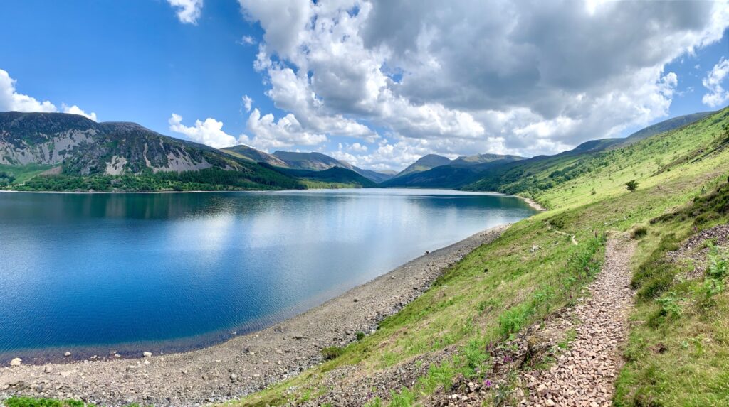
Ennerdale Water is the valley’s centrepiece and one of the most photographed subjects for anyone exploring the western fells. It is a deep glacial lake, roughly 4 km long and 1 km wide, with a maximum depth of around 50 metres. The water is exceptionally clear, so clear that it has historically supplied drinking water to towns along the West Cumbrian coast, and it remains an important source for the region today.
What sets Ennerdale Water apart from Windermere, Ullswater, or Derwentwater is the complete absence of a public road along its banks. Every other major lake in the district has at least a partial road running beside it; Ennerdale has none. That single fact shapes almost everything about a visit here. There are no lakeside car parks halfway around, no waterside cafés, and no boat hire kiosks. To see the lake properly, you have to walk or cycle to it.
The lake is fringed by native woodland and conifer plantation, much of the latter now being gradually removed and replaced with more natural broadleaf cover as part of the Wild Ennerdale rewilding programme. Anglers’s Crag, a rocky outcrop on the southern shore, forces walkers on the full lakeshore circuit into a short, exciting scramble, one of the few moments of genuine adventure on an otherwise gentle walking route.
Wild swimming is popular here among those who know the valley, particularly on calm summer mornings when the water is at its most inviting, though as with any open water in Cumbria, conditions can change quickly and cold-water shock is a real risk even in warmer months. Anyone swimming should stay close to the shore, avoid entering alone in poor visibility, and check the water temperature before committing to more than a short dip.
Fishing is also permitted on Ennerdale Water with the appropriate rod licence, and the lake holds populations of trout and the rarer Arctic char, a cold-water relict species that has survived in a handful of deep, clean English lakes since the last ice age. Spotting one from the shore is unlikely, but their presence is part of what makes the lake ecologically significant, and it is one of several reasons conservation bodies treat Ennerdale Water with such care.
The Wild Ennerdale Project: Rewilding in Action
Ennerdale is not just scenically remote, it is also home to one of the longest-running and most significant rewilding projects in the United Kingdom. Since 2003, the Wild Ennerdale partnership, a collaboration between Forestry England, the National Trust, United Utilities, and Natural England, has been gradually reducing human intervention across the valley and allowing natural processes to reshape the landscape.
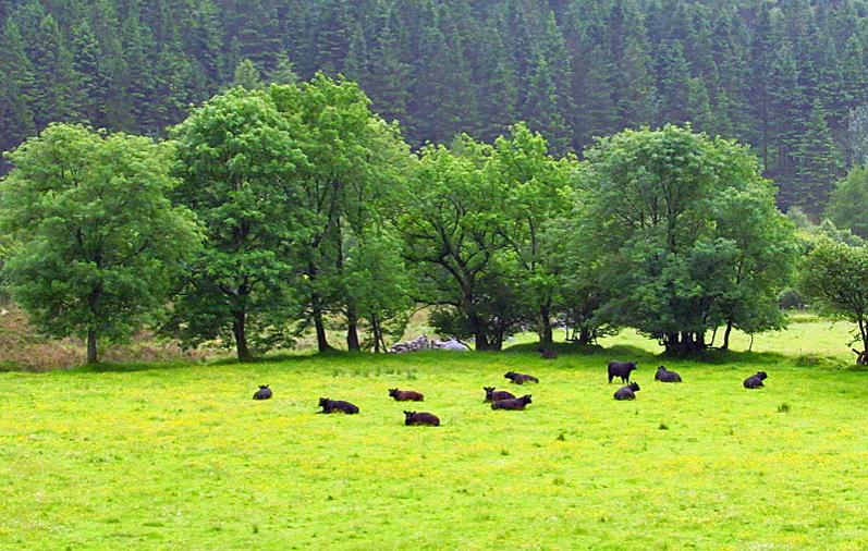
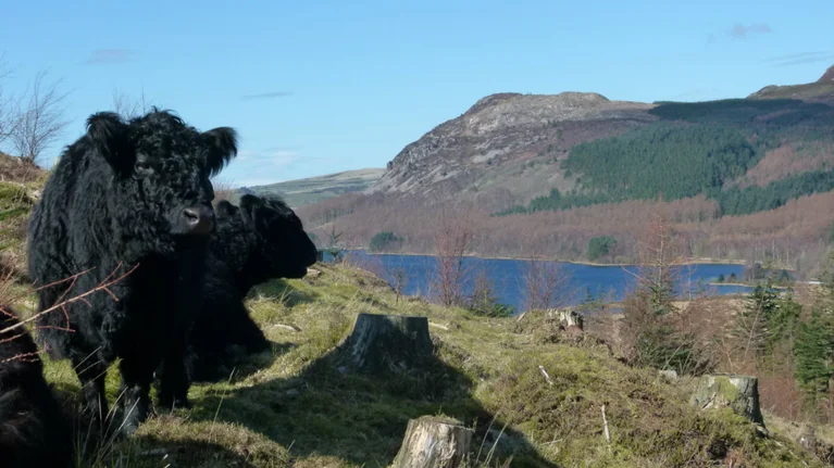
In practice, this means dense conifer plantations planted for timber in the twentieth century are being thinned and, in places, removed entirely, making way for naturally regenerating native woodland. River channels that were once straightened are being allowed to meander again, restoring more natural flood patterns and habitats for fish and invertebrates. Grazing animals, including Galloway cattle and a small free-roaming herd of pigs, are used deliberately rather than incidentally, mimicking the disturbance that wild herbivores would once have created, which in turn helps diverse plant life establish itself.
The project has attracted international attention as a model for landscape-scale conservation, and in November 2022 the surrounding land was declared part of one of the country’s largest National Nature Reserves. Cumbria’s largest National Nature Reserve designation reflects just how significant this stretch of countryside has become for nature recovery in England.
For visitors, the most tangible sign of the project is simply how the valley looks and feels compared with a conventionally managed Lake District landscape. Fallen trees are often left where they lie rather than cleared, providing habitat for insects and fungi. Paths can be rougher and less manicured than elsewhere in the national park. Livestock roam more freely across open ground rather than being confined to small fenced fields. None of this is neglect; it is a deliberate, carefully monitored approach to letting a landscape recover its own rhythms.
Anyone with a specific interest in conservation, ecology, or landscape restoration should build in extra time to read the interpretation boards near Bowness Knott and Bleach Green, or to visit the Wild Ennerdale website before setting off, since the project’s methods and reasoning add real depth to what might otherwise look like an ordinary valley walk.
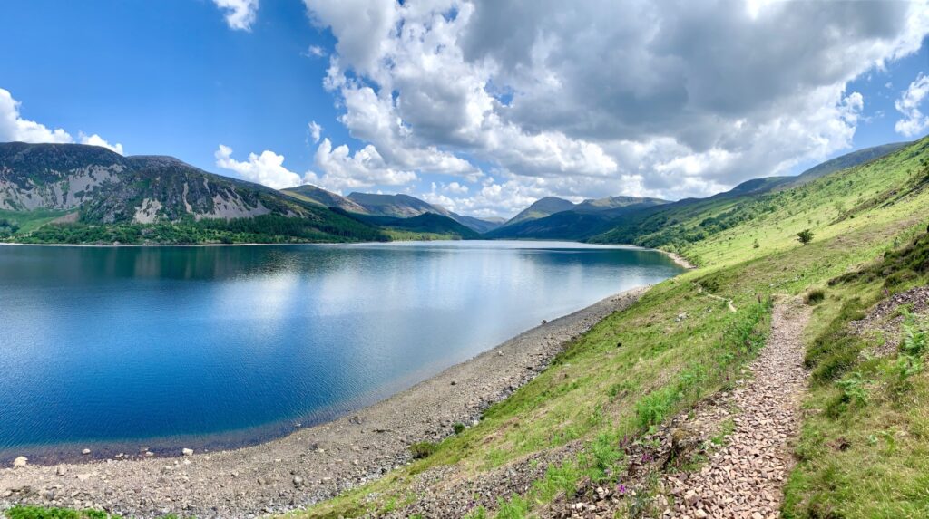
Top Walking Trails in Ennerdale Valley
Walking is the reason most people visit Ennerdale, and the valley offers routes to suit almost every level of experience, from a level, all-ability path to a full mountain day.
The Ennerdale Views Trail starts at Bleach Green car park and is designed to be accessible, with a firm, level surface suitable for wheelchairs, mobility scooters, and pushchairs. It offers some of the finest lake views in the valley without requiring any real exertion, making it an excellent introduction for families or anyone with limited mobility.
The Lakeshore Circuit is the valley’s signature walk, a roughly 6.5-mile (10.5 km) loop around Ennerdale Water combining forest track, open fellside, and a short rocky scramble over Angler’s Crag on the southern shore. Allow around four to five hours at a comfortable pace, and wear proper walking boots, since the scramble section requires the use of hands and is not suitable in very wet or windy conditions.
The Forest Road up-valley from Bowness Knott follows the River Liza for almost two miles through mixed forest before opening into wider mountain scenery. This is a good option for those wanting a taste of the valley’s remoteness without committing to a full mountain ascent. A shorter loop returning via Middle Bridge and Moss Dub makes a round trip of around 12 km, passing close to the Galloway cattle and areas of forest actively being felled as part of the rewilding project.
The walk to Black Sail Hut extends the up-valley route further, passing the isolated YHA Black Sail hostel, where an honesty-box shop often sells tea and home-made cake to passing walkers. Beyond the hostel, the amphitheatre of high fells at the valley head, Pillar, Steeple, Kirk Fell, and Great Gable, comes fully into view, and many walkers consider this one of the most dramatic mountain panoramas in England.
Haystacks and Innominate Tarn is a longer option for those wanting to combine Ennerdale with a pilgrimage of sorts. Wainwright’s ashes were scattered at Innominate Tarn on the summit of Haystacks, a modest fell at just under 600 metres, and the final approach involves some light scrambling. The views back down into Ennerdale and across to Buttermere are considered among the best modest-summit views in the district.
For all but the accessible trail, expect rough, sometimes boggy underfoot conditions, limited signage compared with more manicured Lake District paths, and long stretches with no phone signal. An Ordnance Survey Explorer OL4 map, proper footwear, and a realistic estimate of daylight hours are essential for anything beyond the lakeshore.
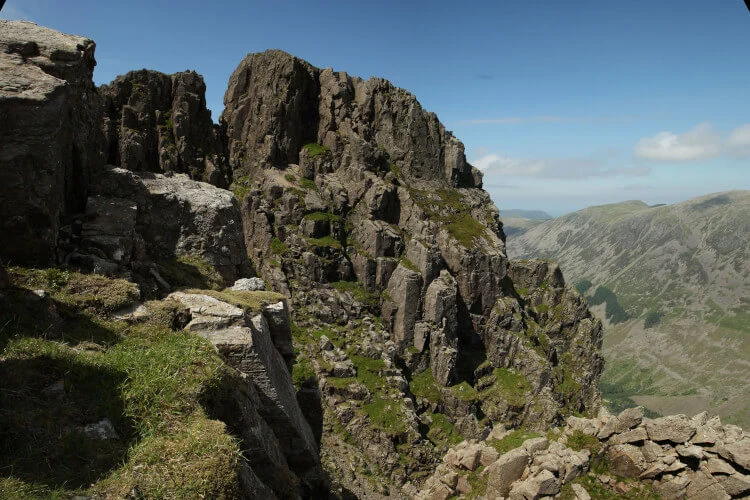
Climbing Pillar and Pillar Rock from Ennerdale
For experienced hillwalkers, Ennerdale is best known as the classic approach to Pillar, the eleventh highest mountain in England, and to Pillar Rock, one of the most historically significant climbing crags in the country.
The approach from Bowness Knott car park takes around two hours on foot, following forest tracks before climbing alongside a beck past an impressive waterfall to reach Pillar Cove at around 500 metres. From here, the path fades in places, but Robinson’s Cairn, a well-known viewpoint looking directly along Ennerdale, marks the start of the celebrated High Level Route. This narrow path traverses beneath Pillar’s northern crags, past Pillar Rock itself, before a steep final climb via the Shamrock Traverse to the summit.
Pillar Rock has a long and storied place in British mountaineering history as one of the birthplaces of English rock climbing, and its multiple faces and gullies still attract serious climbers today. Routes such as the Slab and Notch and the Old West Route range from grade 3 scrambles to more technical climbs requiring rope and protection, and none should be attempted without appropriate experience, equipment, and, ideally, a guide.
Walkers not intending to climb the Rock itself can still enjoy the High Level Route as one of the finest ridge walks in the Lake District, contouring around the mountainside with constant views down into Ennerdale and across to Wasdale. Many combine it with the classic Mosedale Horseshoe from Wasdale Head, taking in Pillar alongside Scoat Fell, Steeple, Red Pike, and Yewbarrow.
This is serious mountain terrain. The High Level Route is exposed in places, weather on the western fells changes quickly, and there is no mobile signal for much of the route. Only attempt it with proper navigation skills, suitable clothing for sudden weather changes, and a realistic assessment of your own scrambling ability. Guided walking options are available from local providers based in Wasdale for those who would prefer expert company on this route.
Wildlife and Nature in Ennerdale
Because so much of Ennerdale has been deliberately left to its own devices, the valley has become one of the best places in the Lake District to see wildlife that has become scarce elsewhere in England.
Red squirrels persist in the valley’s older woodland, benefiting from the relative absence of grey squirrels in this remote corner of Cumbria. Ravens and peregrine falcons nest on the crags around Pillar and the surrounding fells, often visible wheeling above the valley head on clear days. Otters are occasionally spotted along the River Liza and the shores of Ennerdale Water, particularly at dawn or dusk when the valley is at its quietest.
The Wild Ennerdale project has also brought back species that had all but disappeared from more intensively managed landscapes, including a healthy population of the marsh fritillary butterfly, one of the UK’s most threatened butterflies, which depends on the damp, undisturbed grassland the valley now provides. Galloway cattle and a small group of free-roaming pigs graze large parts of the valley floor year-round, and while they are domesticated rather than wild, their presence mimics the disturbance patterns that would once have shaped this landscape naturally, encouraging a much wider range of plants and insects to flourish.
Anyone visiting with wildlife spotting in mind should bring binoculars, move quietly, and allow time to simply sit and watch rather than covering ground quickly. Early morning and early evening tend to offer the best chances of a sighting, and the quieter mid-valley stretch around Low Gillerthwaite Field Centre is often a productive spot.
One practical warning worth taking seriously: ticks are present in the valley’s long grass and bracken, and Lyme disease is a genuine risk in this part of Cumbria. Check yourself thoroughly for ticks after any walk through vegetation, wear long trousers where practical, and remove any tick promptly and correctly if found.
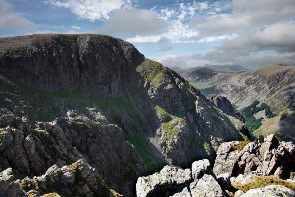
History of Ennerdale Valley
Ennerdale’s history stretches back to prehistoric times, when its glacially carved landscape first attracted early settlers to the more sheltered lower reaches of the valley. Evidence of ancient land use survives in the surrounding fells, though the valley’s more recent history is what shapes the experience of visiting today.
For much of the twentieth century, Ennerdale was managed primarily for timber and water. Large areas of the valley floor and lower fellside were planted with dense conifer plantations from the 1920s onward, transforming what had been open grazing land into commercial forest. Ennerdale Water itself became an important reservoir for the industrial towns of the West Cumbrian coast, a role the lake still partly serves.
The turning point came in 2003, when Forestry England, the National Trust, and United Utilities formed the Wild Ennerdale partnership, later joined by Natural England, with the explicit aim of reversing decades of intensive management and allowing the valley to evolve more naturally. This shift from production forestry and tight land management toward a rewilding approach makes Ennerdale one of the earliest and longest-running examples of this kind of conservation in Britain, predating the term’s more recent popularity by well over a decade.
The valley also holds a significant place in the history of English rock climbing, with Pillar Rock attracting pioneering climbers since the Victorian era, when it was considered one of the great unclimbed challenges of the Lake District. That climbing heritage continues today, with routes first pioneered over a century ago still drawn on modern guidebooks.
Literary connections run through the valley too. Alfred Wainwright, the celebrated fellwalker and guidebook author, wrote extensively about Ennerdale’s fells in his Pictorial Guides, and chose Innominate Tarn on nearby Haystacks as the place where his own ashes would eventually be scattered, a detail that draws a steady trickle of admirers to that particular summit each year.
Where to Stay in and Around Ennerdale
Accommodation options directly inside Ennerdale Valley are deliberately limited, in keeping with its wild character, but a good spread of choices exists just outside its edges.
Ennerdale Bridge, the small village at the valley’s western gateway, offers the most convenient base. Both the Fox and Hounds Inn and the Shepherds Arms provide rooms alongside food and drink, and both are well used to welcoring walkers, particularly those tackling the Coast to Coast path, which passes directly through the village. Expect comfortable, unfussy rooms rather than luxury, with the atmosphere of a proper walkers’ pub.
For a genuinely remote overnight stay, YHA Black Sail sits at the head of the valley itself, a converted shepherd’s bothy that is one of the most isolated youth hostels in England, reachable only on foot or by bike. Booking ahead is essential, since it sleeps a small number of guests and is understandably popular with walkers wanting to be right at the foot of Pillar and Great Gable for an early start.
YHA Ennerdale, closer to the village, offers a more accessible hostel and camping barn setup with dormitory and private rooms, a sociable dining and lounge area, and a warm welcome for cyclists and walkers passing through on longer routes.
For groups, the Low Gillerthwaite Field Centre, situated halfway up the valley, offers dormitory and self-catering accommodation for up to 40 people, and the Ennerdale Scout Camp on the lake’s western shore provides a good base with parking for organised groups.
Self-catering cottages and B&Bs are widely available in and around Ennerdale Bridge and the wider area, ranging from renovated seventeenth-century farm cottages to more modern holiday lets, many within easy walking distance of the lake. Booking well in advance is strongly advised during the peak summer months and around the Coast to Coast walking season in spring and early autumn, when demand along this stretch of the route is high.
Food and Drink Near Ennerdale
Given the valley’s remoteness, options for eating and drinking are limited but well-loved by those who use them regularly.
The Gather, a community-owned café and information centre in Ennerdale Bridge, is the best all-round stop for coffee, light bites, and locally sourced food, alongside a small shop stocking walking and camping essentials, maps, and supplies for anyone tackling the Coast to Coast route or a day in Ennerdale itself.
Both village pubs, the Fox and Hounds Inn and the Shepherds Arms, serve proper pub food, with hearty options like steak and ale pie particularly popular with walkers refuelling after a day on the fells. Expect classic Cumbrian pub fare, generous portions, and a genuinely warm welcome for muddy boots and wet coats, though as with any small rural pub, kitchen hours can be limited, so it is worth checking ahead, particularly outside peak season.
Deep inside the valley itself, the honesty-box shop at Black Sail Hut is a small but memorable stop, often offering tea and home-made cake for walkers passing through, run on trust with an honesty box for payment. It is not a guaranteed service, but it is one of the valley’s most charming surprises for those who reach it.
Beyond the immediate valley, Cockermouth and Egremont both offer a wider range of cafés, restaurants, and supermarkets for stocking up before or after a visit, and are worth factoring into a day’s planning if you want more choice than the valley itself provides.
Best Time to Visit Ennerdale Valley
Ennerdale rewards visitors in every season, but each brings a distinctly different experience.
Spring (March to May) sees the valley’s woodland come alive with fresh growth, and the marsh fritillary butterflies and other insect life beginning to emerge. Lambing season means extra care is needed on the access roads, and river levels can still run high after winter rain.
Summer (June to August) is the most popular time to visit, with long daylight hours ideal for the full Lakeshore Circuit or an ascent of Pillar. Even at the height of summer, Ennerdale remains far quieter than the central Lake District, though the Coast to Coast walking season brings a steady flow of long-distance walkers through Ennerdale Bridge and up the valley toward Black Sail. Midges can be a genuine nuisance on still summer evenings near the lake and forest, so insect repellent is worth packing.
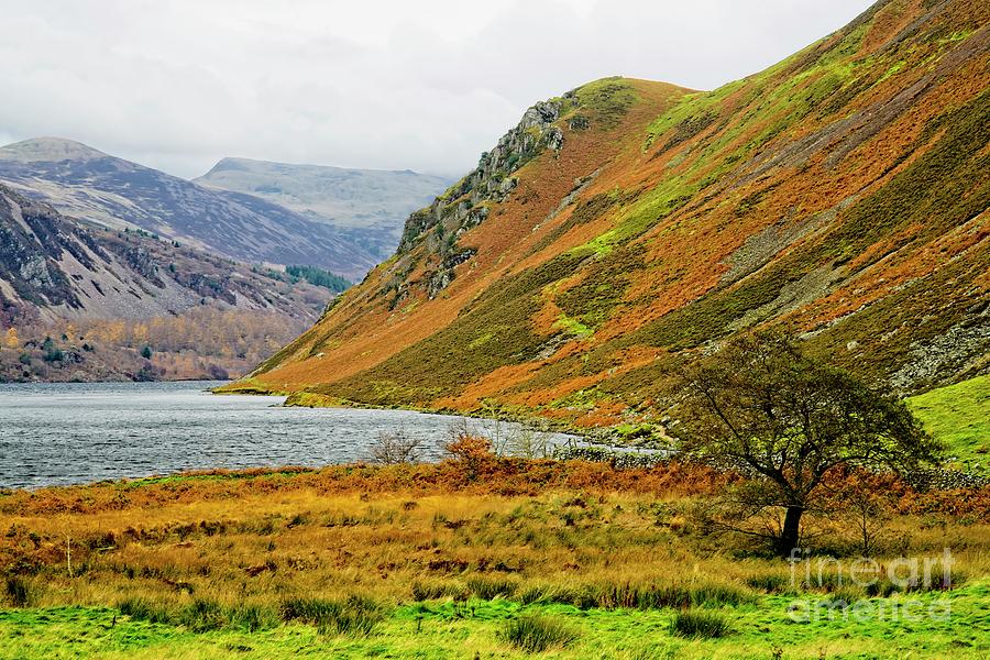
Autumn (September to November) is arguably the valley’s most photogenic season, as the mixed woodland turns gold and russet against the darker green of the remaining conifer plantation, and the Galloway cattle become easier to spot against the changing colours. Weather becomes increasingly unpredictable, and days shorten quickly, so plan any high-level walks with an earlier start.
Winter (December to February) transforms Ennerdale into a genuinely wild place, with the high fells often holding snow long after it has melted elsewhere, and the valley receiving very few visitors indeed. This is a season strictly for experienced winter hillwalkers with the right equipment; the lakeshore circuit and lower forest tracks remain accessible to less experienced walkers on clearer days, but conditions can turn dangerous quickly on the open fell.
For most visitors, late spring and early autumn offer the best balance of good walking conditions, interesting wildlife activity, and fewer midges than high summer.
Practical Travel Tips for Ennerdale Valley
A visit to Ennerdale rewards preparation more than almost anywhere else in the Lake District, given how few facilities exist once you leave the car park.
- Parking: Both Bowness Knott and Bleach Green car parks operate pay-and-display charges. Forestry England annual membership offers free parking at Bowness Knott for regular visitors.
- Mobile signal: Coverage is patchy to non-existent for much of the valley, particularly beyond the lake. Download offline maps and tell someone your planned route before setting off.
- Navigation: Carry Ordnance Survey Explorer map OL4 (Western Lake District) and know how to use it; waymarking is deliberately minimal in keeping with the valley’s wild character.
- Footwear and clothing: Proper waterproof walking boots are essential for anything beyond the accessible lakeshore trail, and weatherproof layers are advisable even in summer, since conditions on the surrounding fells change quickly.
- Ticks: Check yourself for ticks after walking through bracken or long grass, and know how to remove one safely.
- Water and supplies: Buy food and fill water bottles before entering the valley, since there is no reliable shop beyond The Gather in Ennerdale Bridge.
- Photography: Early morning light on Ennerdale Water, with mist often lingering over the surface, offers some of the best photographic conditions in the valley. Anglers’s Crag and the view up-valley from Bowness Knott toward Pillar are two of the most rewarding vantage points.
- Family visits: The Ennerdale Views trail from Bleach Green is the most suitable option for families with young children or pushchairs; the full lakeshore circuit and any fell ascent are better suited to older, more experienced children.
- Solo travellers: Ennerdale is a popular and generally safe destination for solo walkers, but the lack of phone signal and limited passing traffic mean it is especially important to share your route and expected return time with someone before setting out.
- Couples and longer stays: Pairing a night at the Fox and Hounds or Shepherds Arms in Ennerdale Bridge with a full day exploring the lake and lower valley makes for a relaxed, low-key alternative to the busier central Lake District bases.
Nearby Destinations Worth Combining With Ennerdale
Ennerdale pairs naturally with several other quieter corners of the western Lake District. Buttermere, reachable on foot via Scarth Gap from the head of the valley, offers another beautiful, relatively uncrowded lake and village. Wasdale, on the far side of Pillar and Great Gable, is home to Wastwater, England’s deepest lake, and Scafell Pike, the country’s highest mountain. The coastal town of St Bees, the official starting point of the Coast to Coast walk, is around a 30-minute drive away and worth combining with a visit if time allows.
Conclusion
Ennerdale Valley is not a destination for anyone chasing a quick, easy day out with all the comforts of a busy Lake District town on hand. It asks more of its visitors: a longer drive, a walk-in on foot, a willingness to check a map rather than follow a crowd. In return, it offers something increasingly rare in England, a genuinely wild valley shaped as much by nature as by people, with some of the finest mountain scenery, wildlife, and walking the Lake District has to offer. Whether you come for a gentle afternoon beside Ennerdale Water, a serious mountain day on Pillar’s High Level Route, or simply to see what a rewilded British landscape looks like in practice, Ennerdale rewards those willing to make the effort to reach it.
Frequently Asked Questions About Ennerdale Valley
Is Ennerdale Valley suitable for beginners? Yes, in part. The Ennerdale Views trail from Bleach Green is level and accessible for all abilities. However, the full Lakeshore Circuit and any fell walks require proper footwear, fitness, and navigation skills, so beginners should stick to the accessible sections.
Can you drive into Ennerdale Valley? No. Ennerdale Water is the only lake in the Lake District without a public road along its shore, and there is no through-road into the valley. Cars must be left at Bowness Knott or Bleach Green car parks.
How long does it take to walk around Ennerdale Water? The full Lakeshore Circuit is around 6.5 miles (10.5 km) and typically takes four to five hours, including the short scramble over Angler’s Crag on the southern shore.
Is there public transport to Ennerdale? No direct public transport serves the valley. The nearest railway stations are at Whitehaven and St Bees, both requiring a further walk or taxi journey to reach Ennerdale Bridge.
What is the Wild Ennerdale project? Wild Ennerdale is a long-running rewilding partnership between Forestry England, the National Trust, United Utilities, and Natural England that has been restoring the valley’s natural processes since 2003, including thinning conifer plantations and allowing rivers to meander freely.
Is wild camping allowed in Ennerdale? Wild camping is tolerated in parts of the high fells above Ennerdale under the Lake District’s traditional above-the-wall guidance, but campers should follow Leave No Trace principles and avoid camping near the lake shore or on farmed land without permission.
What wildlife might I see in Ennerdale? Red squirrels, ravens, peregrine falcons, otters, Galloway cattle, and the rare marsh fritillary butterfly are all present in the valley, along with Arctic char in the deeper waters of the lake.
Where is the best place to stay near Ennerdale? Ennerdale Bridge is the most convenient base, with the Fox and Hounds Inn and Shepherds Arms offering rooms, food, and a genuine walkers’ welcome. YHA Black Sail offers the most remote overnight option, deep inside the valley itself.
Is Ennerdale part of the Coast to Coast walk? Yes. Wainwright’s Coast to Coast Walk passes through Ennerdale Bridge and continues up the valley past Ennerdale Water toward Black Sail, making it a well-used stretch of the long-distance route.
When is the best time to visit Ennerdale Valley? Late spring and early autumn generally offer the best balance of good walking conditions, interesting wildlife, and fewer midges than peak summer, though each season offers a distinctly different experience.