
Table of Contents
Dovedale Peak District
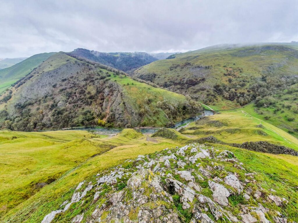
Some places in England look like they were designed for the lid of a biscuit tin. Dovedale Peak District is one of them. The River Dove runs through a steep, green limestone valley on the border of Derbyshire and Staffordshire, and visitors can see most of it on foot with nothing fancier than sturdy shoes and a relaxed attitude towards mud.
This guide covers seven of the best sights and routes in the Dovedale valley, from the famous stepping stones to a few quieter corners that many day-trippers walk straight past. There are also tips on parking, timing and what to wear, plus a few jokes, because a walking guide without jokes is just a map with extra steps.
The good news is that Dovedale walks suit most abilities. Some Dovedale walking trails are flat and easy enough for a relaxed family afternoon, while others climb steeply enough to make you question your life choices halfway up. Here is how it all fits together.
1. Thorpe Cloud: The Hill That Says Hello First
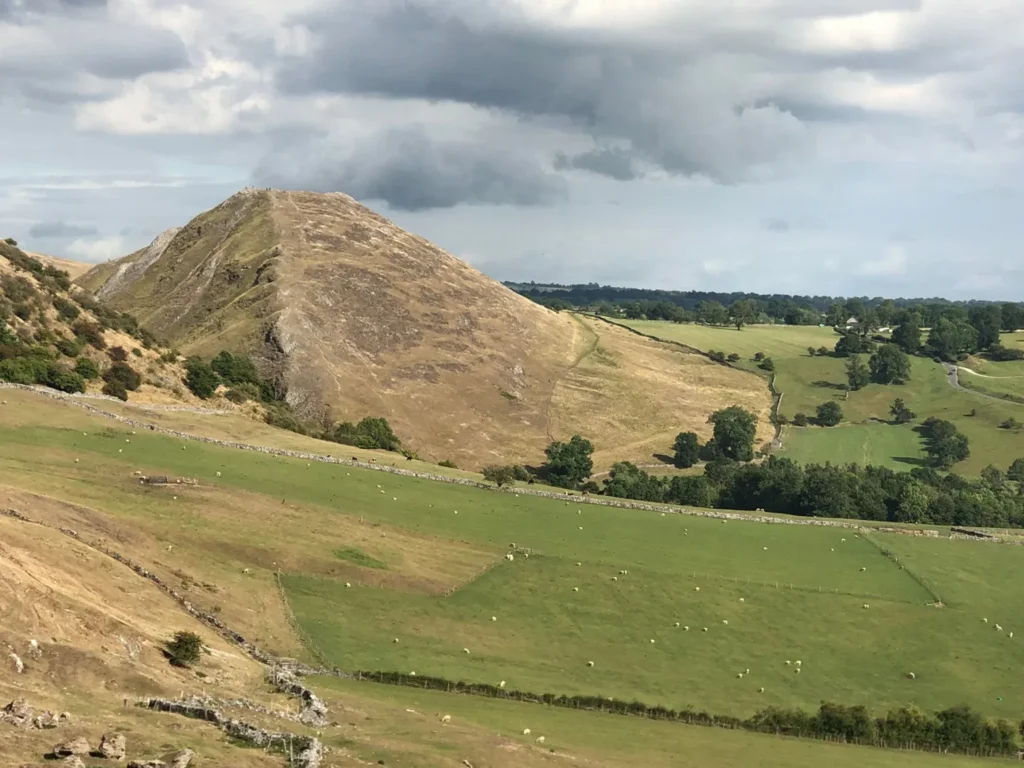
Thorpe Cloud is the rounded hill at the southern end of the valley, and visitors will spot it before they have even locked the car. It looks a bit like a small volcano. It isn’t one, which is probably for the best. For any walk in Dovedale Peak District, this hill is the natural place to begin, mostly because it is impossible to ignore.
The path to the top is short but steep, and in wet weather it can get slippery. Good grip on your shoes matters more than good fashion here. At the summit, visitors can look back along the Dovedale valley and out over the countryside around it. The climb is a proper workout, but the view pays the bill.
Here is a small tip. Some visitors climb Thorpe Cloud first while their legs are fresh, and others save it for the end. Saving it for the end is brave. Your legs will file a formal complaint either way.
2. The Stepping Stones: Wet Feet Optional (But Common)
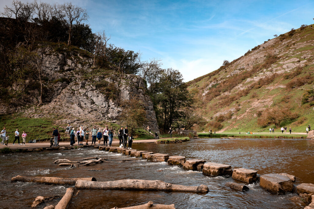
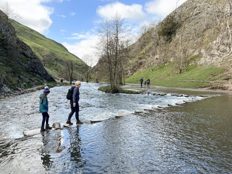
The stepping stones are probably the most famous feature of the valley. They sit near the start of the path and cross the River Dove in a neat line, which is why every second photo of Dovedale seems to include them. Visitors can cross them for the classic picture, and plenty of people do.
Take your time on them. The stones can be wet, uneven and slippery, and the river can rise after heavy rain, so it is worth checking the conditions before you try. If the water looks high or fast, skip the crossing and enjoy the view from the bank. Nobody has ever been told off for being careful.
Falling in is technically optional, though the river does sometimes make the decision for people.
Many Dovedale walking trails begin around here, so this is also a good spot to decide how far you want to go. Be honest with yourself about the snacks you brought. A short stroll needs a biscuit. A long one needs a plan.
3. Lovers’ Leap and the Dove Holes: Names With Stories
Further along the path, visitors will come across Lovers’ Leap, a rocky outcrop above the trail. The name comes from a local legend, and like most legends, the details change depending on who is telling it. The safest approach is to enjoy the view and keep both feet on the path.
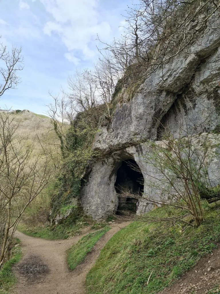
Along the same stretch, the Dove Holes are a pair of shallow caves in the rock. Visitors can peek inside from the path. They are not deep enough for proper caving, which is a relief to anyone who left their helmet at home. Think of them as nature’s way of saying “here is a cave, but you don’t have to commit.”
Dovedale Peak District has plenty of spots like this, where the rock is the main attraction and the walking is almost a side effect. Take a slow pace. The limestone cliffs rise on both sides, trees fill the gaps, and the river keeps up a steady background noise that beats most playlists.
4. Reynard’s Cave and Arch: A Short Climb for a Big Photo
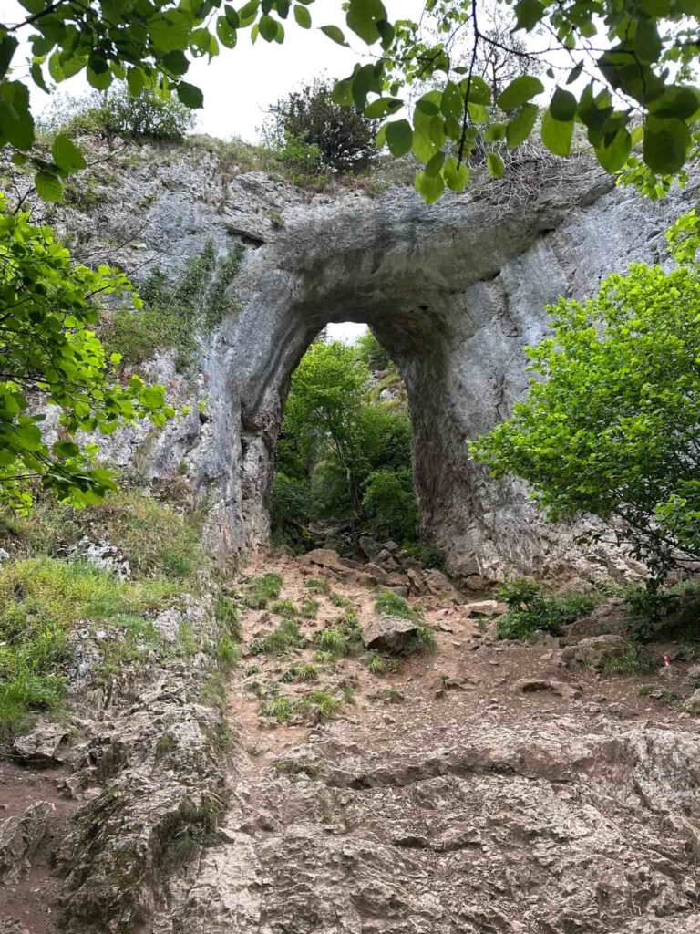
Reynard’s Cave is a large natural opening in the hillside, with an arch that frames the view back across the valley. Visitors reach it by climbing a set of stone steps up from the main path. The climb is short, but the steps can be slippery when wet, so go carefully and don’t rush for the photo.
It is one of the headline sights of Dovedale Peak District, and it earns that place. Stand under the arch, look out over the valley, and pretend you found it yourself. Everyone else does. The arch has been there for a very long time and has seen far worse poses than yours.
Because it is so popular, expect a short wait for the best photo spot on busy days. British politeness helps here. Wait your turn, smile, and nobody gets hurt. Among all the Dovedale walks, this little detour is one of the easiest ways to add a bit of drama without adding many miles.
5. Ilam Rock and Pickering Tunnel: Tall Rock, Short Tunnel
Ilam Rock is a tall limestone pillar standing close to the river, and it is hard to walk past without craning your neck. It looks like a giant started building something, changed their mind, and left without tidying up. Visitors usually stop for a long look, then another one, because the first look rarely feels like enough.
Pickering Tunnel is along the same stretch of the valley. It is a short, man-made passage through the rock, and visitors can walk straight through it. The whole thing takes about ten seconds and makes you feel like the hero of a very short adventure film. There is no treasure at the other end, but the path carries on, which is nearly as good.
This part of the Dovedale valley is where Dovedale Peak District starts to feel properly dramatic. The sides close in, the rock gets bigger, and even people who “aren’t really into scenery” tend to go quiet for a minute.
6. Milldale and Viator’s Bridge: The Far End of the Main Walk
Milldale is a small village at the upper end of the main Dovedale path, and it works as a natural turning point for many walkers. The route from the car park is a few miles one way, so visitors should plan for the return trip as well. It sounds obvious. People forget it all the time.
Viator’s Bridge is the narrow stone bridge in Milldale. Its name comes from a character in The Compleat Angler, a famous old fishing book. The bridge is small and pretty, and it is exactly the sort of place where you can sit down, eat a sandwich, and quietly congratulate yourself for making it this far.
Many Dovedale walks end here, and then everyone turns around and heads back down the valley the way they came. The return trip looks different from the opposite direction, which is a polite way of saying you will notice things you missed on the way up. Anyone doing the full out-and-back route in Dovedale Peak District should allow plenty of daylight and a few spare snacks.
7. Ilam Park and the Longer Walks: When One Day Isn’t Enough
Visitors who want a calmer start can begin at Ilam Park, which is looked after by the National Trust and has paths linking it with the lower end of the valley. The walking from there is gentle, and the river scenery is just as good as the busier sections.
For people with extra energy, longer Dovedale walking trails continue upstream beyond Milldale. The Dove runs on through Wolfscote Dale towards Hartington, which gives a different feel from the main valley. The Tissington Trail, an old railway line turned walking route, also offers flatter walking in the same part of the Peak District. Trains used to run here. Now it is just you, your legs and a lot of cyclists saying “thanks” as they pass.
Planning a longer route is where Dovedale Peak District really shows that it works for both a lazy afternoon and a proper hike. Pick the version that matches your mood and your shoes.
Before you go: Dovedale Peak District gets busy, especially on summer weekends and bank holidays, so arriving early makes parking and the stepping stones much less stressful. Wear shoes with decent grip, pack water and snacks, and check the weather first. The path can be rocky and muddy, and the valley does not care about your new trainers.
Final thoughts: The charm of Dovedale Peak District is that it is easy to enjoy and hard to get bored of. There is a hill to climb, a river to cross, caves to peek into, and a bridge with a literary name at the end. You do not need to be an expert hiker, just curious and prepared to get your boots a bit dirty. Take your time, walk the Dovedale valley at your own pace, and save a few snacks for the way back.
Dovedale FAQs
1. Where is Dovedale Peak District located?
Dovedale is a valley in the Peak District, on the border of Derbyshire and Staffordshire. The River Dove runs through it.
2. How long does it take to walk the main path?
A full out-and-back walk in Dovedale Peak District usually takes several hours, depending on your pace and how often you stop for photos. Many visitors set aside half a day.
3. Is Dovedale suitable for beginners and families?
Parts of the path are fairly easy, but the stepping stones, steps and uneven ground mean it is not ideal for everyone. Is Dovedale Peak District family-friendly? Often yes, as long as children are supervised and you choose the right section.
4. Can you walk across the stepping stones?
Yes, visitors can cross them, but they can be wet and slippery. Check the river level, especially after rain, and skip the crossing if the water looks high.
5. Is there parking at Dovedale?
There is a main car park near the start of the valley. It can fill up early on busy days, and in Dovedale Peak District it is worth checking current charges and opening details before you travel.
6. Are dogs allowed in Dovedale?
Dogs are generally welcome, but there is often livestock nearby. Keep your dog on a lead near animals and follow any signs.
7. What is the best time of year to visit Dovedale Peak District?
Spring and autumn are popular because the weather is mild and the scenery is at its best. Weekdays are usually quieter than weekends, especially in summer.
8. Do I need hiking boots?
Sturdy footwear with good grip is the safest choice. Trainers can work in dry weather, but the path and stones can be slippery.
9. How hard is the Thorpe Cloud climb?
It is short but steep, so most visitors will find it moderately tough. Take it slowly, especially if it has rained.
10. Are there toilets and refreshments nearby?
Facilities can change, so check before you go. To be safe, bring your own water and snacks and use the nearby villages as a backup. Planning ahead makes any visit to Dovedale Peak District much more comfortable.
A note: you mentioned adding “these 10 FAQs”, but the list didn’t come through with your message, so I wrote ten of my own. If you meant to include specific questions, send them over and I’ll swap them in.